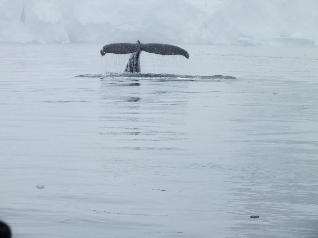
We took the Zodiacs out for a trip around Wilhelmina Bay – favourite feeding ground for humpback whales.
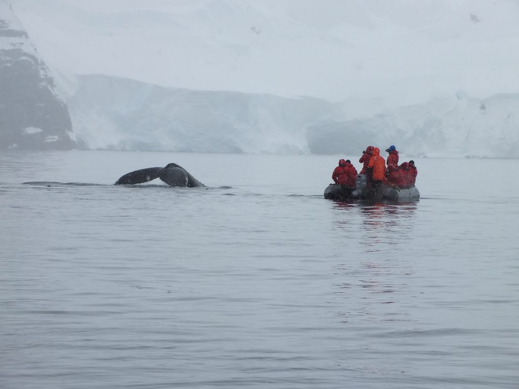

We took the Zodiacs out for a trip around Wilhelmina Bay – favourite feeding ground for humpback whales.
Before I go any further I need to explain something about this and the next couple of blogs. I am posting this 5 years on. Until this week I hadn’t noticed that I had neglected to finish posting the last 3 blogs. In the meantime, the application I use to write the blogs has improved significantly. The photographs are a decent size now when inserted – putting the older blogs to shame. (I may have to go back over old blogs and re-insert the photos).
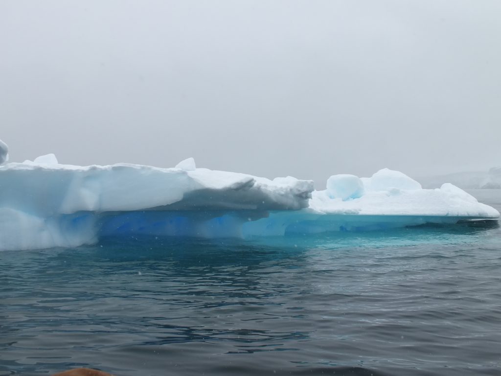
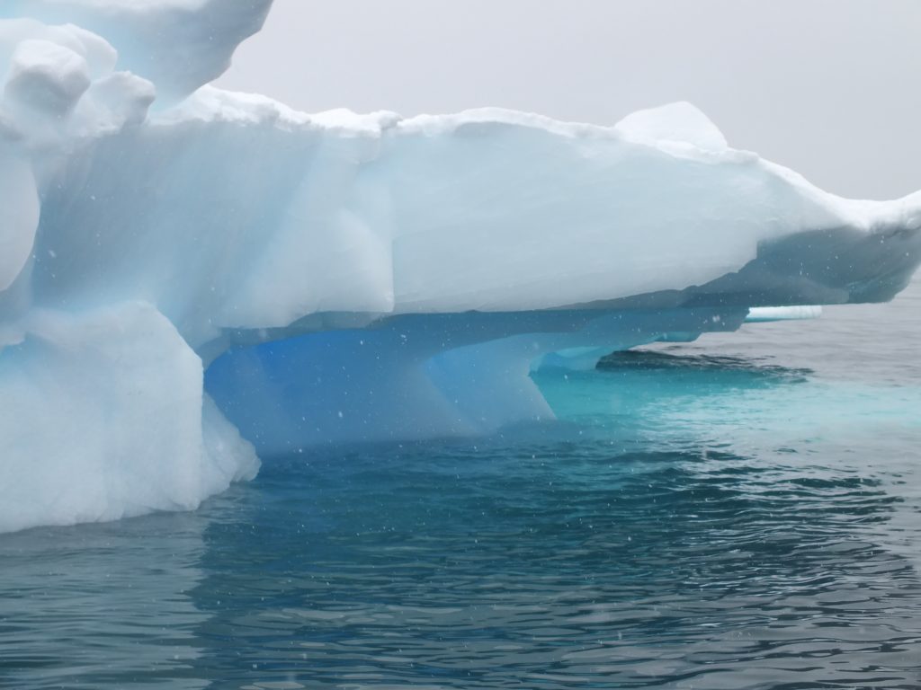
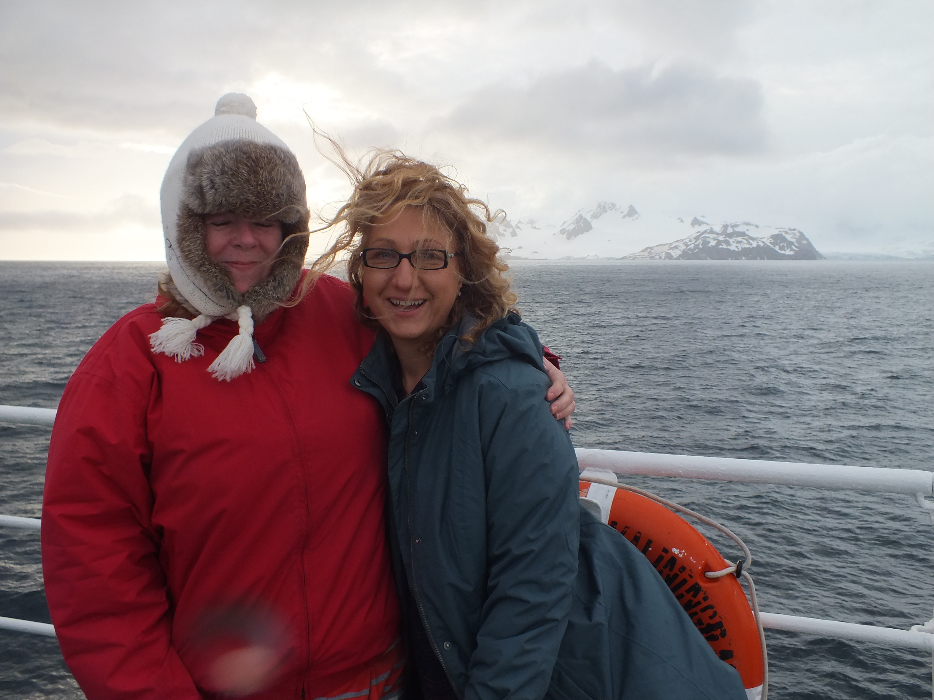
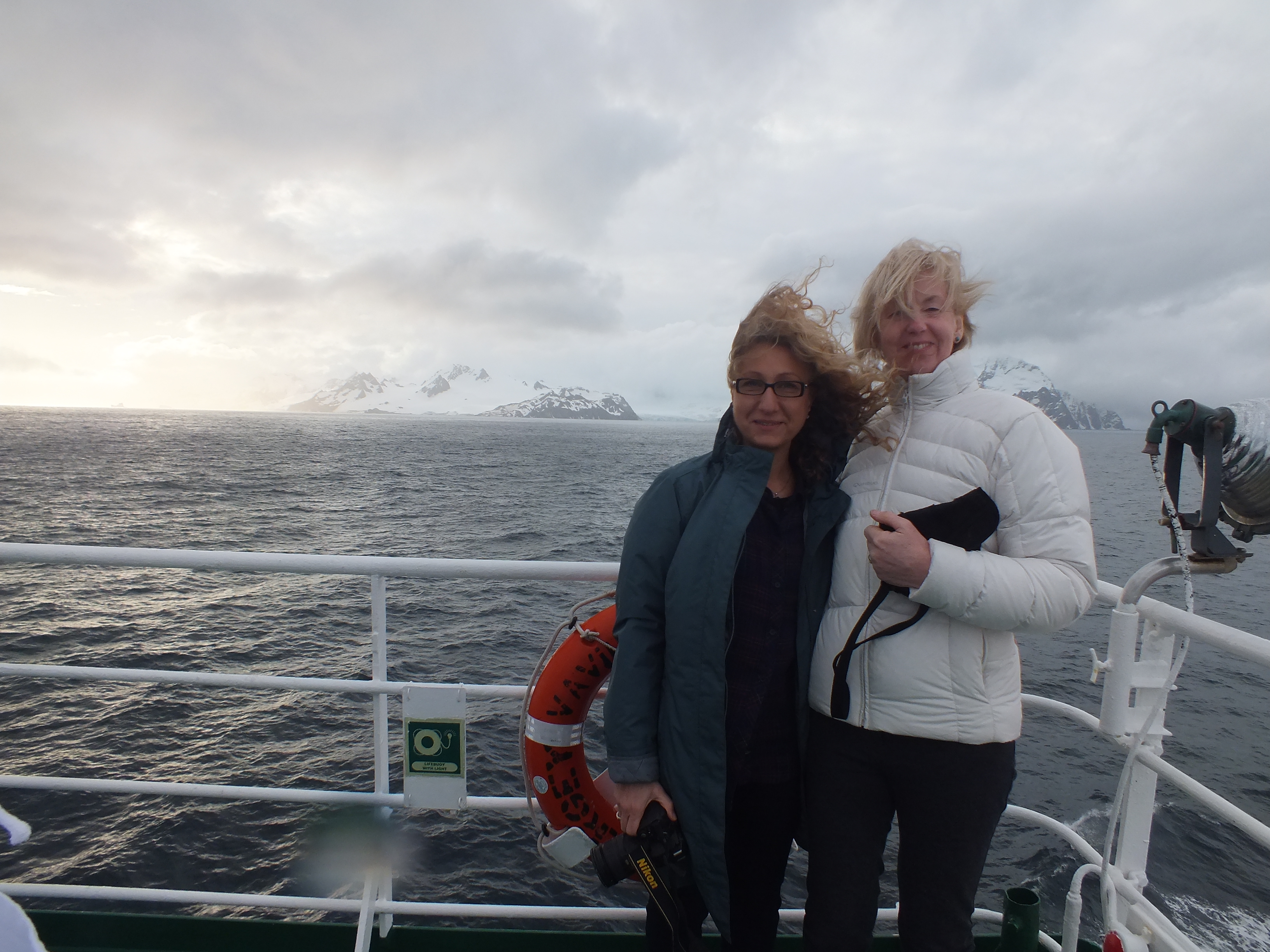
Because it has been so long since we did the trip, I’ll have less to say than usual so I’ll let the photos speak for themselves.
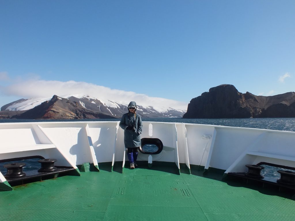
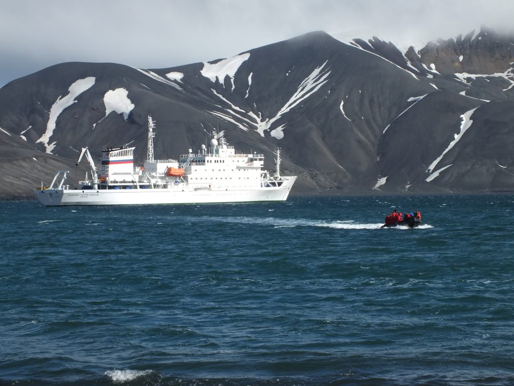
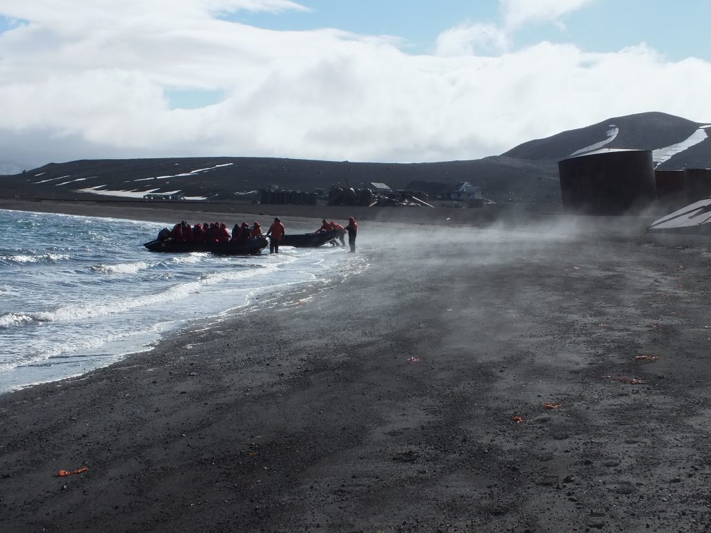
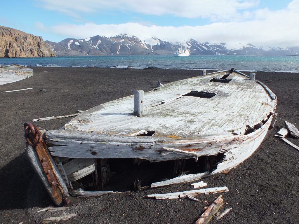
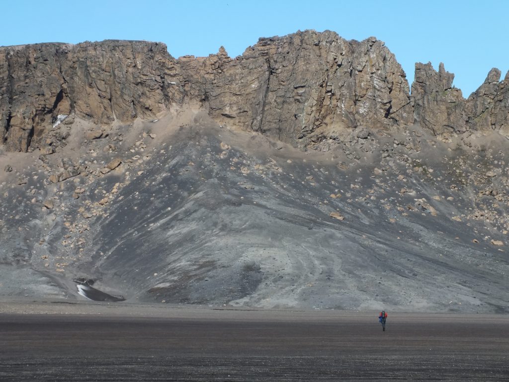
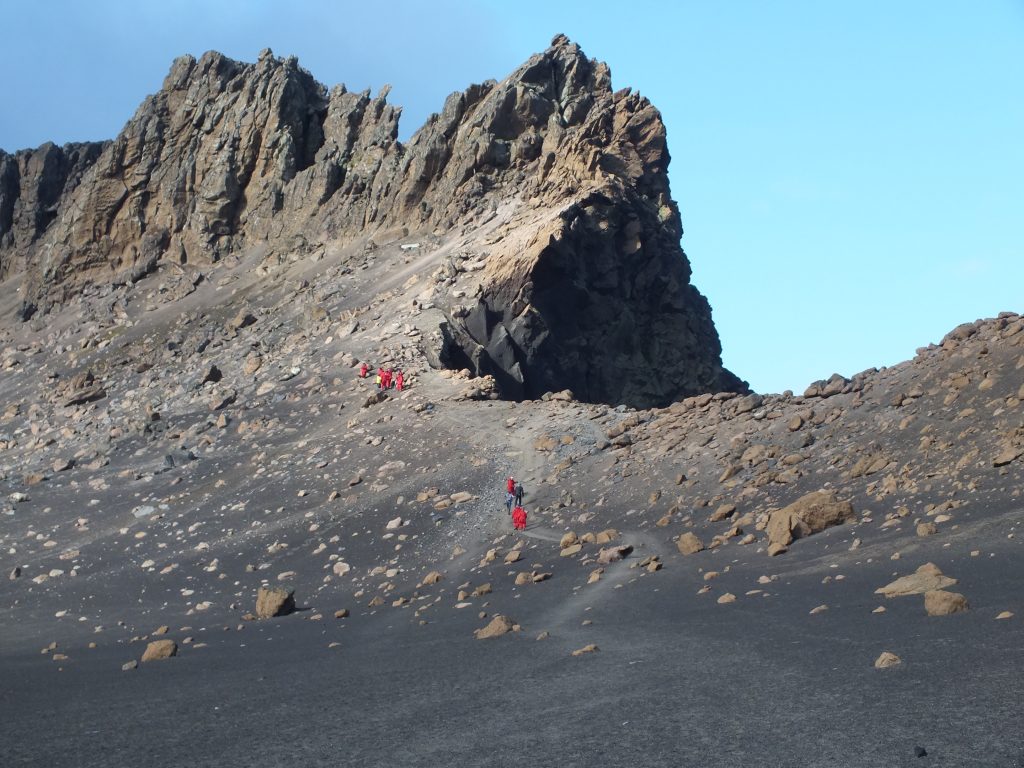
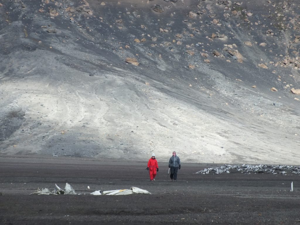
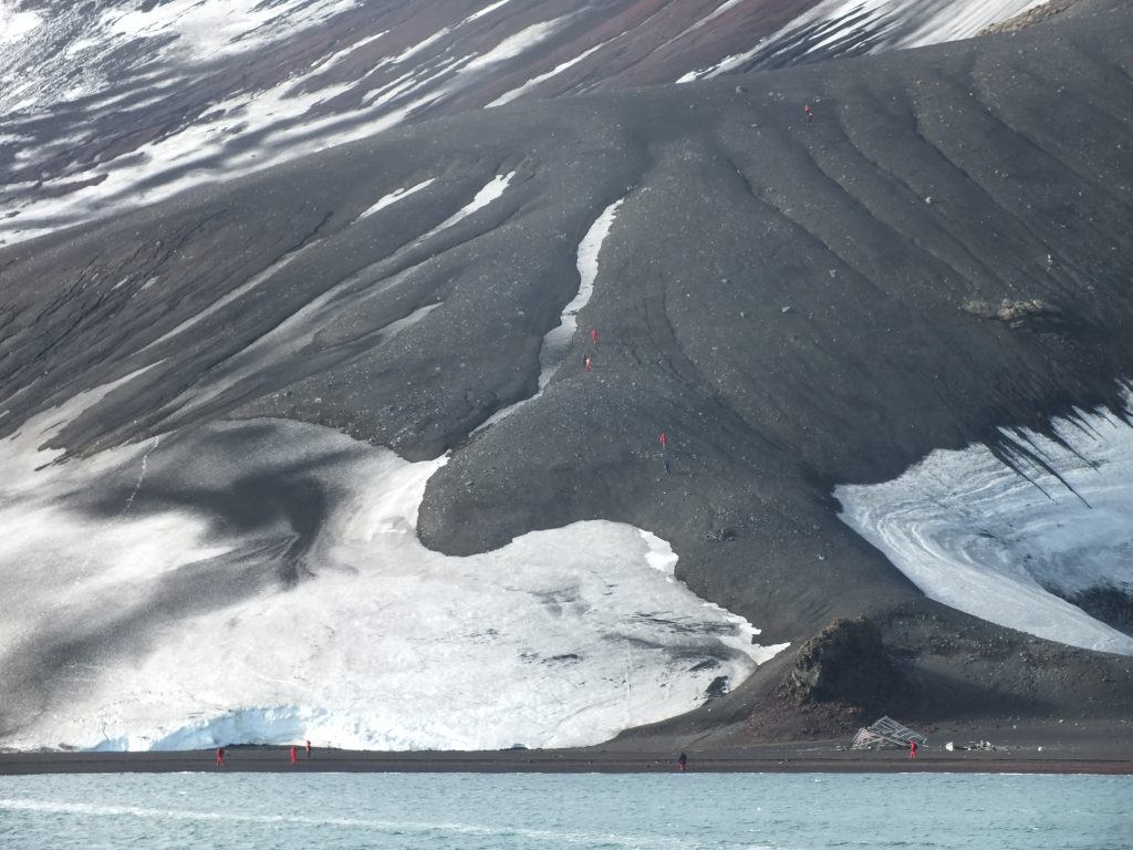
One of the many advantages of our ship, the Vavilov, is the fact that due to its size, it is more maneuverable than larger cruise ships. This meant that we were able to pay a visit and land on Deception Island. The island got its name due its outward appearance as a normal island, when in fact it is actually a ring around a flooded volcano caldera. The narrow entrance is called Neptune’s Bellows.
One of the the things I really wanted to see on this trip was Elephant Island. As I mentioned in an earlier blog and as many of you already knew, this is where Shackleton left 22 men while he and 5 others went off to South Georgia to secure their rescue. I knew we wouldn’t be able to land, even in the Zodiacs, because the island is surrounded by outlying rocks and the sea here is rough. However, the plan was to get us to within 100 meters of the beach where these incredible men spent 4 months before they were eventually rescued. The beach is at Wild Point, named for Shackleton’s right-hand man, Frank Wild. He is credited with keeping the men’s spirits and sanity intact during the long wait.
Unfortunately, we hit very thick fog long before the approach which failed to lift in time for us to make a sortie. We were also behind schedule at this point because the fog had persisted through the previous night and the ship had to slow to 7 knots. Knowing a lot of the passengers would be disappointed the captain circumnavigated the island and when we got to the south side we managed to get a glimpse.
Elephant Island
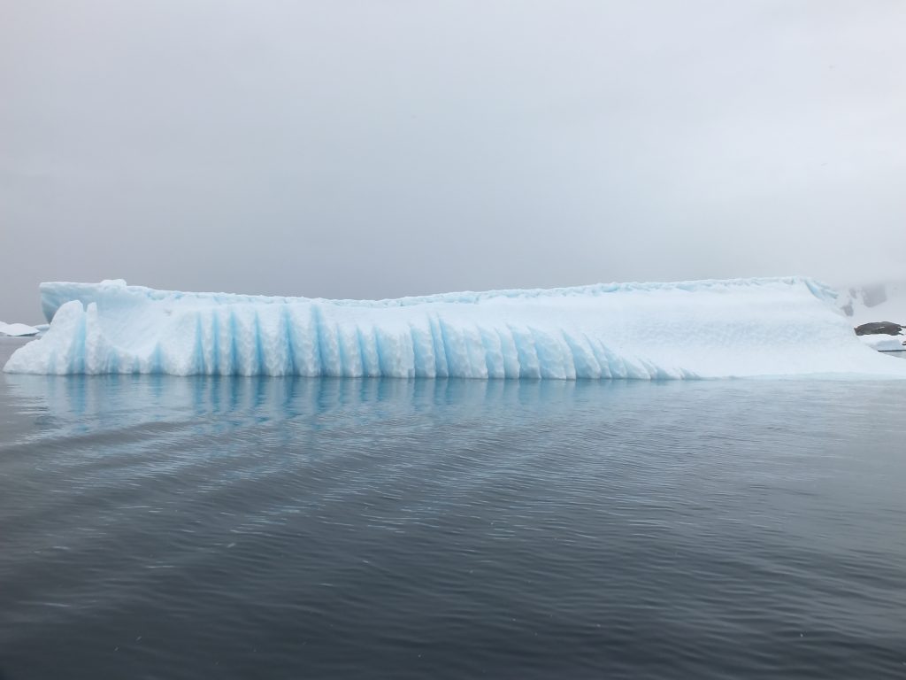
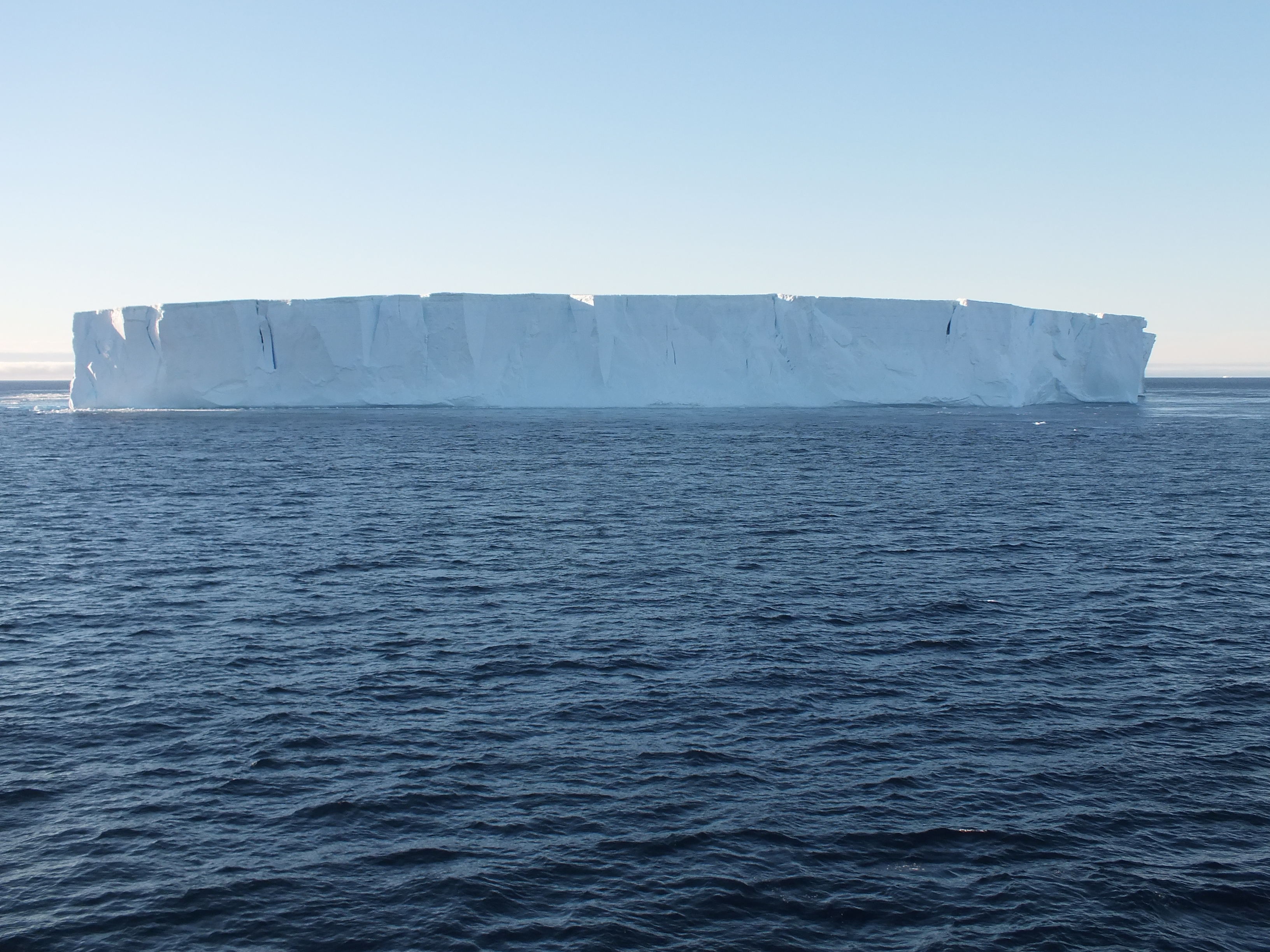
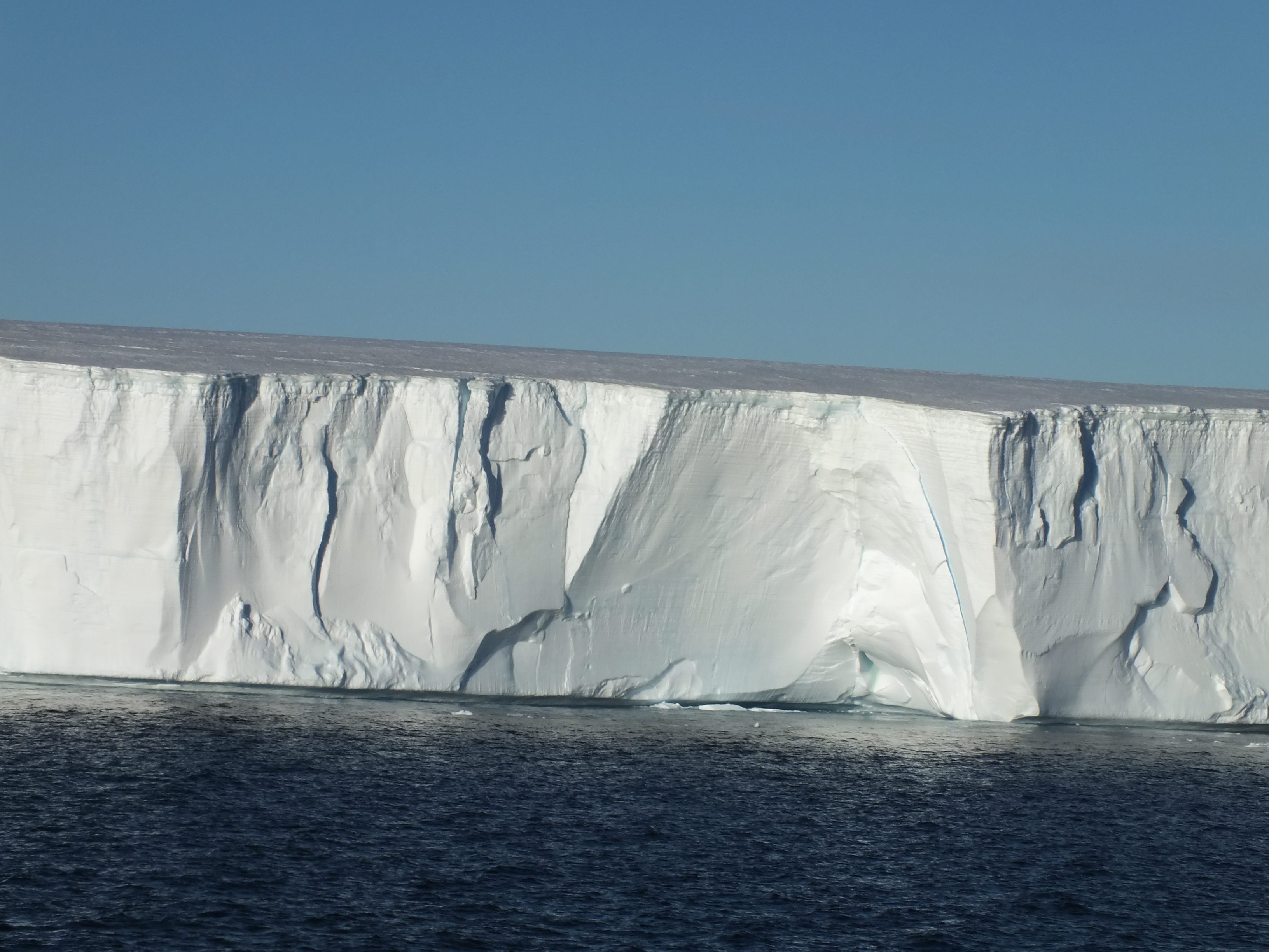
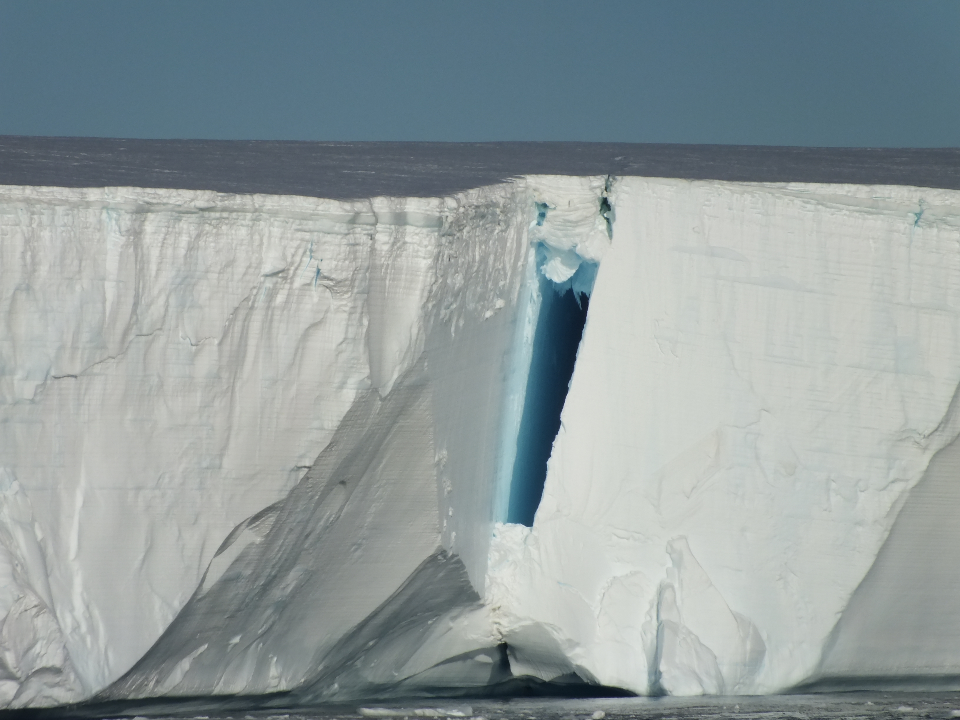
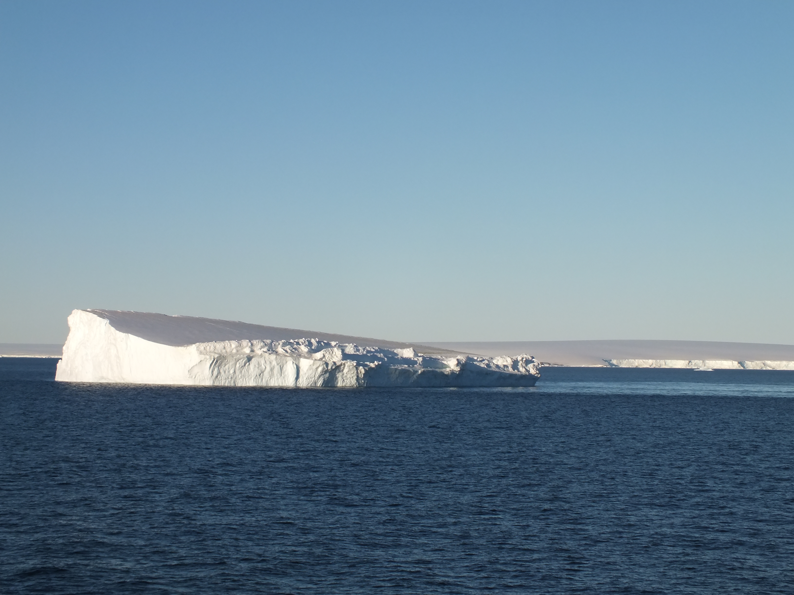
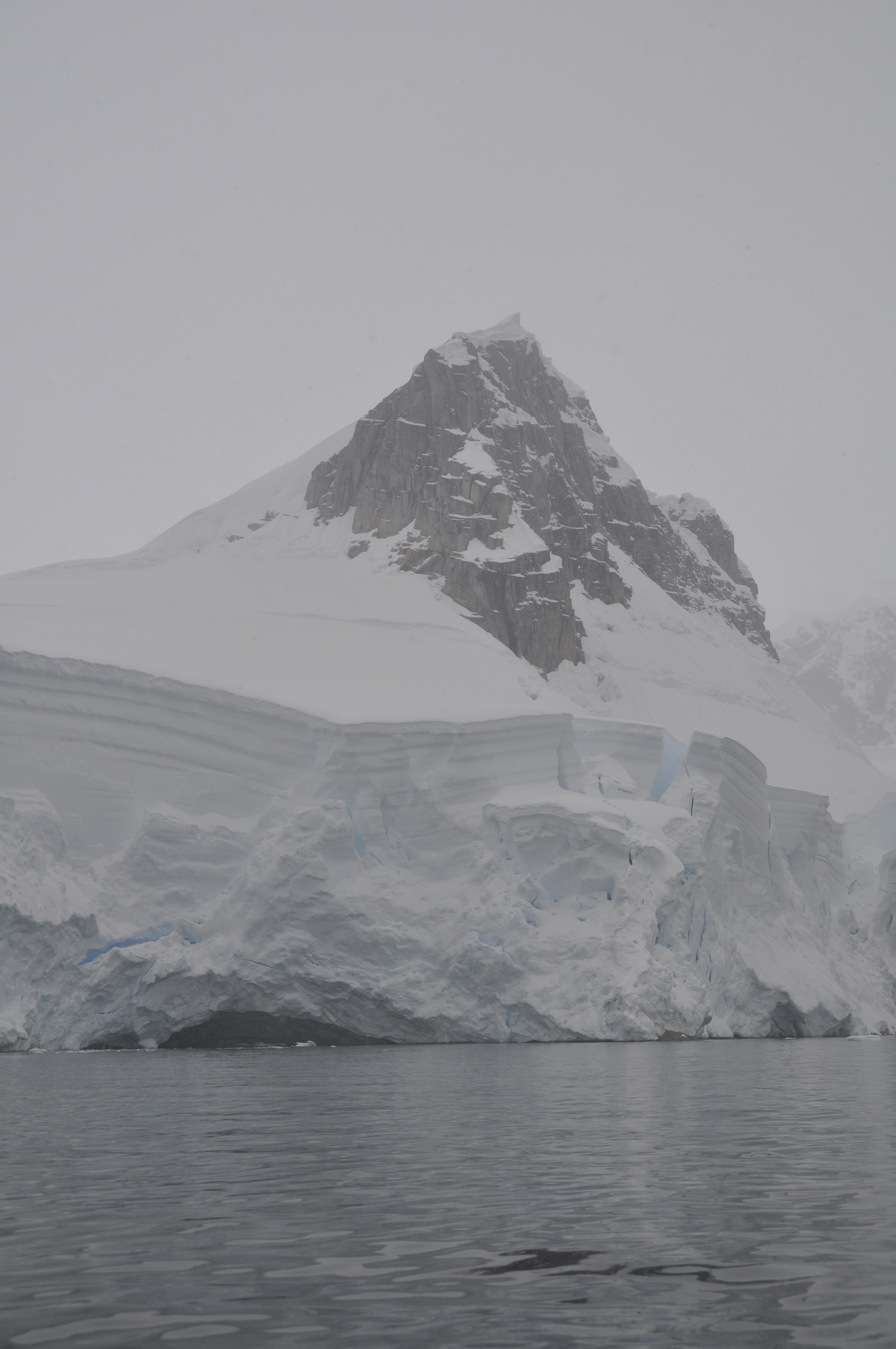
 There was nothing for it at this stage but to head into the Antarctic Sound and get our first sight of the Antarctic mainland. We headed off to Brown Bluff and marveled at the tabular ice bergs along the way.
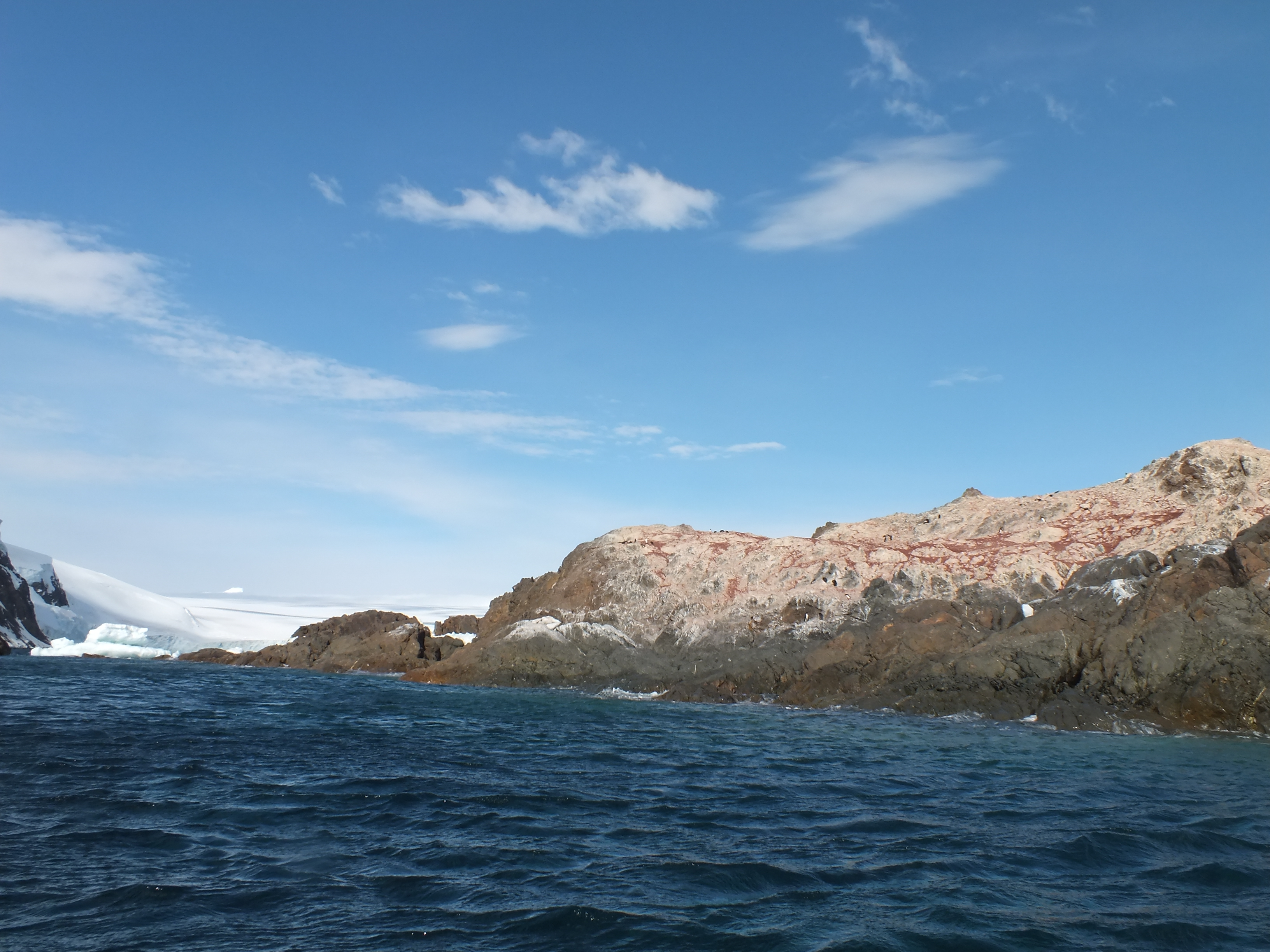
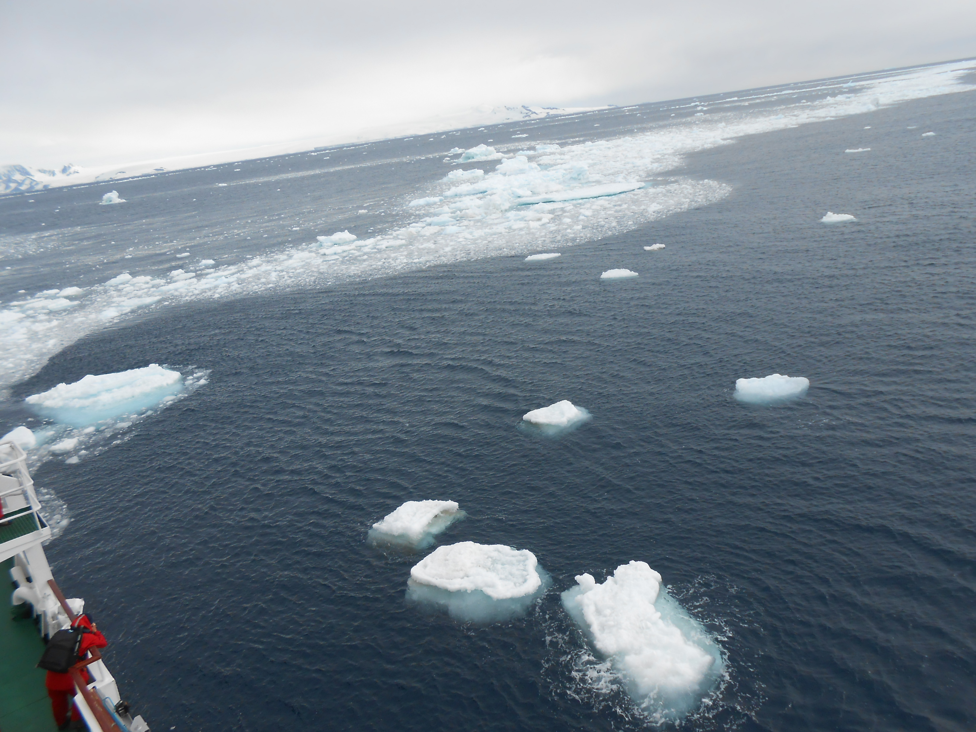
 Well, we didn’t get to land at Brown Bluff. When we got there the sea was full of brash ice and massive ice bergs. This captain was not going to be stuck in the ice like his colleague before Christmas on the Academik Shokalskiy. We moved on to Joinville Island and landed there at Madder Cliff. The mainland will have to wait a few more days. At least we are in the Antarctic Sound.
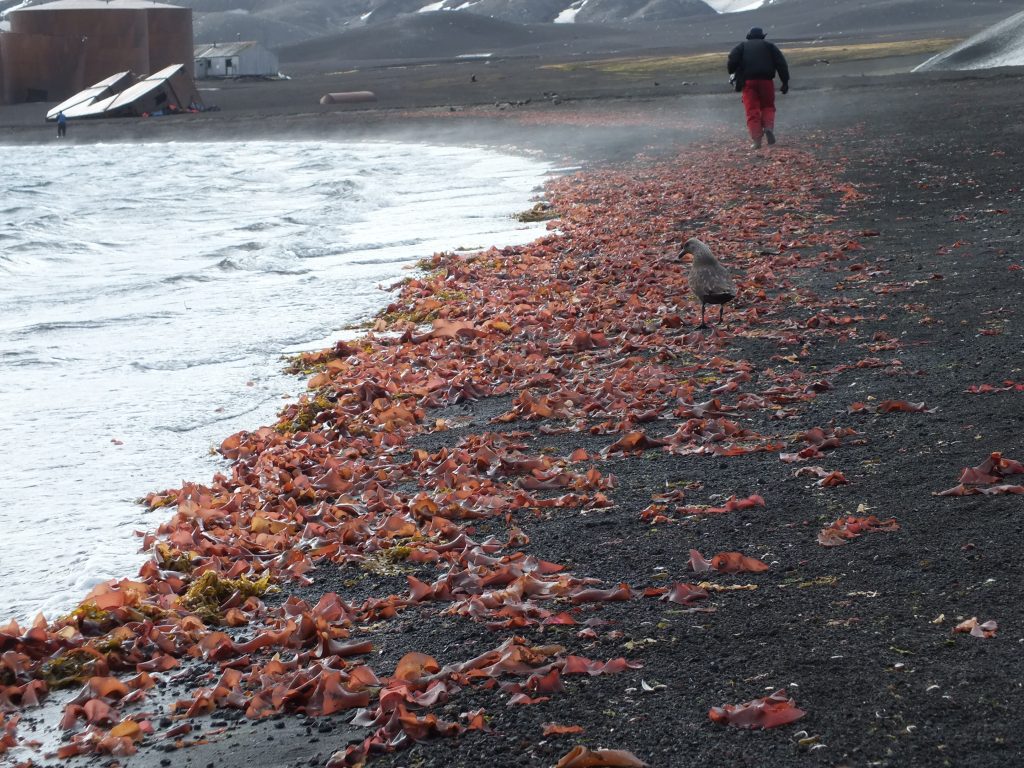
Madder Cliff is so called because of it’s red colour, derived from an algae.
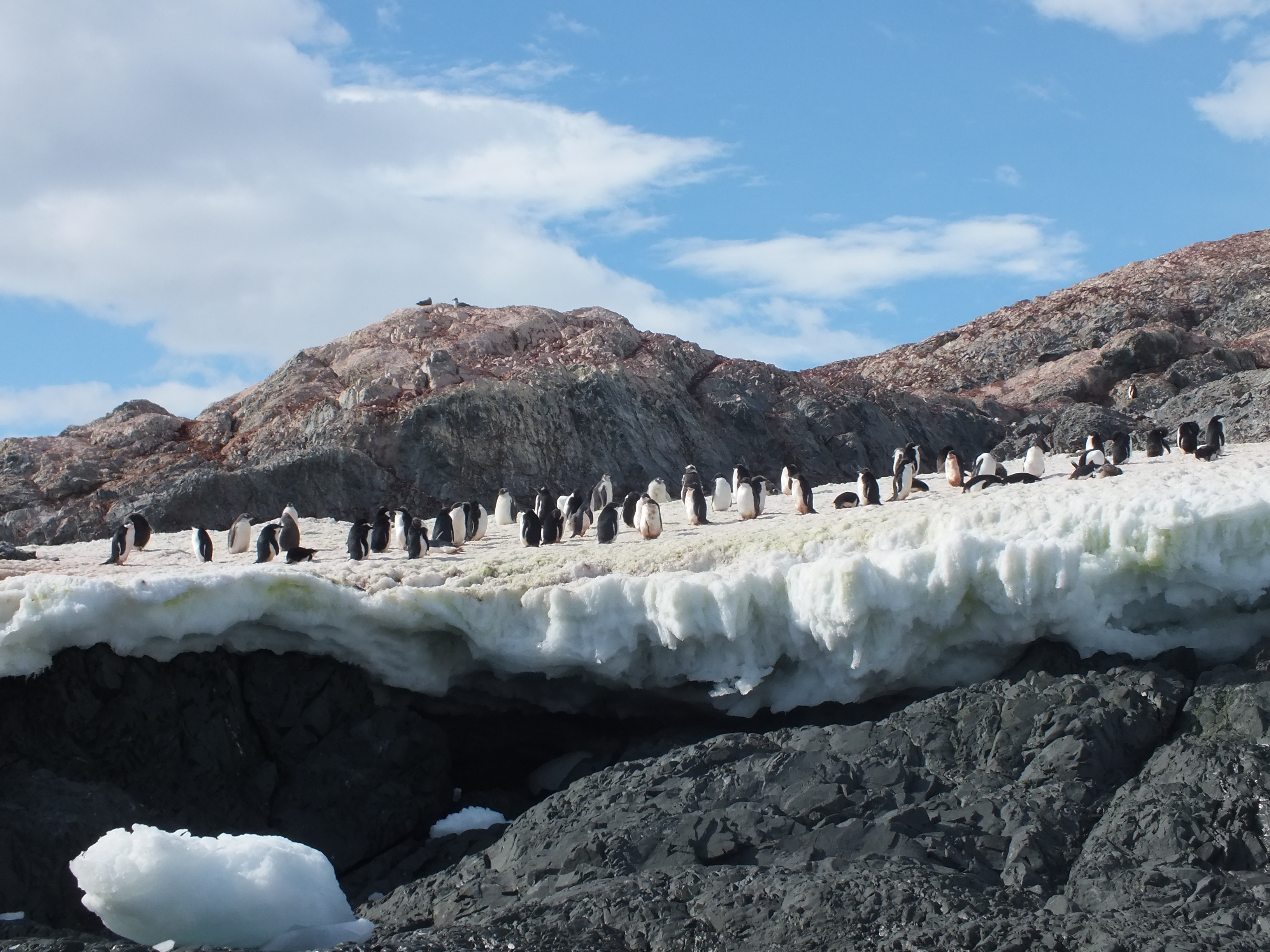
Penguins not so clean here!
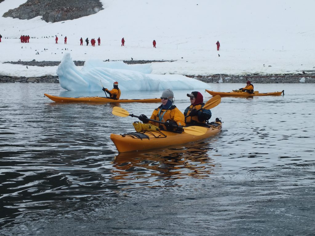
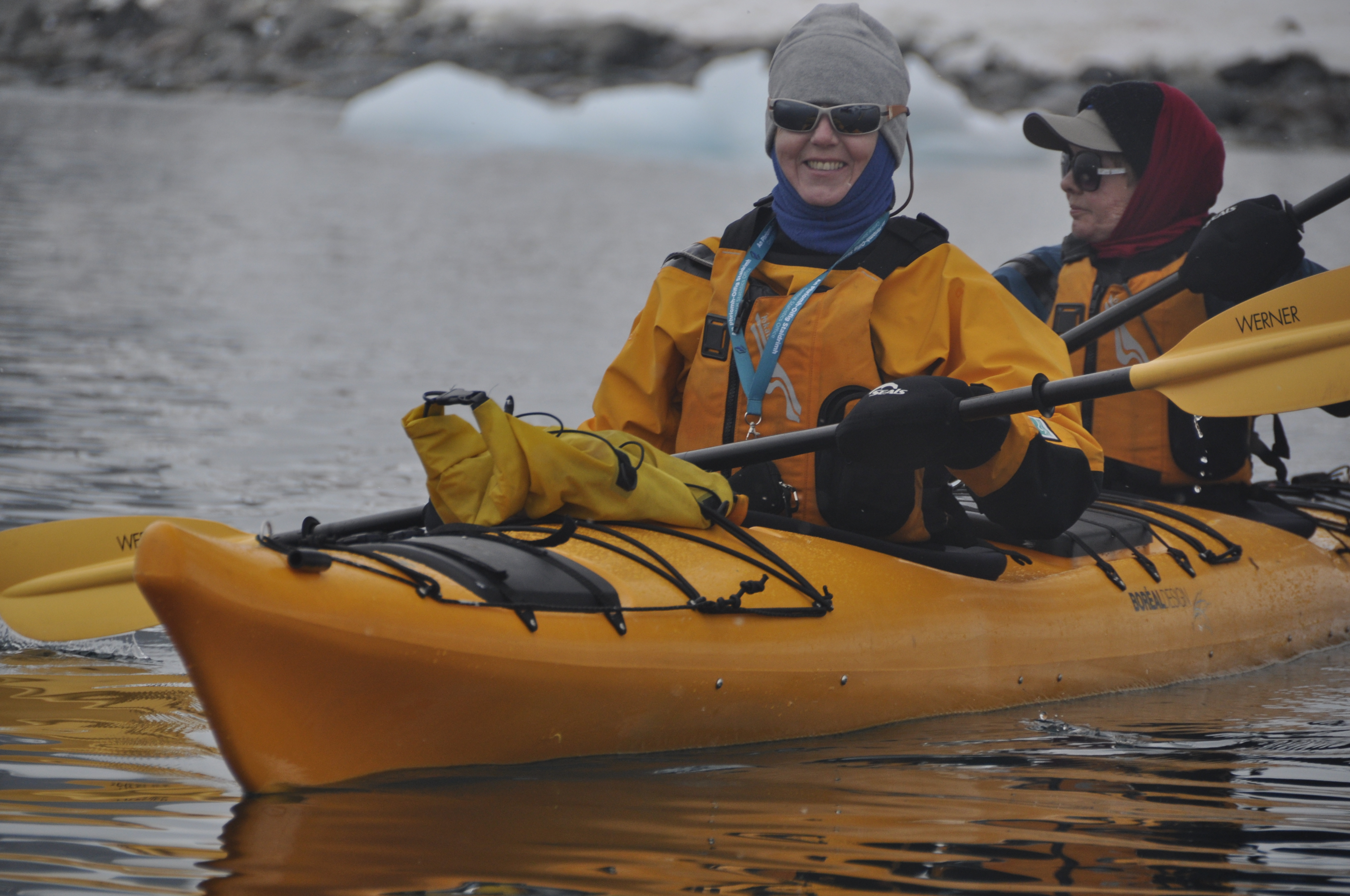
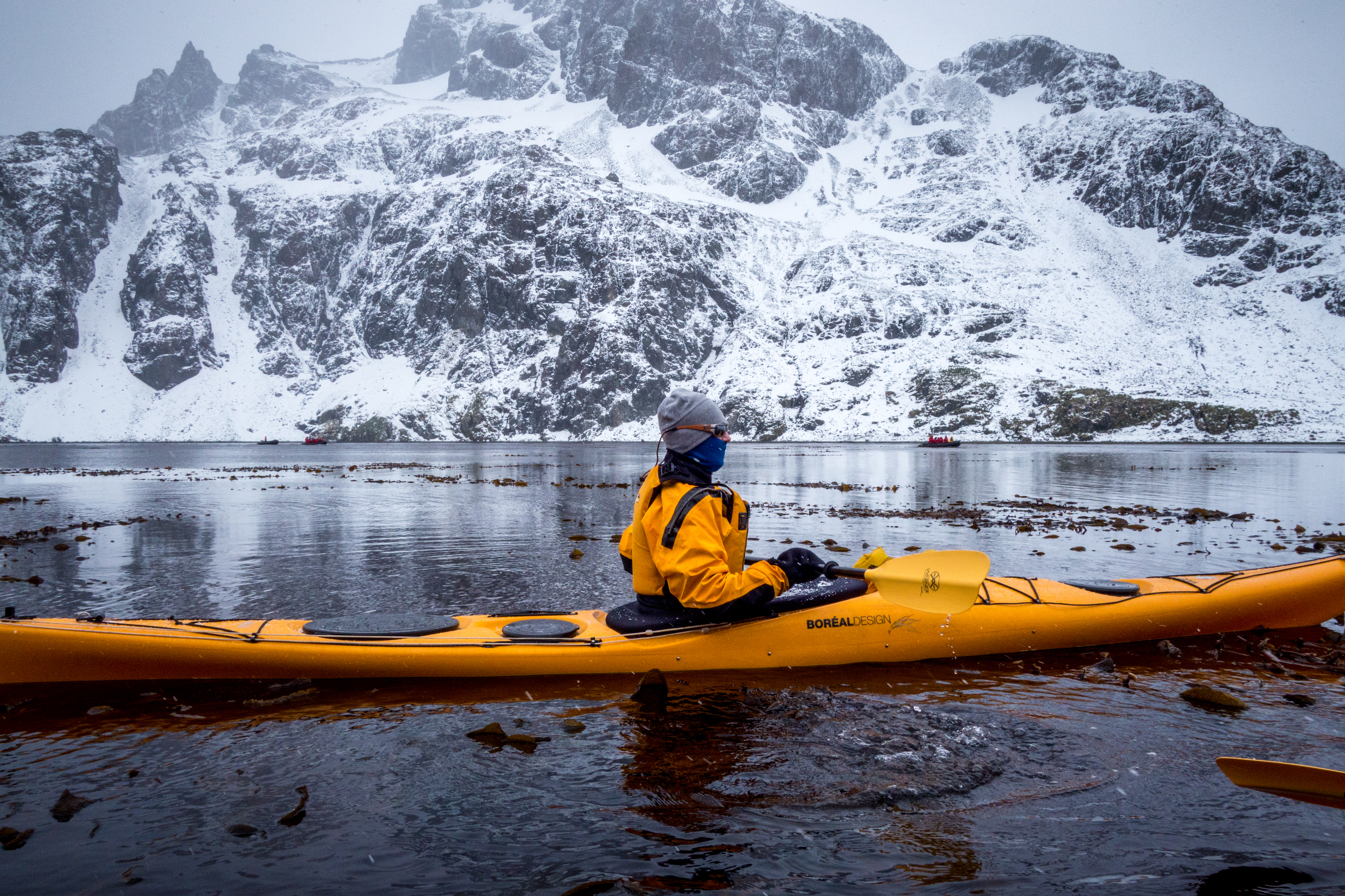
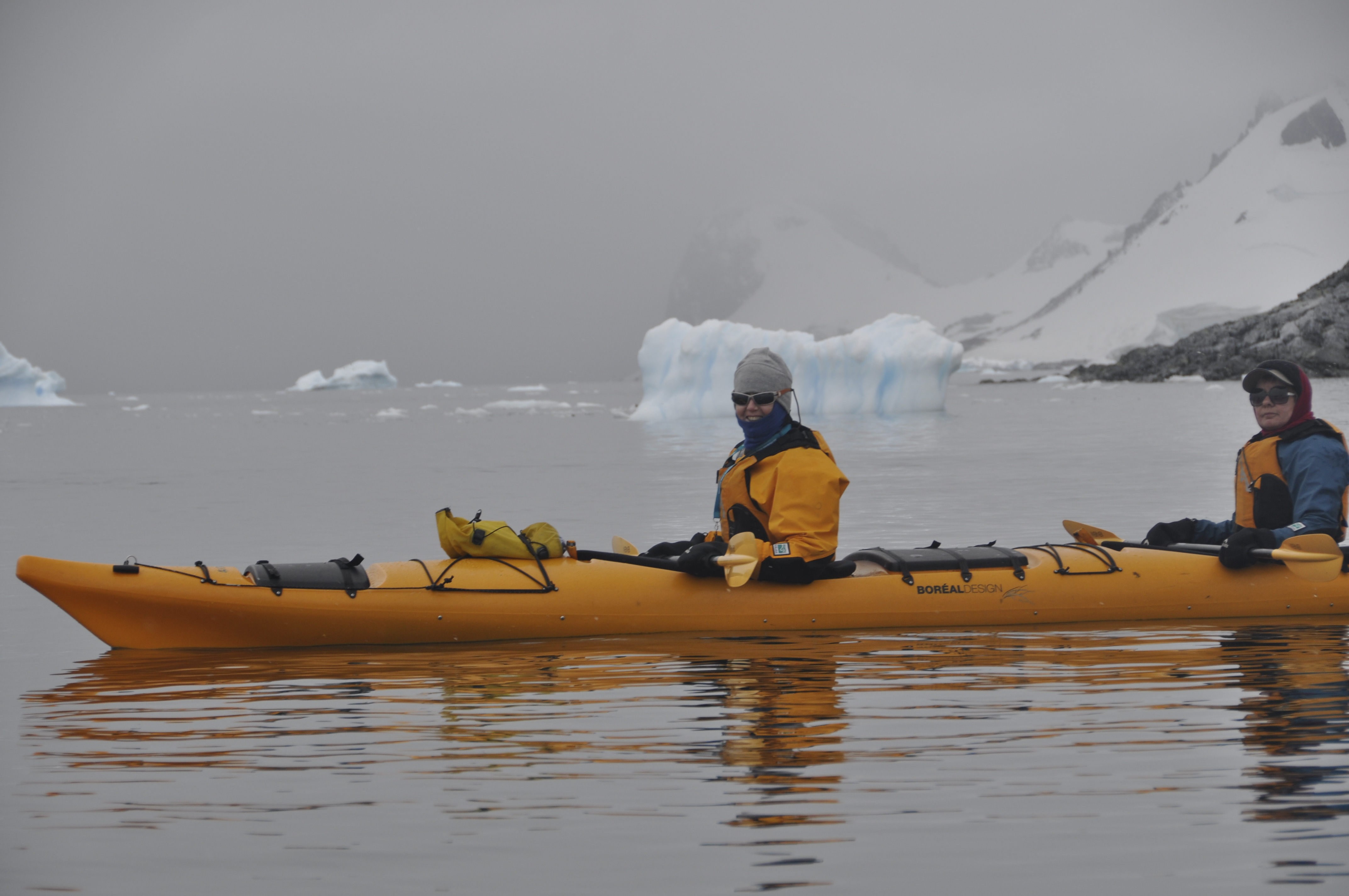
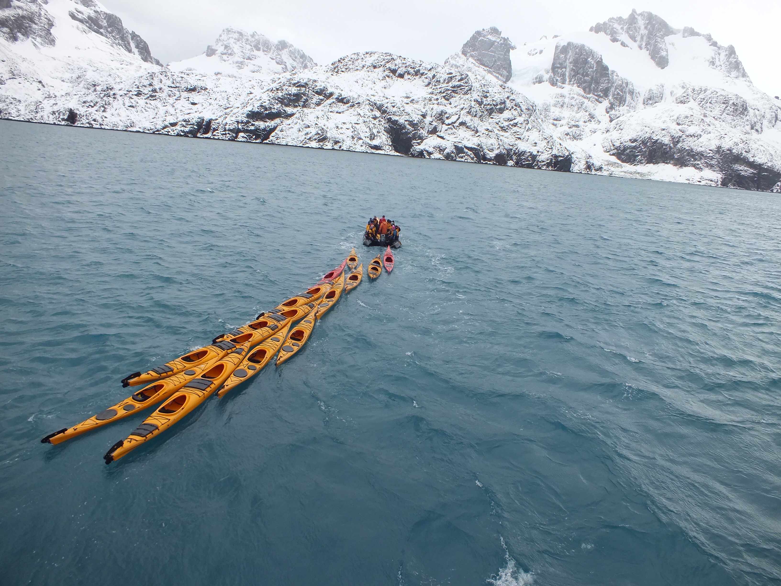
I didn’t bother landing here. On the other hand Margaret, never daunted, headed off with the rest of the kayakers. It’s been a while since I posted any photos of her canoeing so here’s a few taken by Patricia.
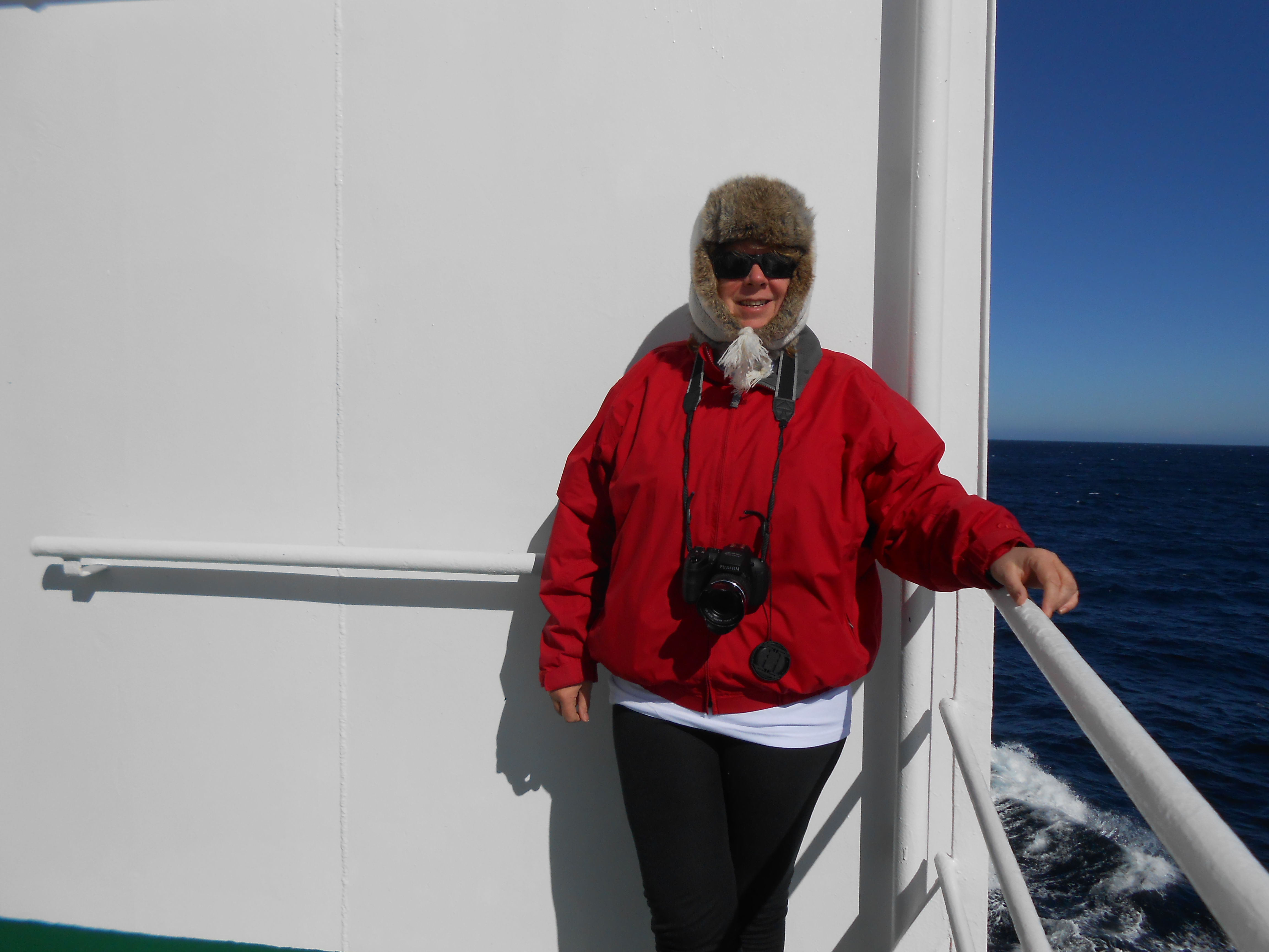
 All the while I mitched at the back of the ship.
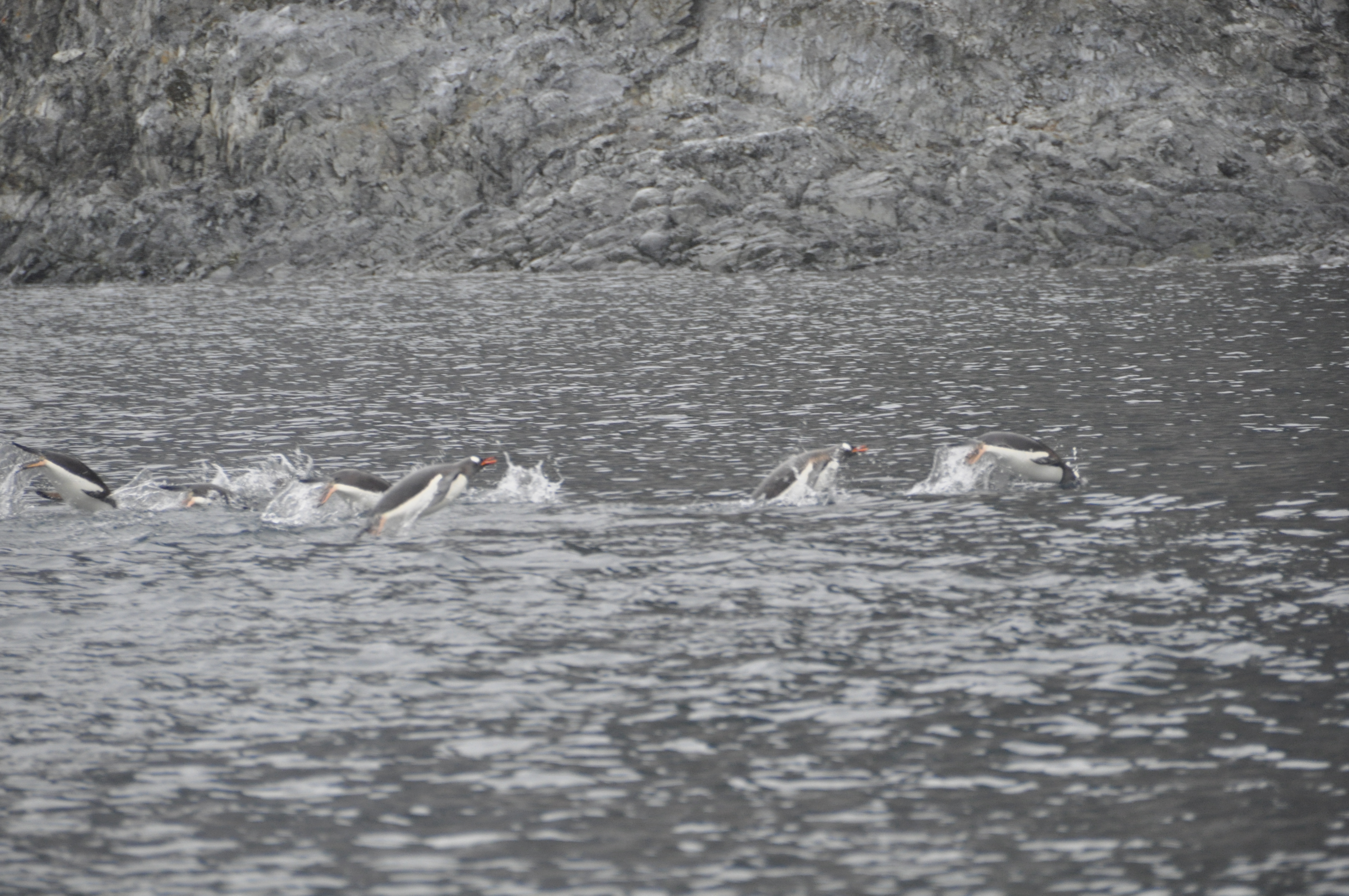
 … and to finish off – more penguins – these ones rushing home with bellies full of dinner no doubt.
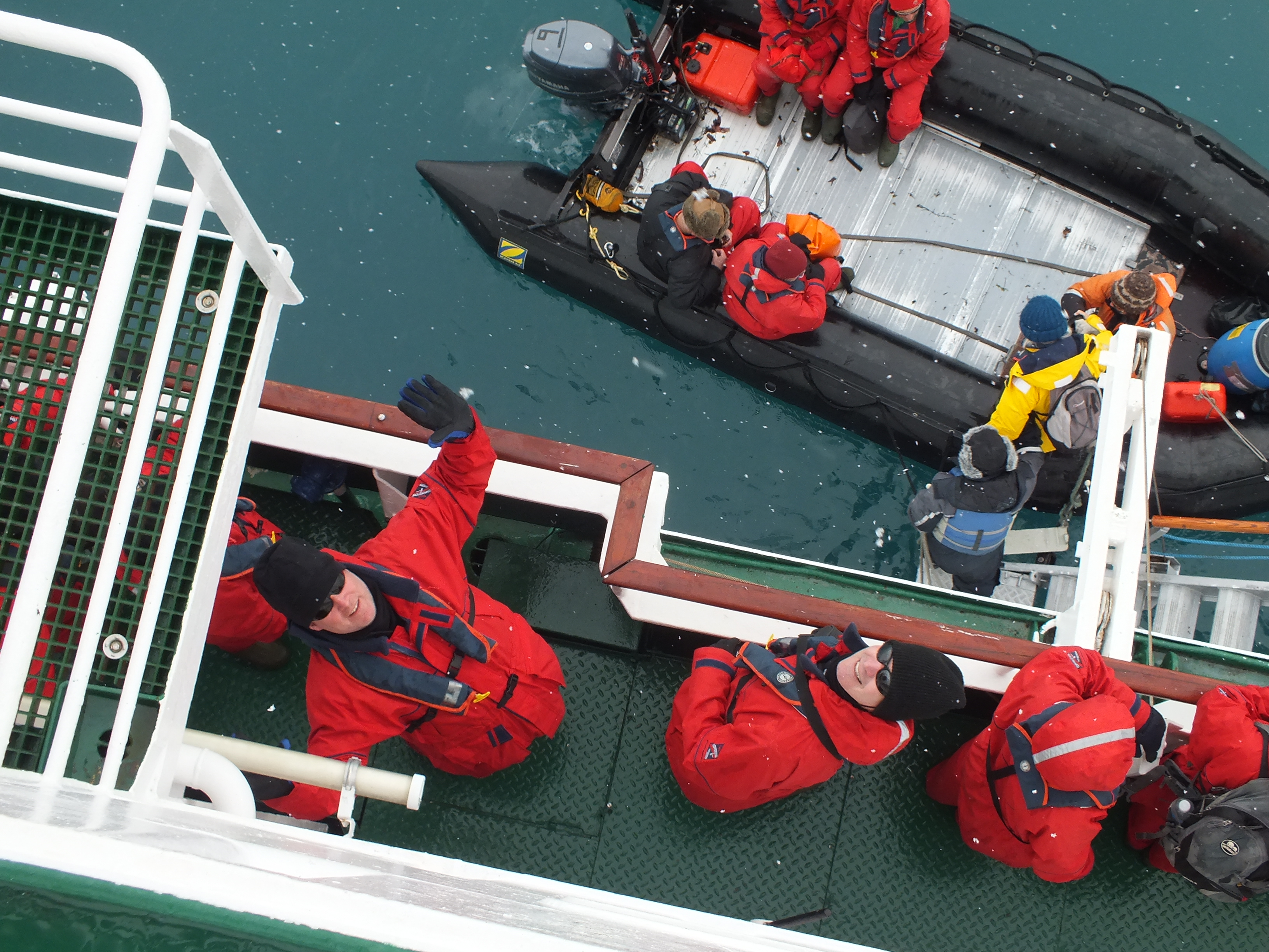
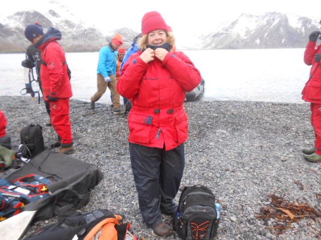
After a couple of stormy days at sea with winds upward of 40kts, we arrived at the South Orkney Islands. We are now at 61′ South and inside the Antarctic Treaty Zone at last. There are 4 islands in the S. Orkneys. The Vavilov anchored off Laurie Island. It is cold now, though I hear it is colder in New York! So, on with the 4 layers of clothes and foul weather gear on top and into the Zodiacs with us. The sea was still a little rough and I got splashed on the way to land. While the foul weather gear kept me dry I couldn’t believe how cold the water felt, even through all the layers.
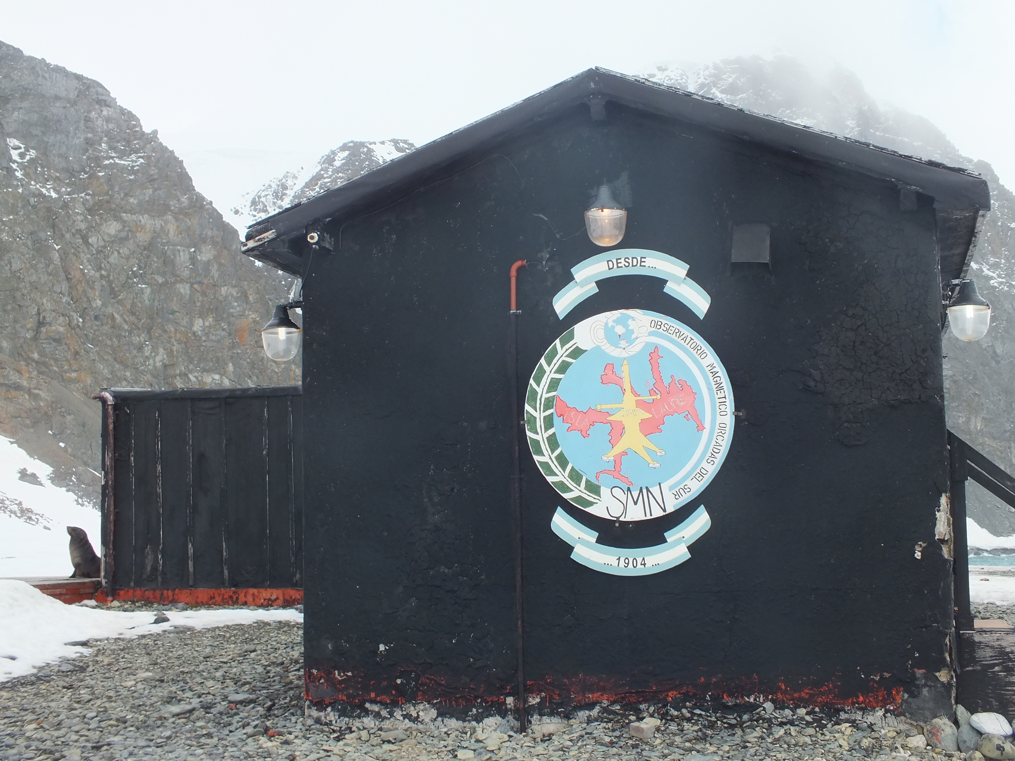
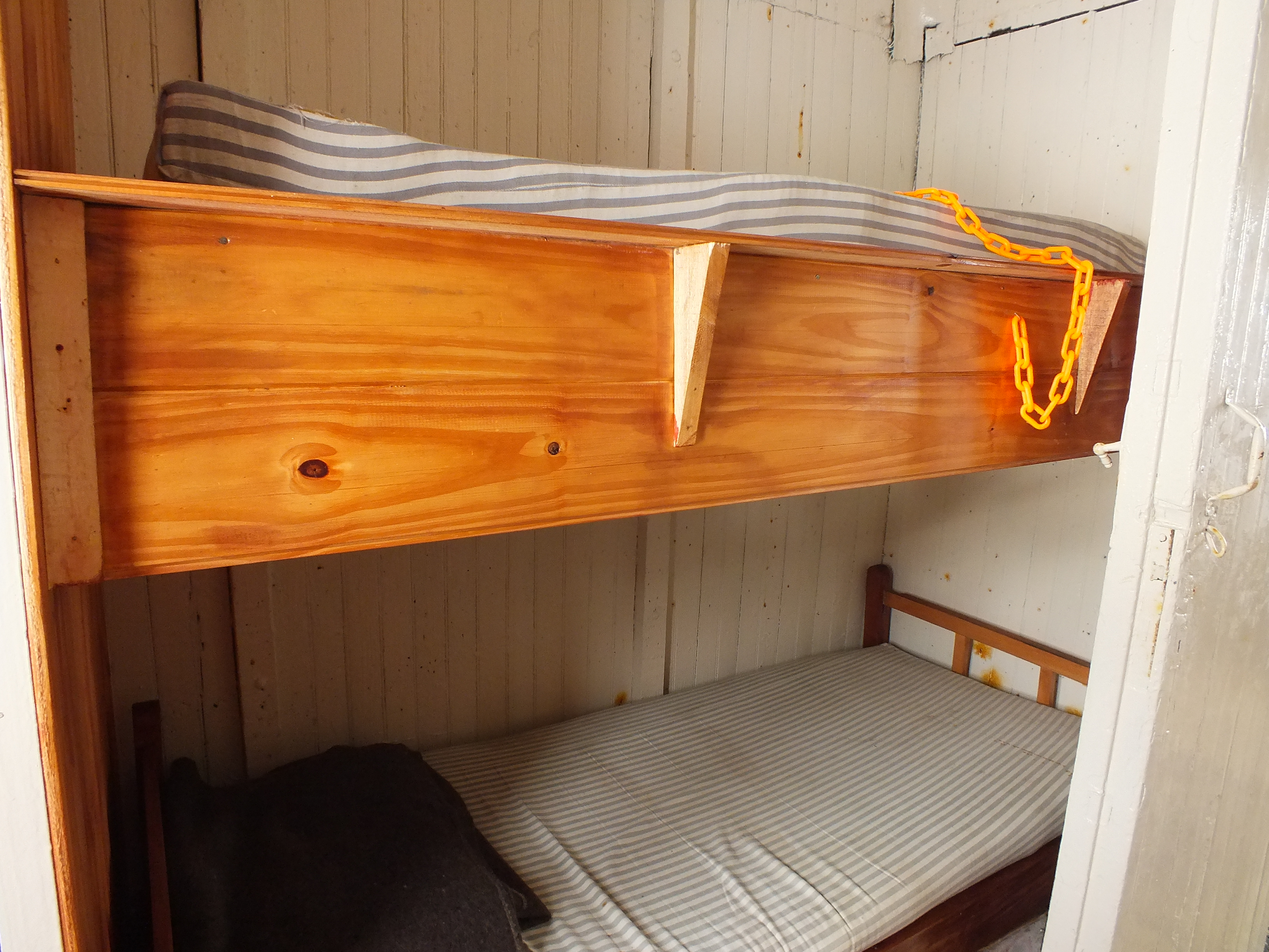
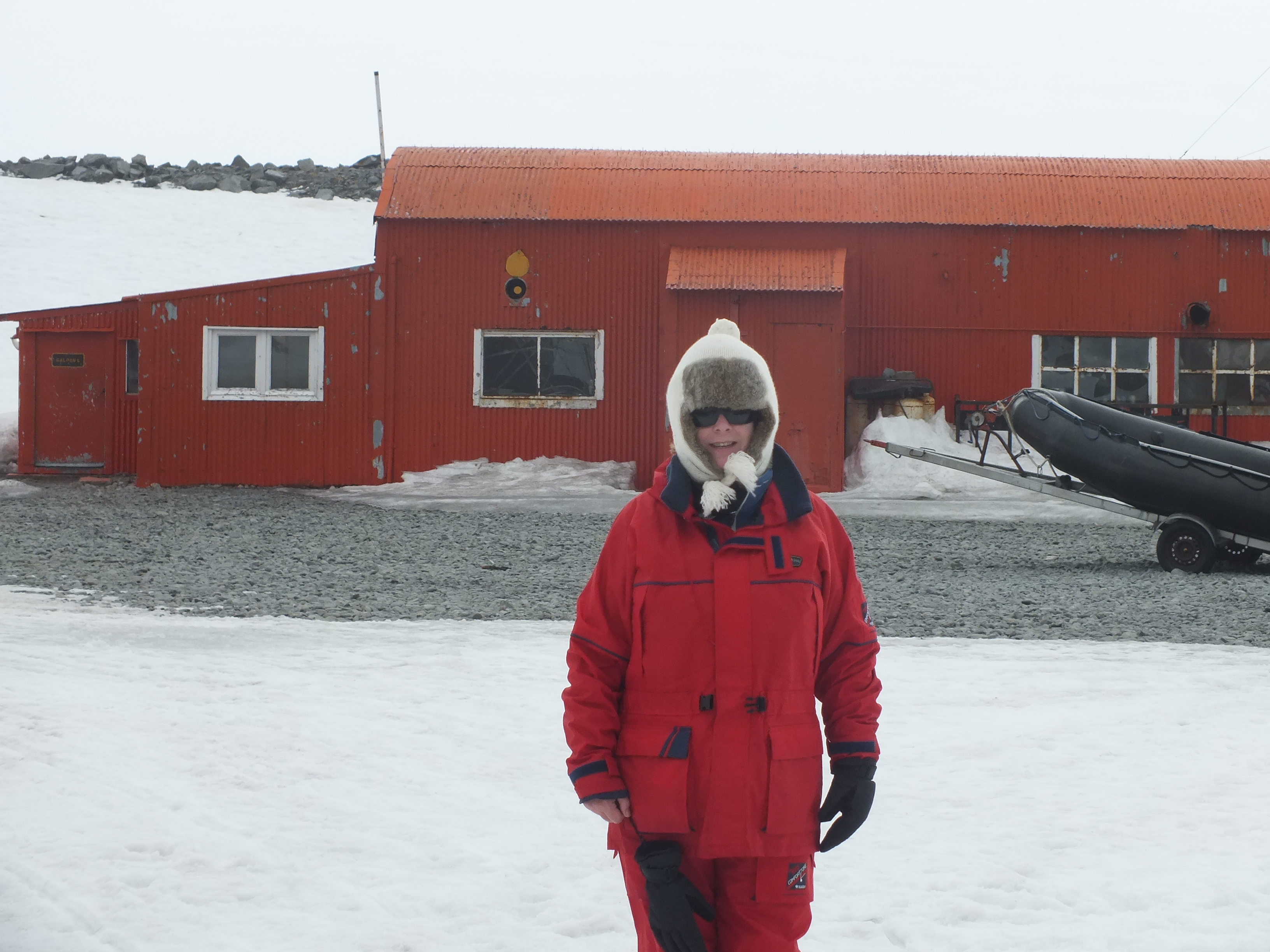
The only people living on Laurie are housed in the Orcadas Meteorology Station, owned by Argentina. It was set up in 1903 by a Scotish explorer William Spiers Bruce. When Bruce left Laurie a year later he handed it over to Argentina and as such is the oldest continuously run research facility in Antarctica. The accommodation has improved over the years (not by much) but the original base is still there and is open to visitors.
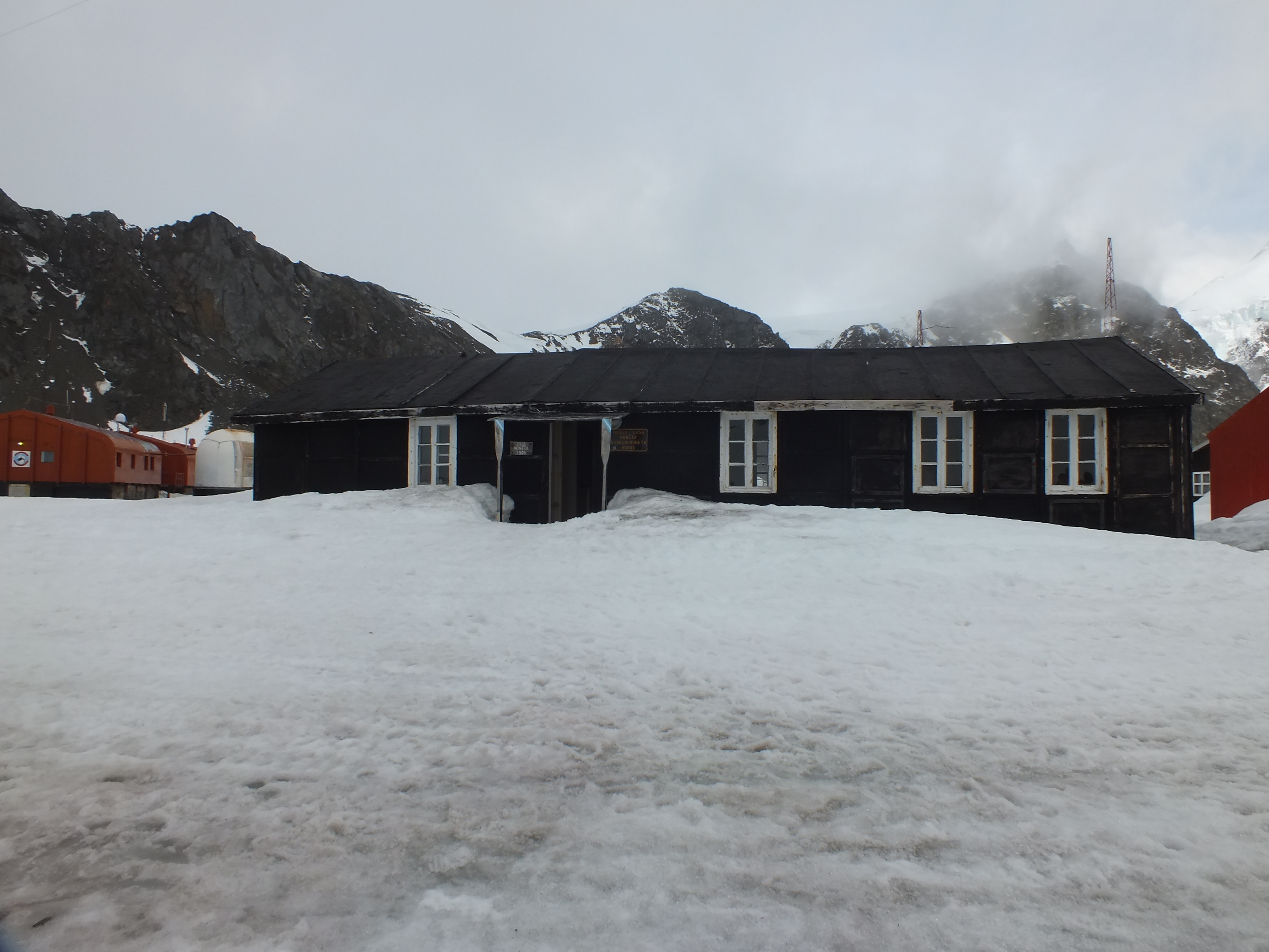
Original Station
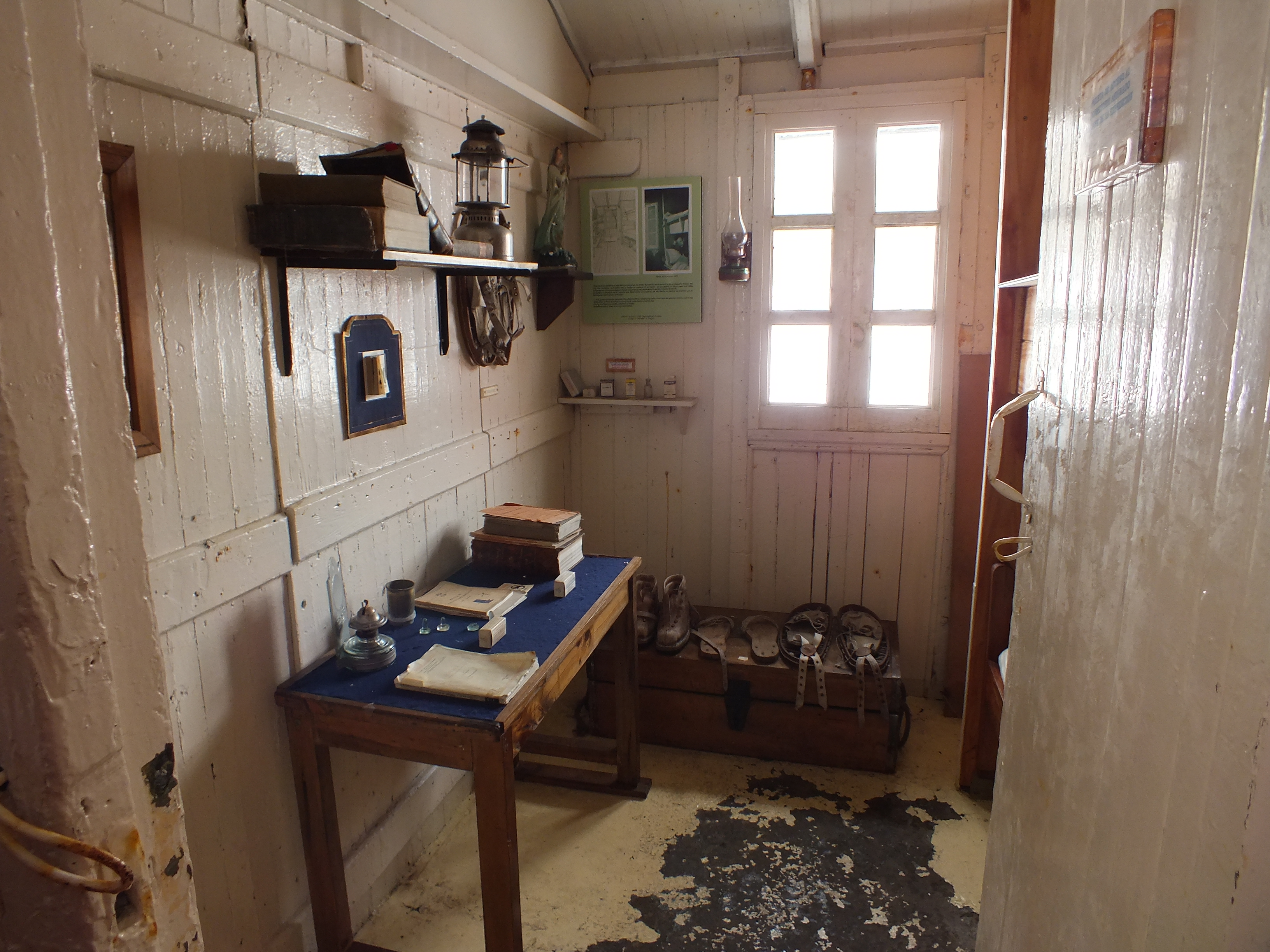
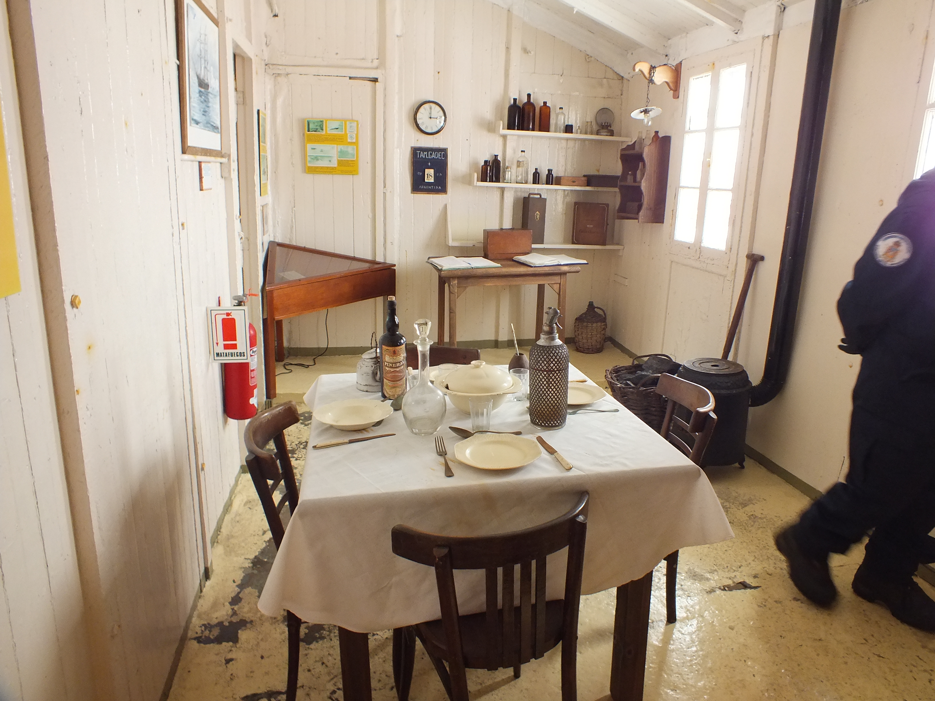
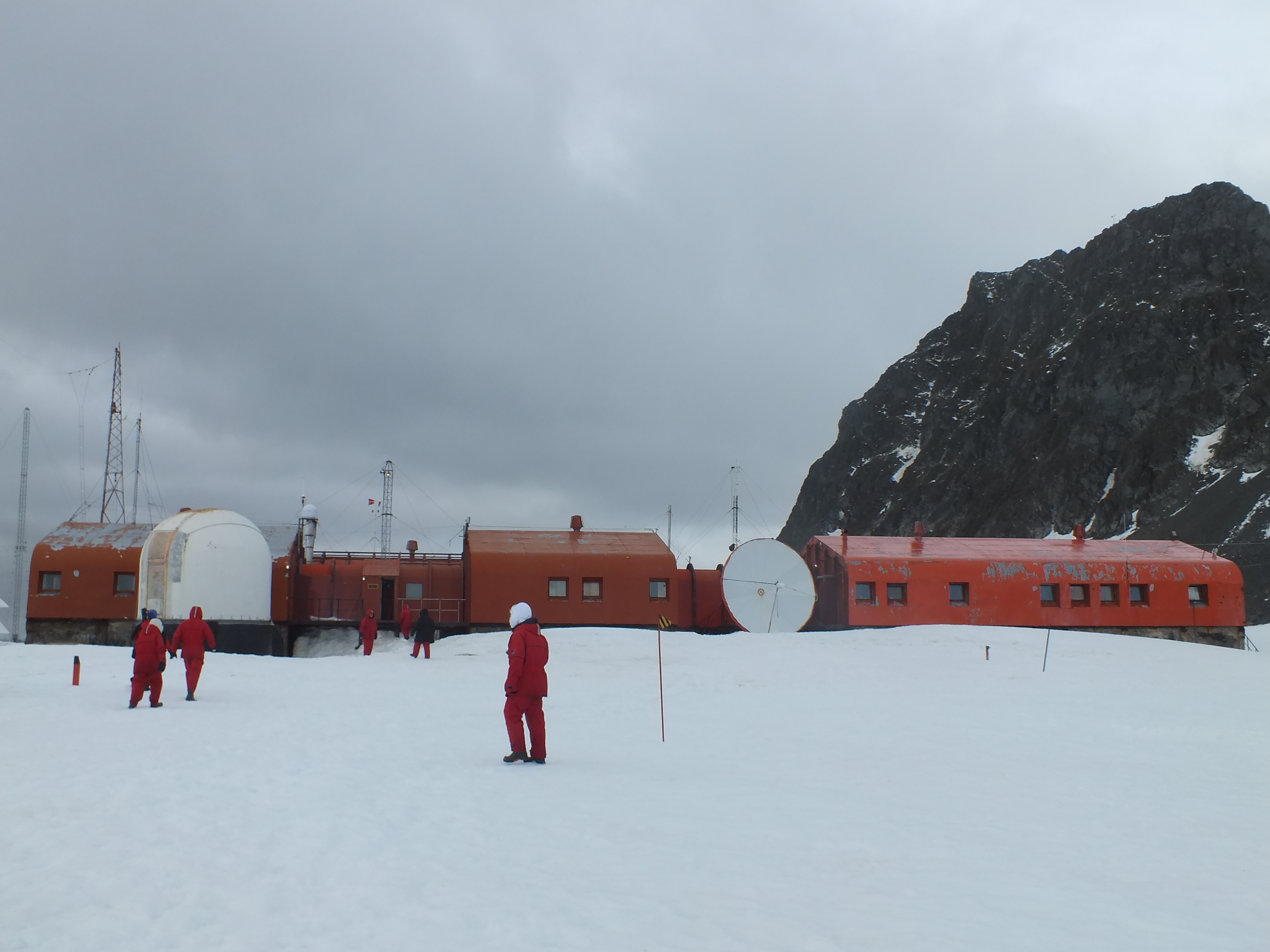
There are 45 people stationed here in during the Summer months, 14 of whom stay on through the Winter (only 2 women – doctor and nurse). They were delighted to have visitors and plied us with tea/coffee and biscuits. I would have felt bad taking their goodies except that we passed piles and piles of crates on the beach where a supply ship had just re-provisioned them. This is a desolate place and I can’t imagine how people spend a whole year here. No mobile phone signal!! No WiFi. I couldn’t do it. There is a church though, maybe life here would drive me into believing.
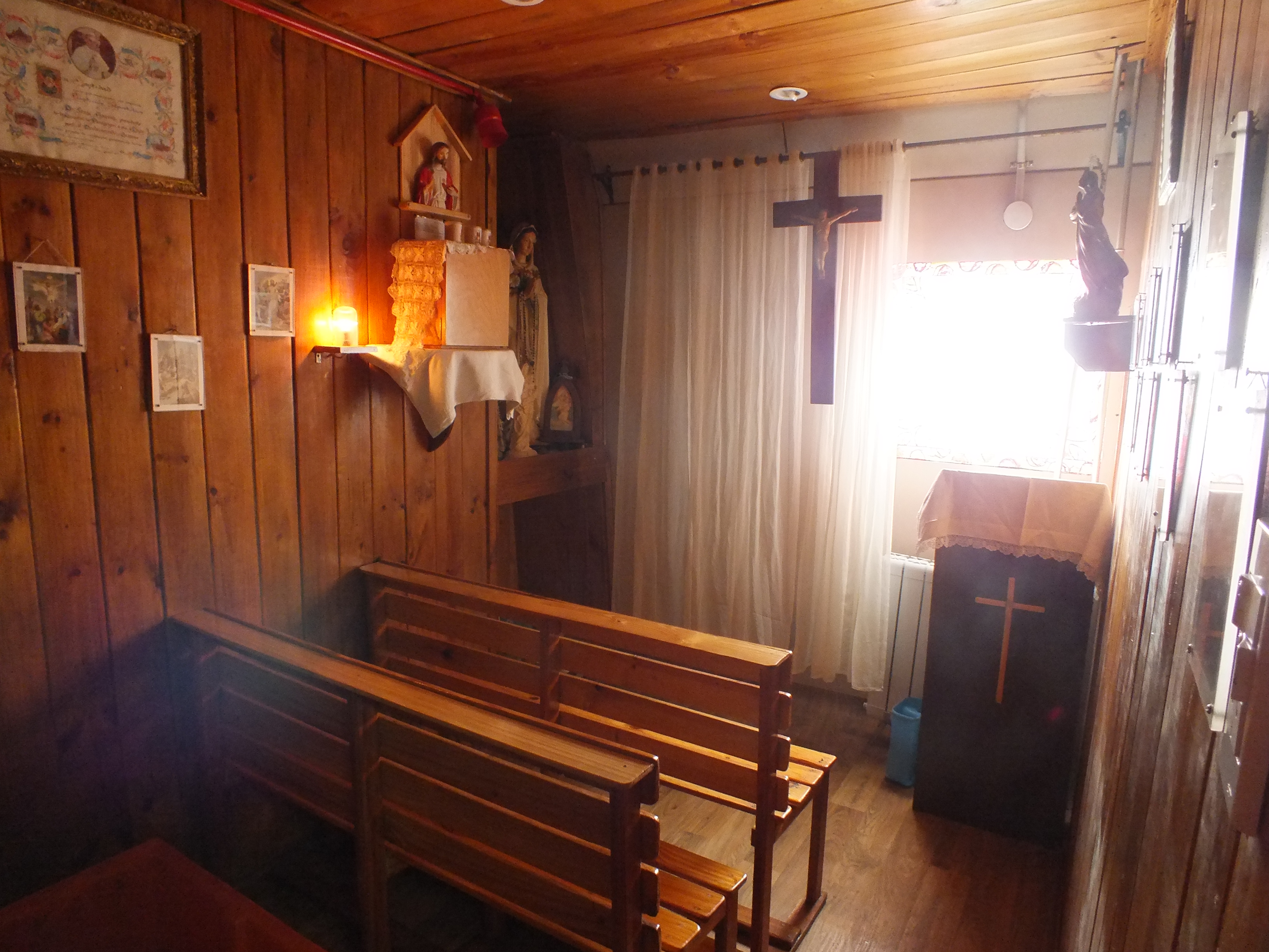
Tiny church in the new base.
New base in the background. Not as pretty as the old one but definitely warmer.
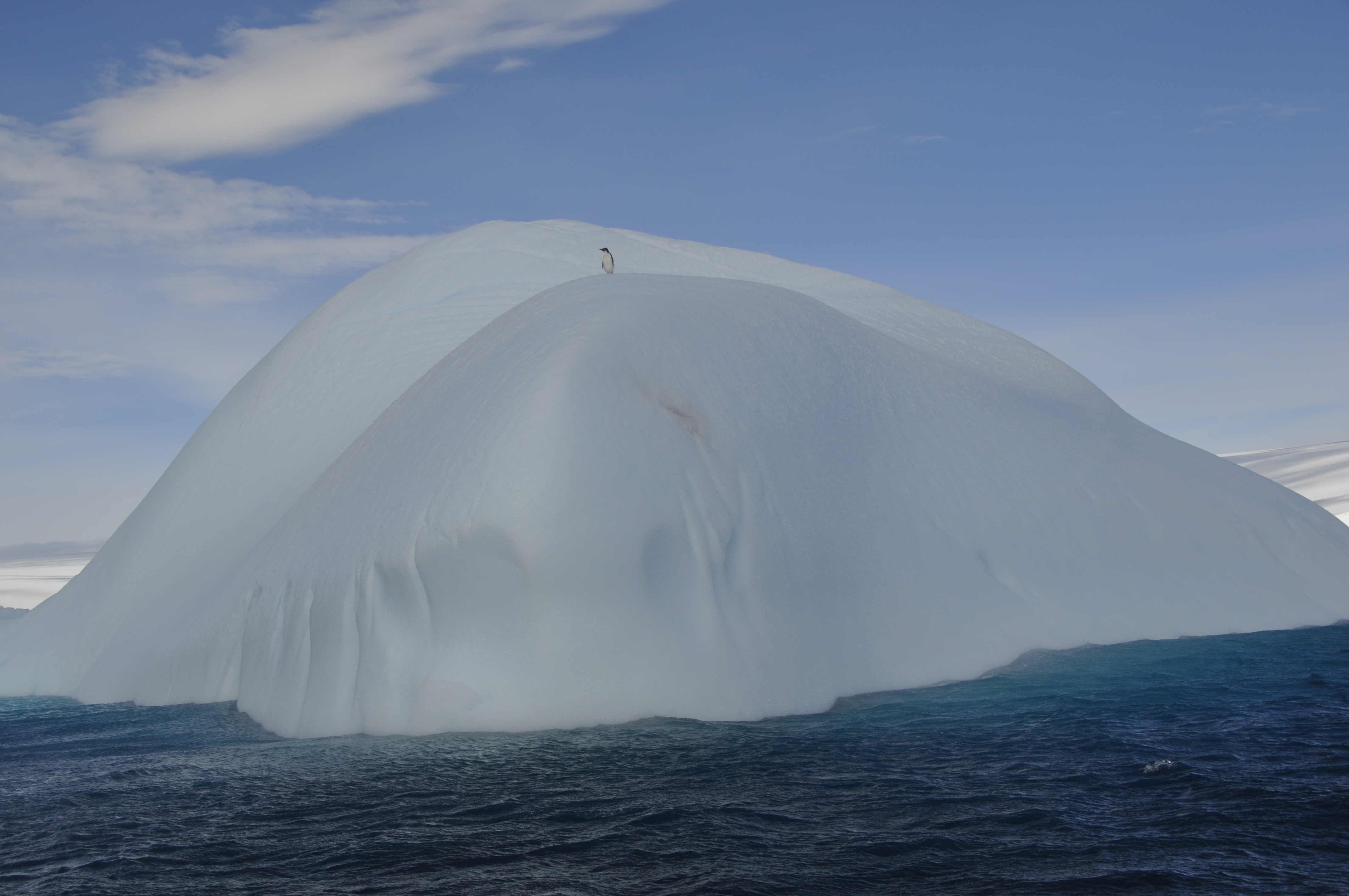
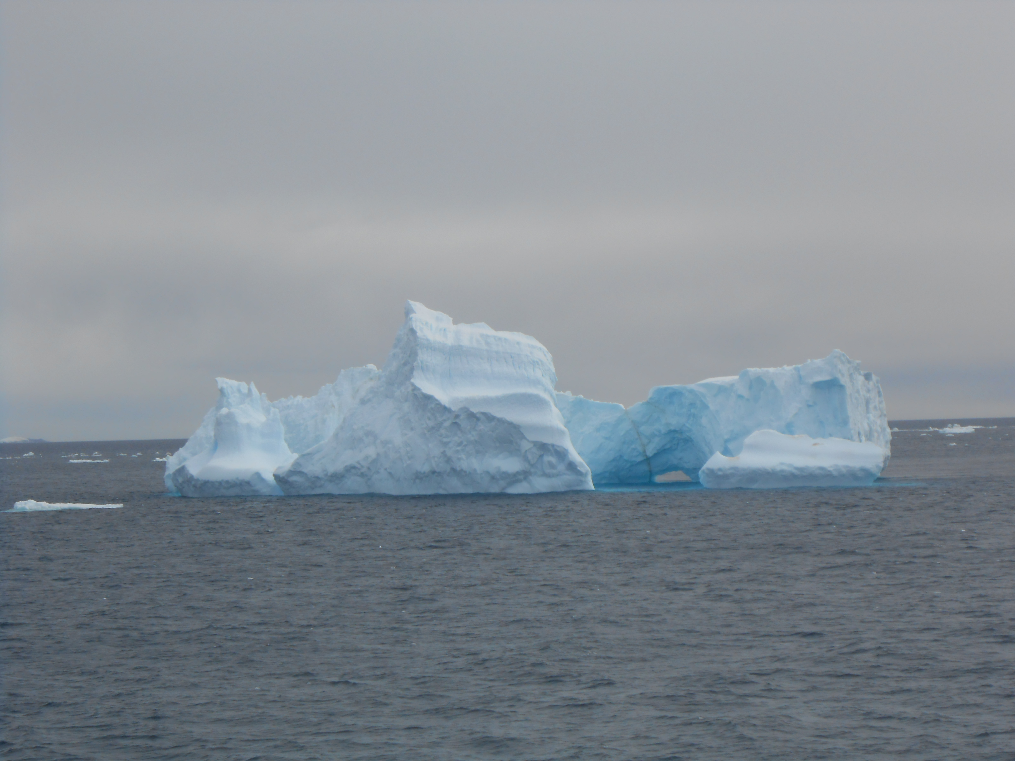
For an hour or so before we arrived at Laurie we started to see out first ice bergs. They have broken away from the Filchner Ice Shelf on the Antarctic peninsula and floated out through the Weddell Sea into the Southern Ocean. (More on ice bergs in the next blog). So, on the way back to the ship, the Zodiac drivers took us for a spin to see a couple.
Where is everyone? click to see lone penguin.
About to be an ice berg – known as calving.
Oh Oh !!
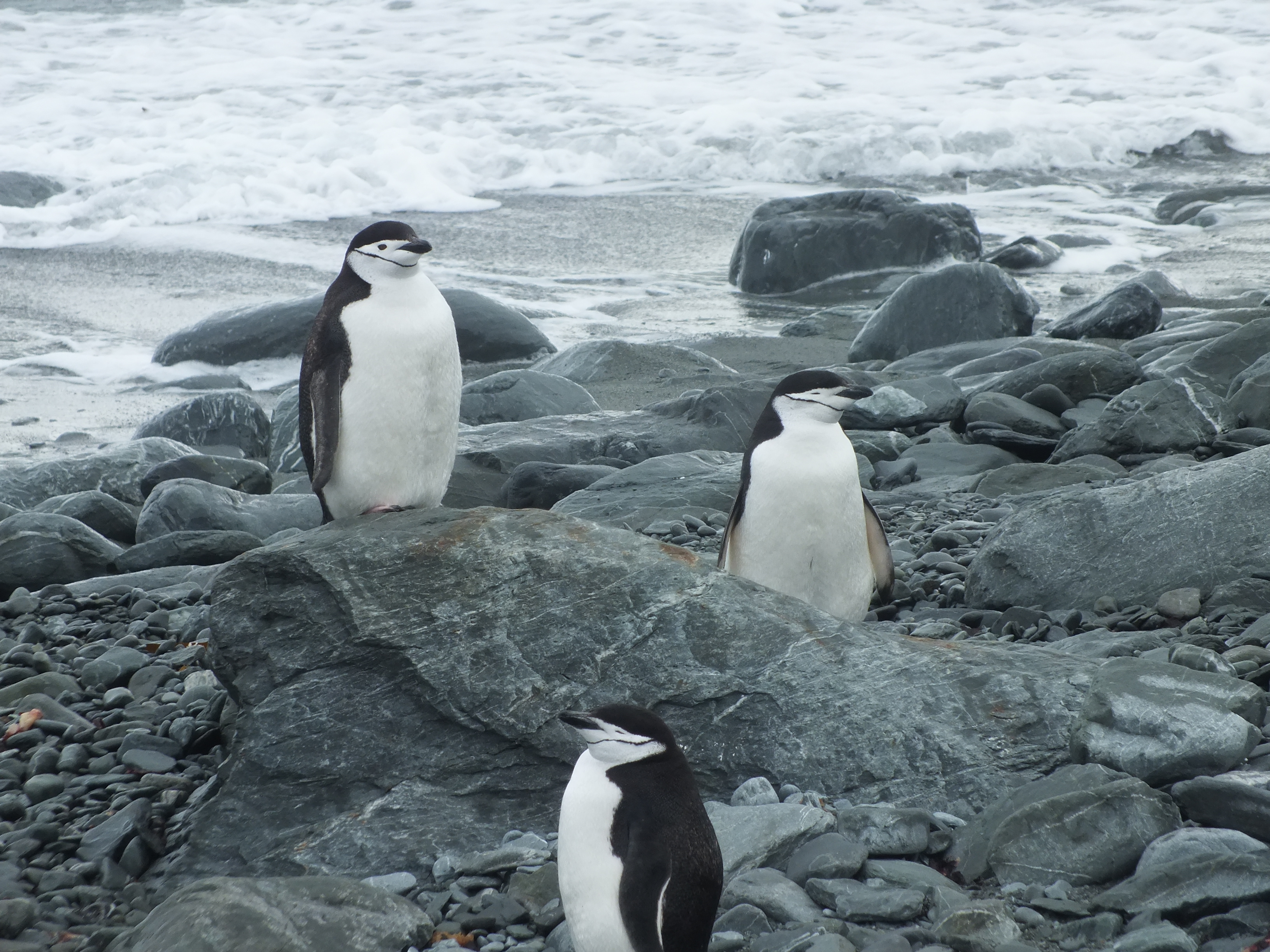
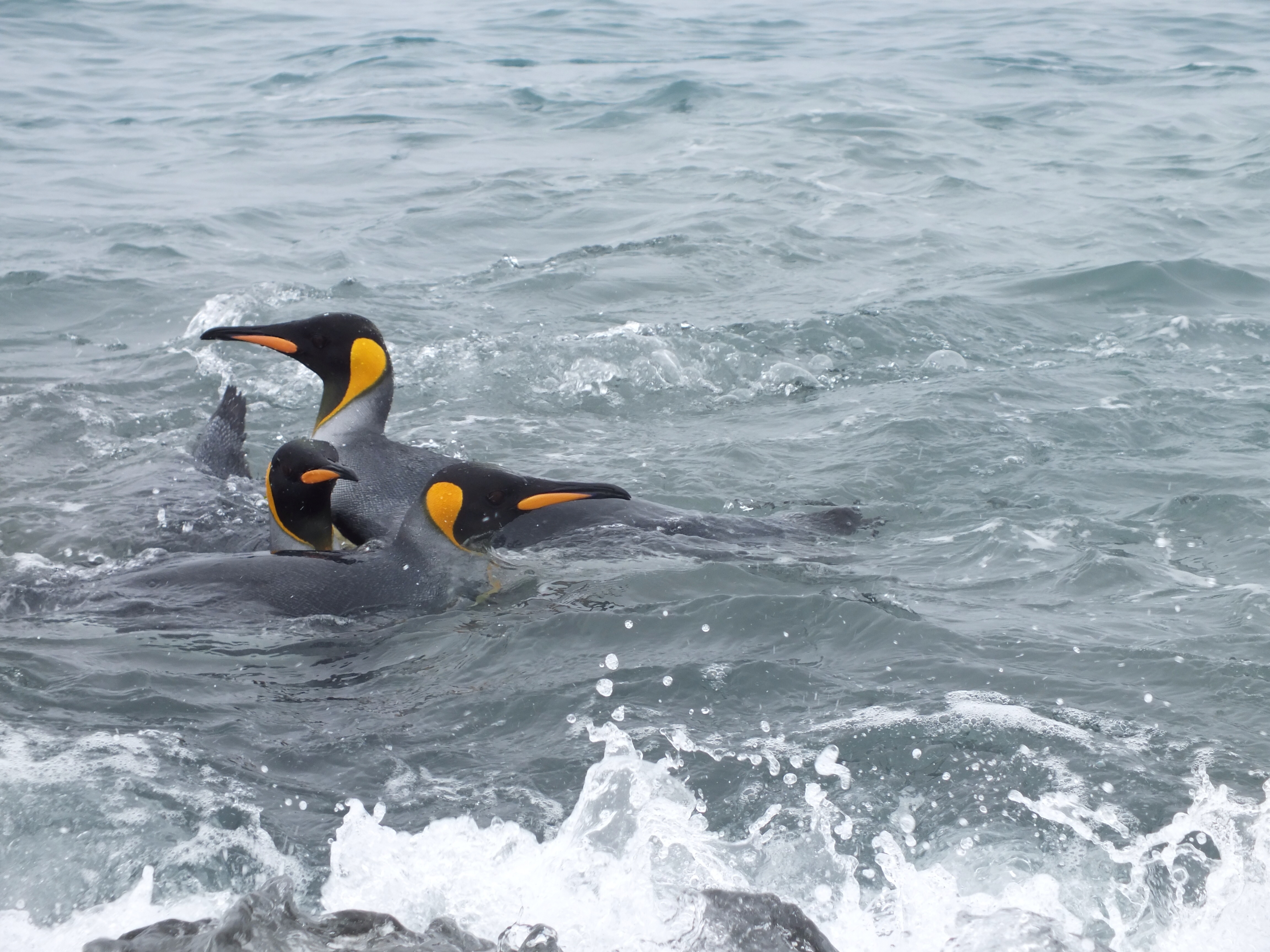
No blog would be complete without a shot of some penguins. In this case, Chinstraps.
Last day in S. Georgia. We had 2 excursions today. The first was a Zodiac landing at Gold Harbour, so called for its pyrite or “fools gold”. It was snowing and cold and since there was nothing new to be seen here I stayed in bed and watched a movie on my iPad. I just couldn’t face getting togged out in all the gear and tramping around amongst penguins and fur seals. I know this probably sounds ungracious, but penguin poo smells to high heaven and I could see the landing point from the boat. The beach was about 100 meters long so just didn’t seem worth the effort. Margaret on the other hand joined the indomitable kayakers. I don’t know where they get the energy from!
So, I took a couple of photos from the ship, and borrowed some of Margaret’s, to show you Gold Harbour.
Off go the kayakers
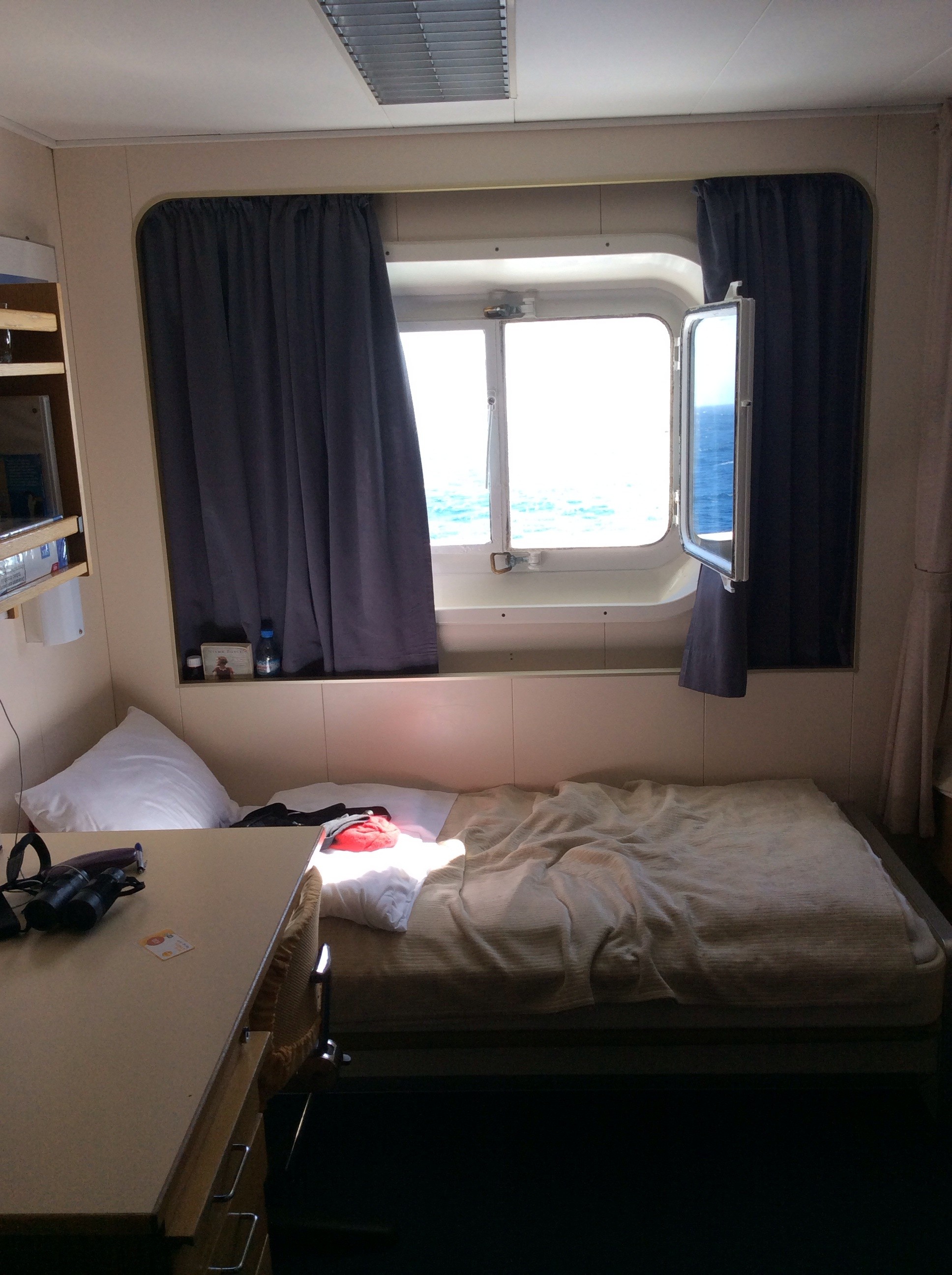
Taken from my cosy bunk.
Didn’t fancy scrambling over this lot to get ashore
Elephant Seal – I don’t think he is yawning!
You can’t have too many pictures of penguins. Can you?
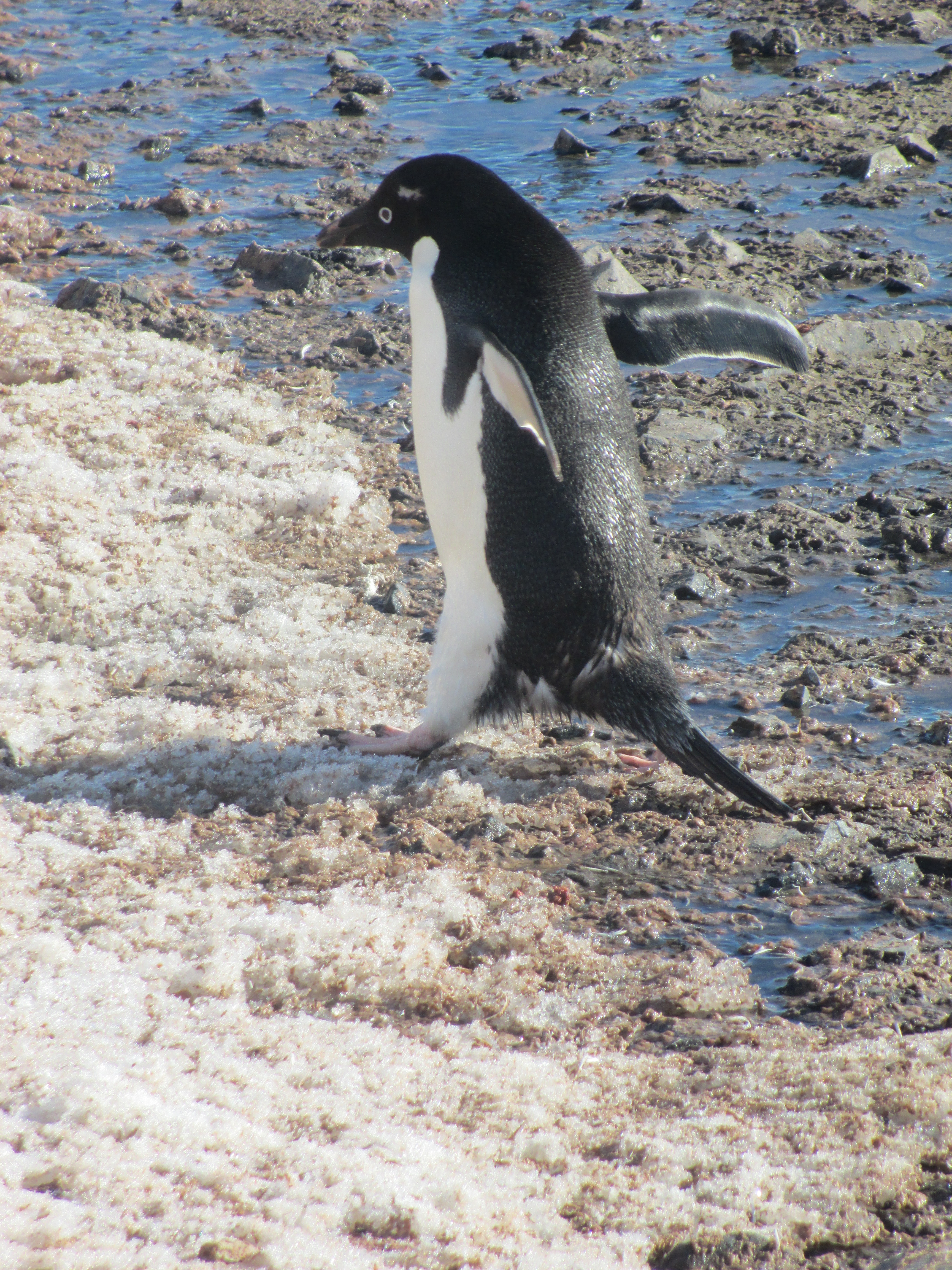
On the hop! An Adelie penguin
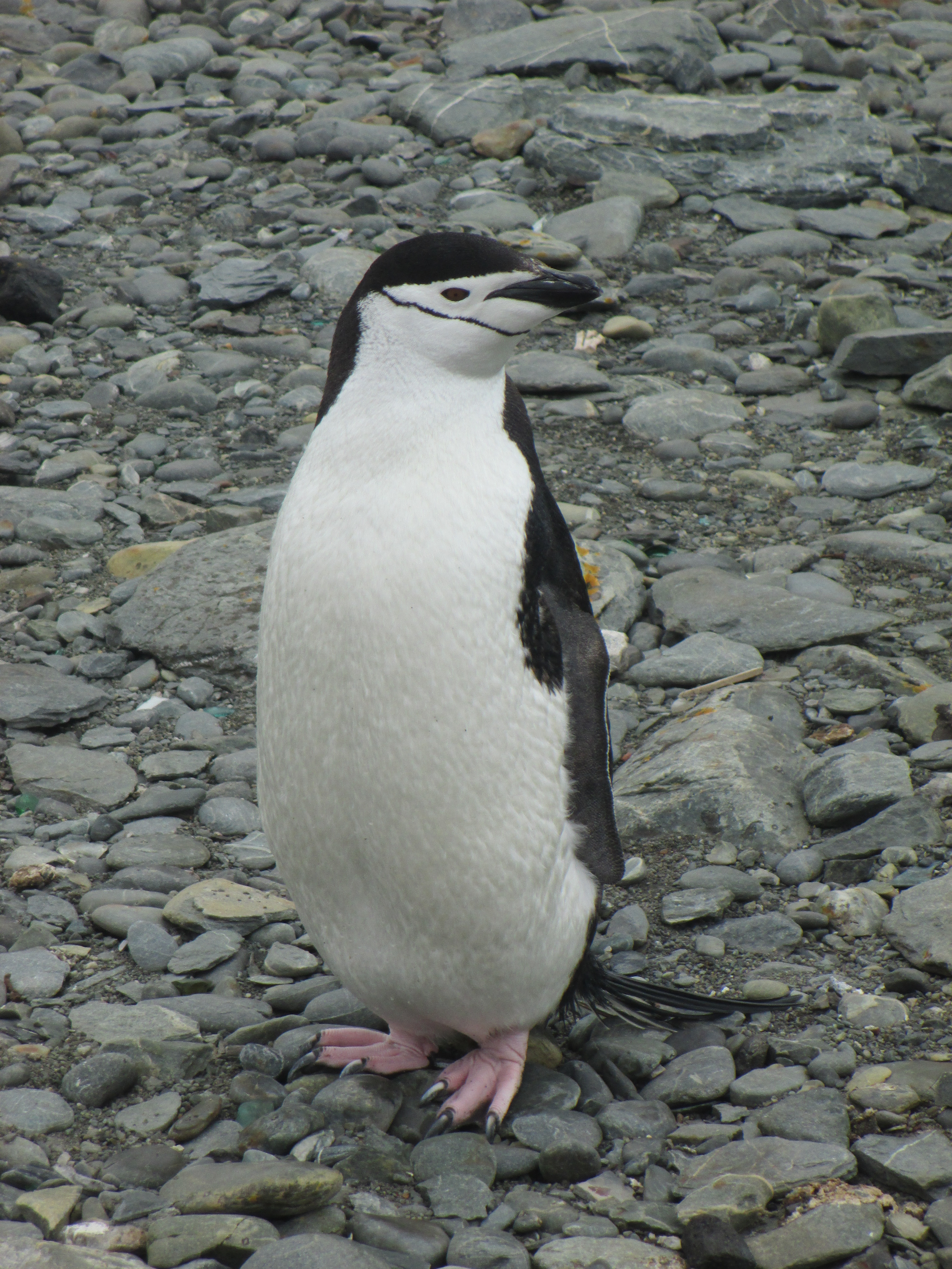
The aptly named Chinstrap penguin
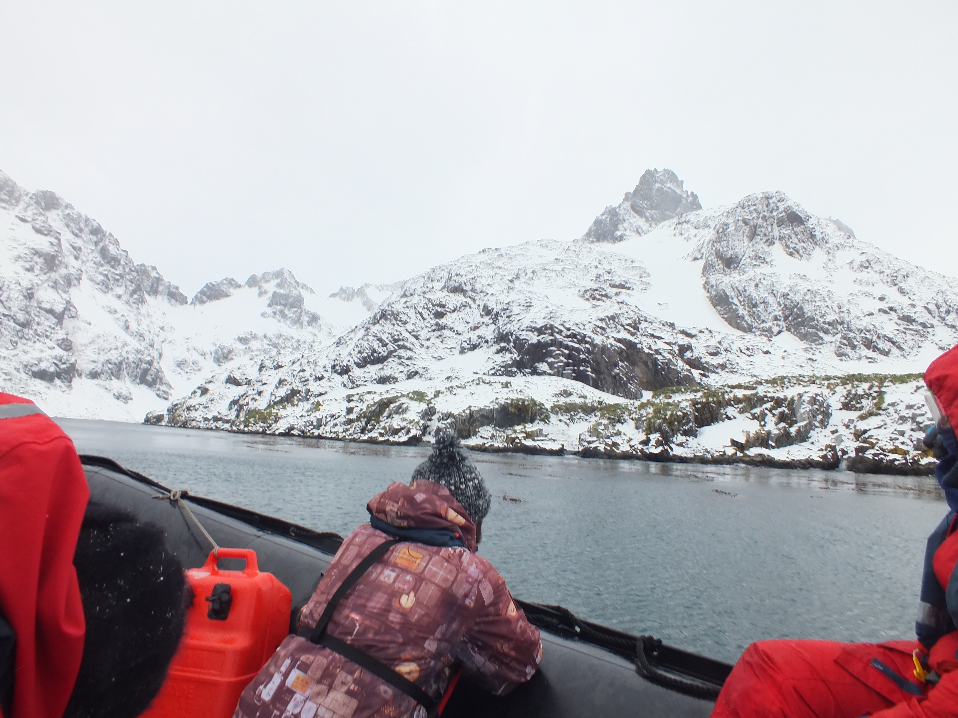
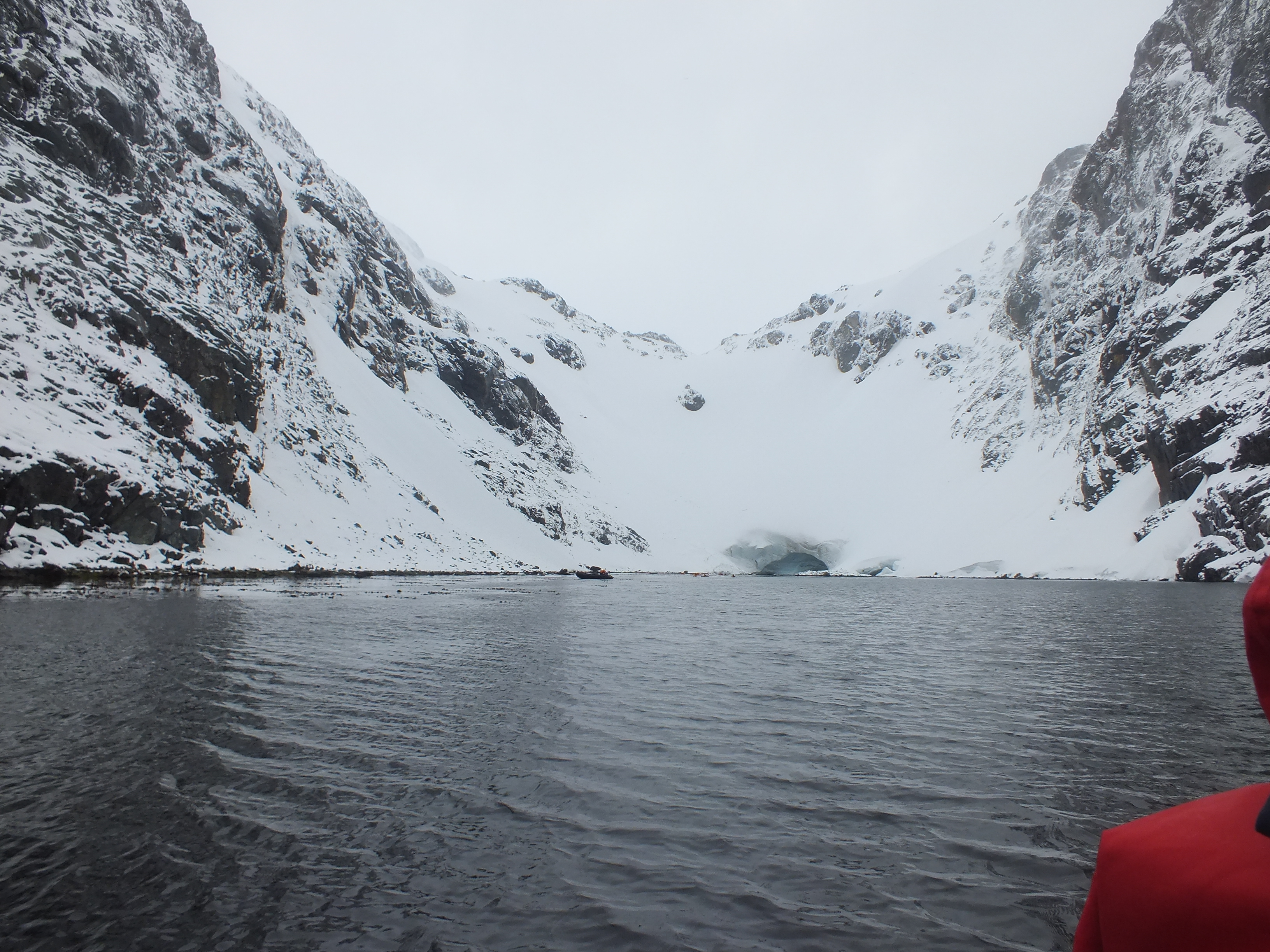
By the time the afternoon came around I had revived. The afternoon excursion consisted of a Zodiac trip into Larsen Harbour, part the way up the Drygalski Fjord. The fjord extends 14k into the island’s interior ending at the Risting Glacier. Ships, if they can get up there at all, must maneuver a tight turnaround to get back out. Our captain decided against going all the way up. The weather was closing in and thankfully he seems to be a cautious man. Larsen Harbour is about 4k up through the fjord. It is like a mini fjord – if there is such a thing. Steep, snow covered sides, lots of bird life and very peaceful. It was a stunning trip. Well worth getting out of bed for.
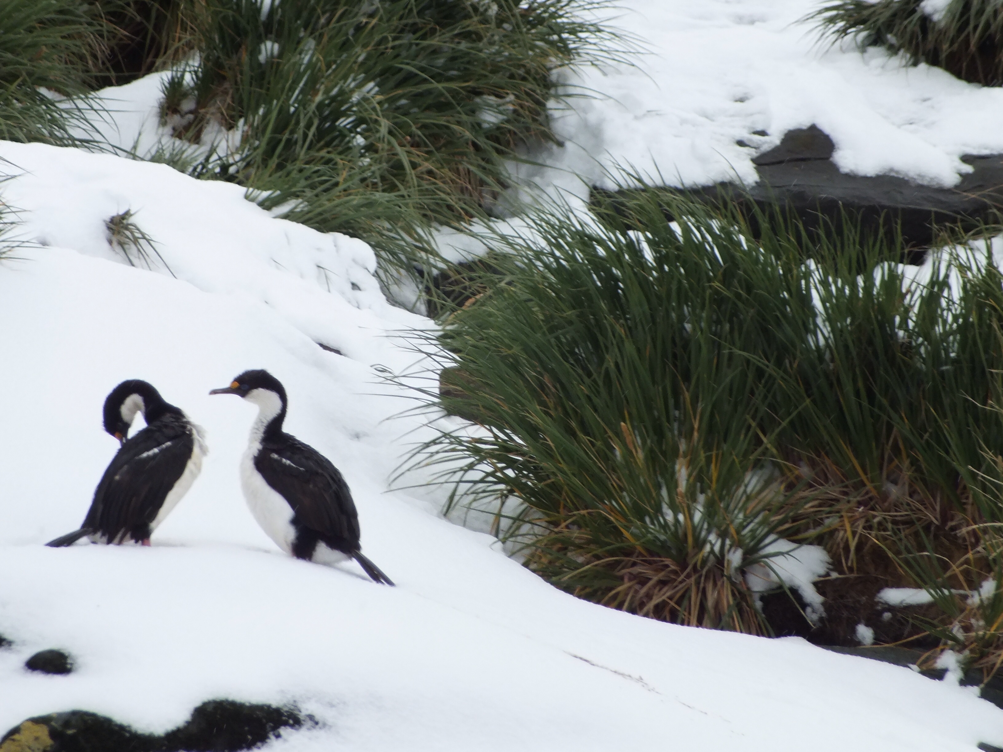
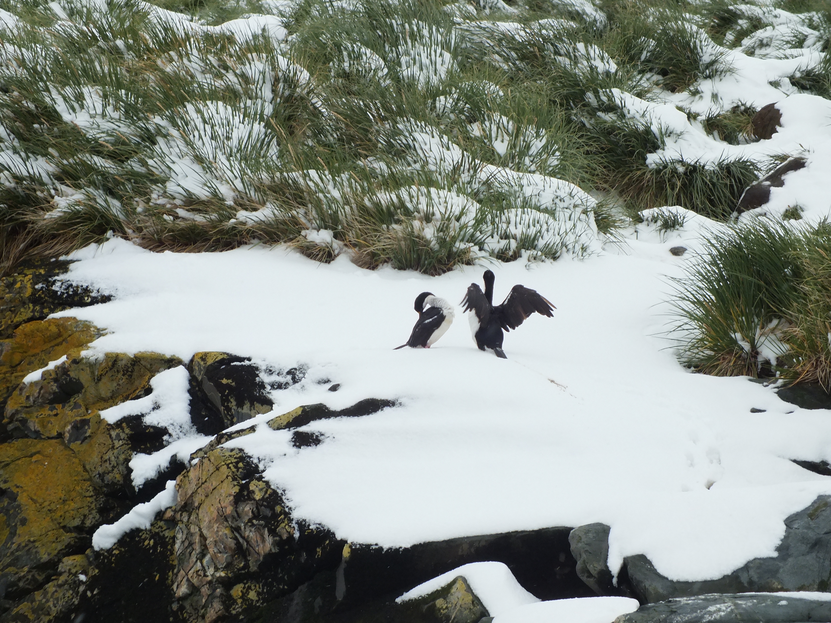
Antarctic Shags – a relative of our cormorants
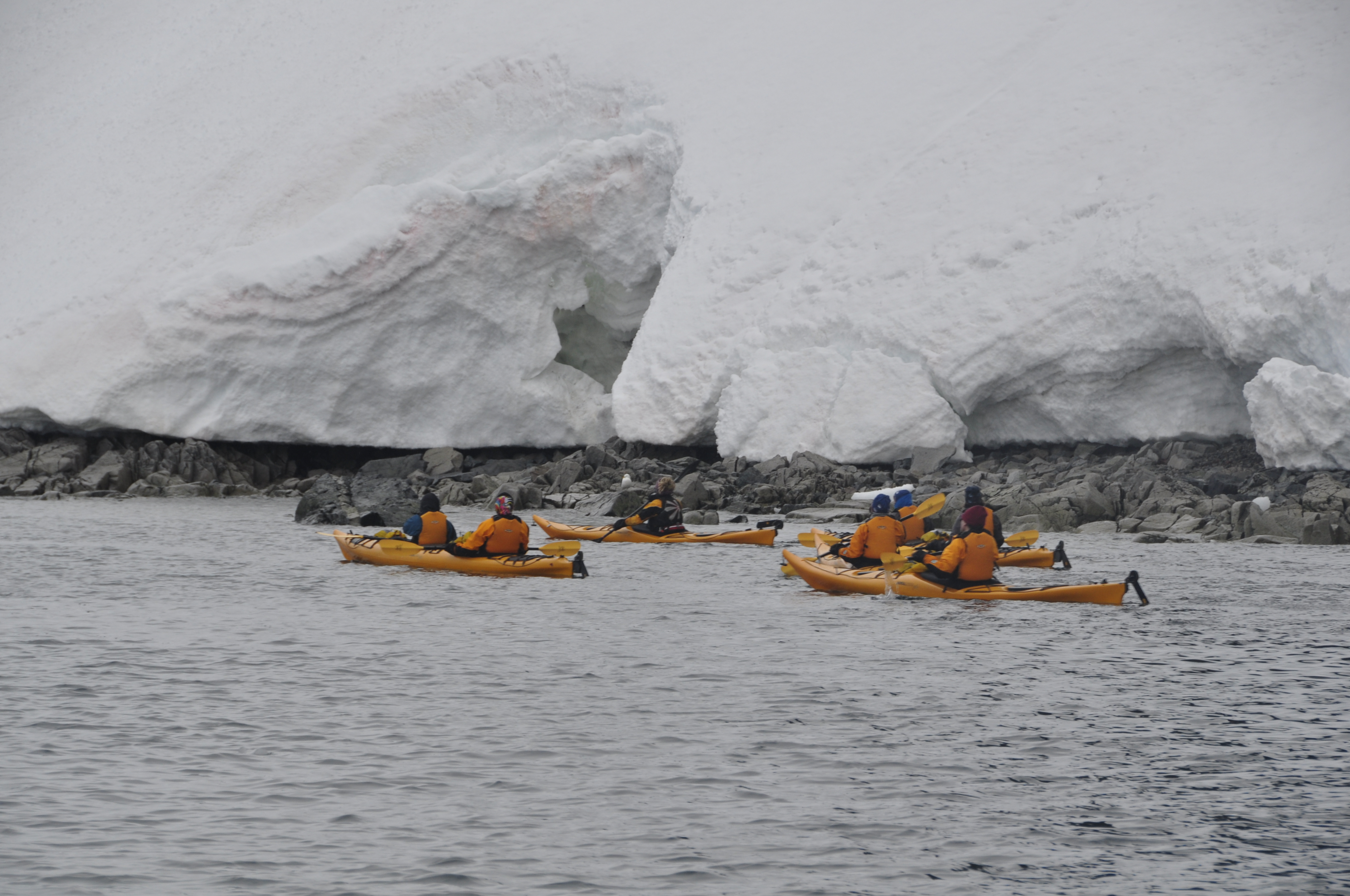
Ice cave, kayakers were able to go in.
I was sad to leave S. Georgia behind. But strangely enough, looked forward to a 2 day passage and a chance to catch up on some reading and socialising with other passengers.
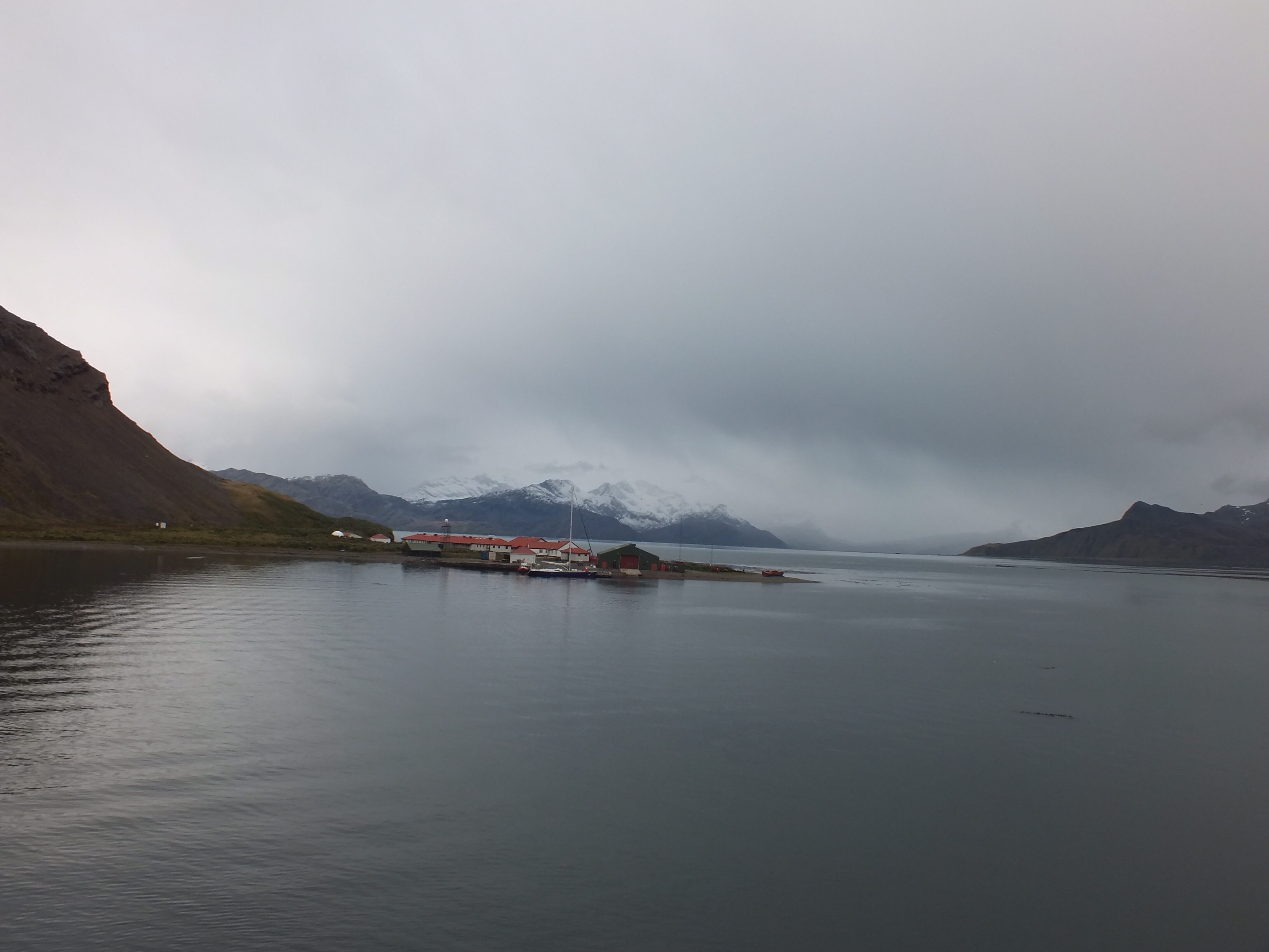
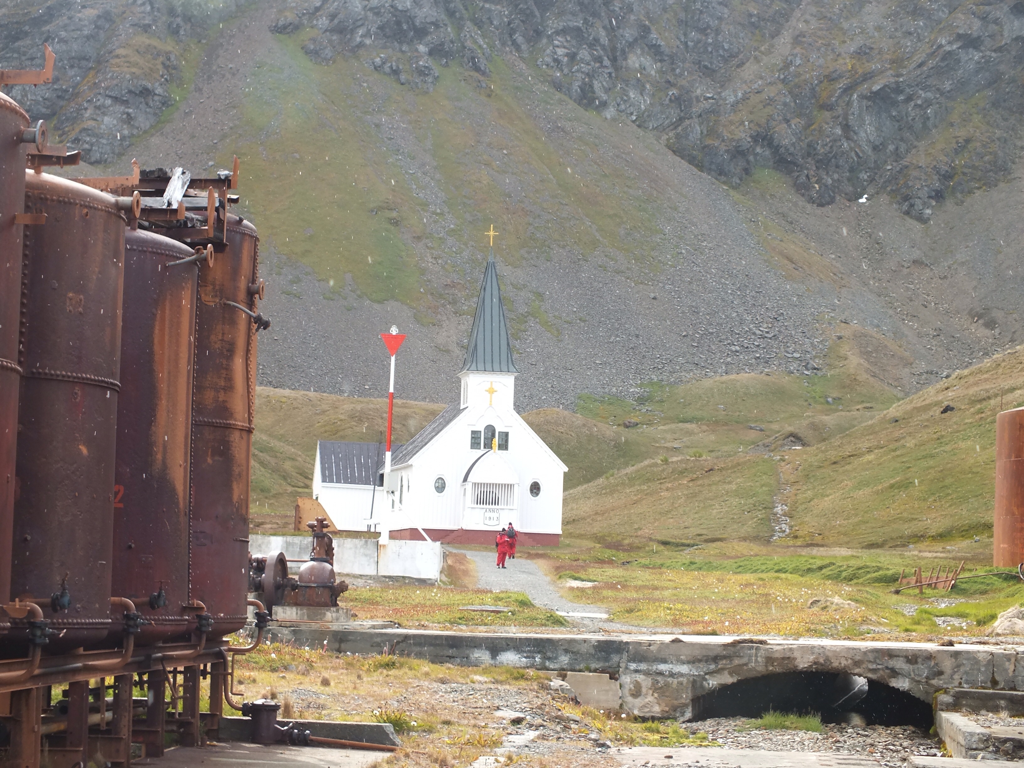
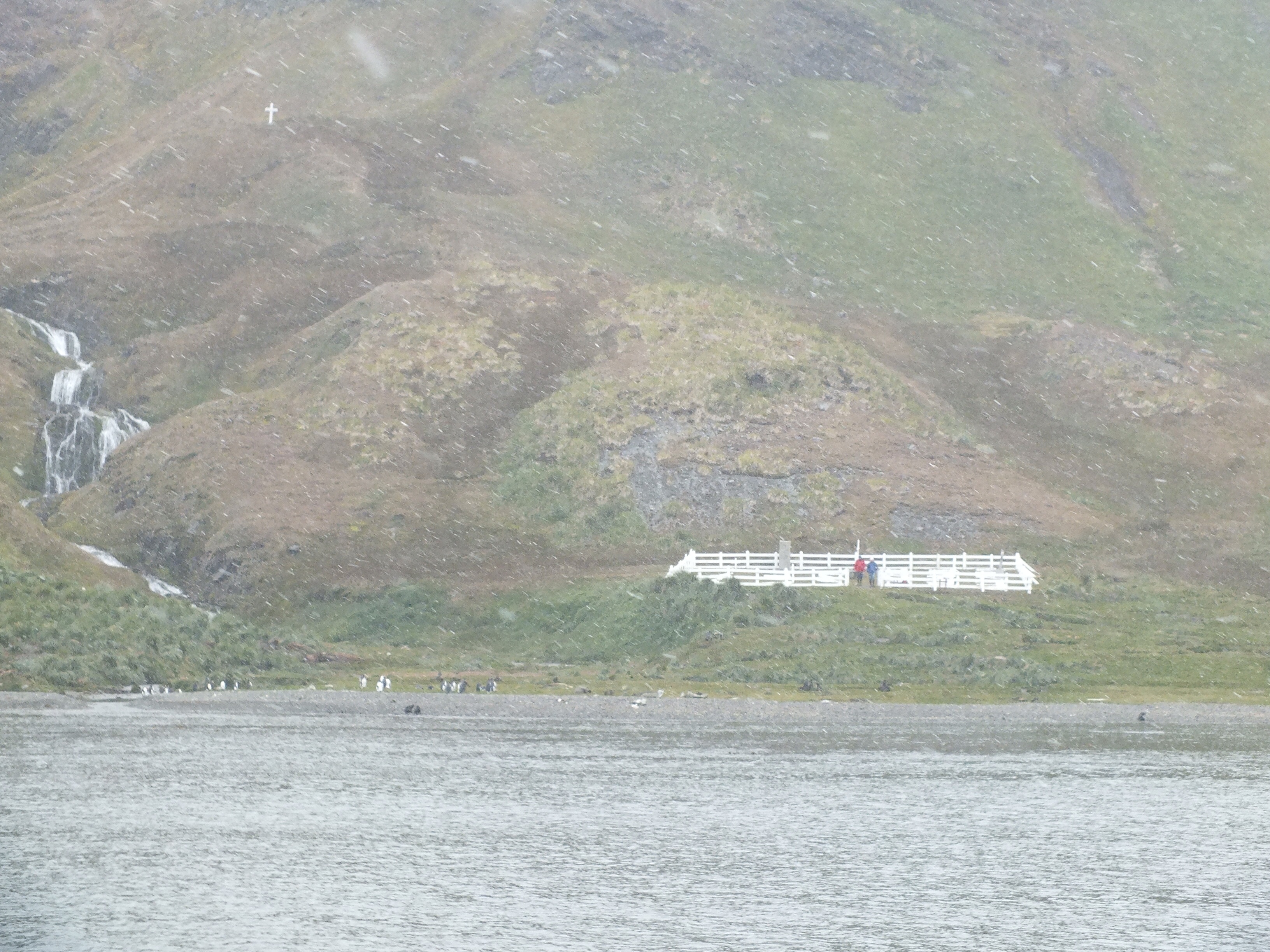
While we recovered from the early morning rise and Shackleton walk, the ship moved on to Grytviken. This is a serene bay which was once home to yet another whaling station. It only ceased operation in 1965 and is the only one in South Georgia that can be visited. All hazardous materials have been removed and there is a small museum explaining how it once operated. There are a few people living in Grytviken over the Summer months. They are there on a voluntary basis for scientific and environmental purposes. I posted a couple of postcards from the tiny post office, but later found the next collection will not be for 6 weeks so I guess I’ll be home long before them.
Looking back at the entrance to the bay
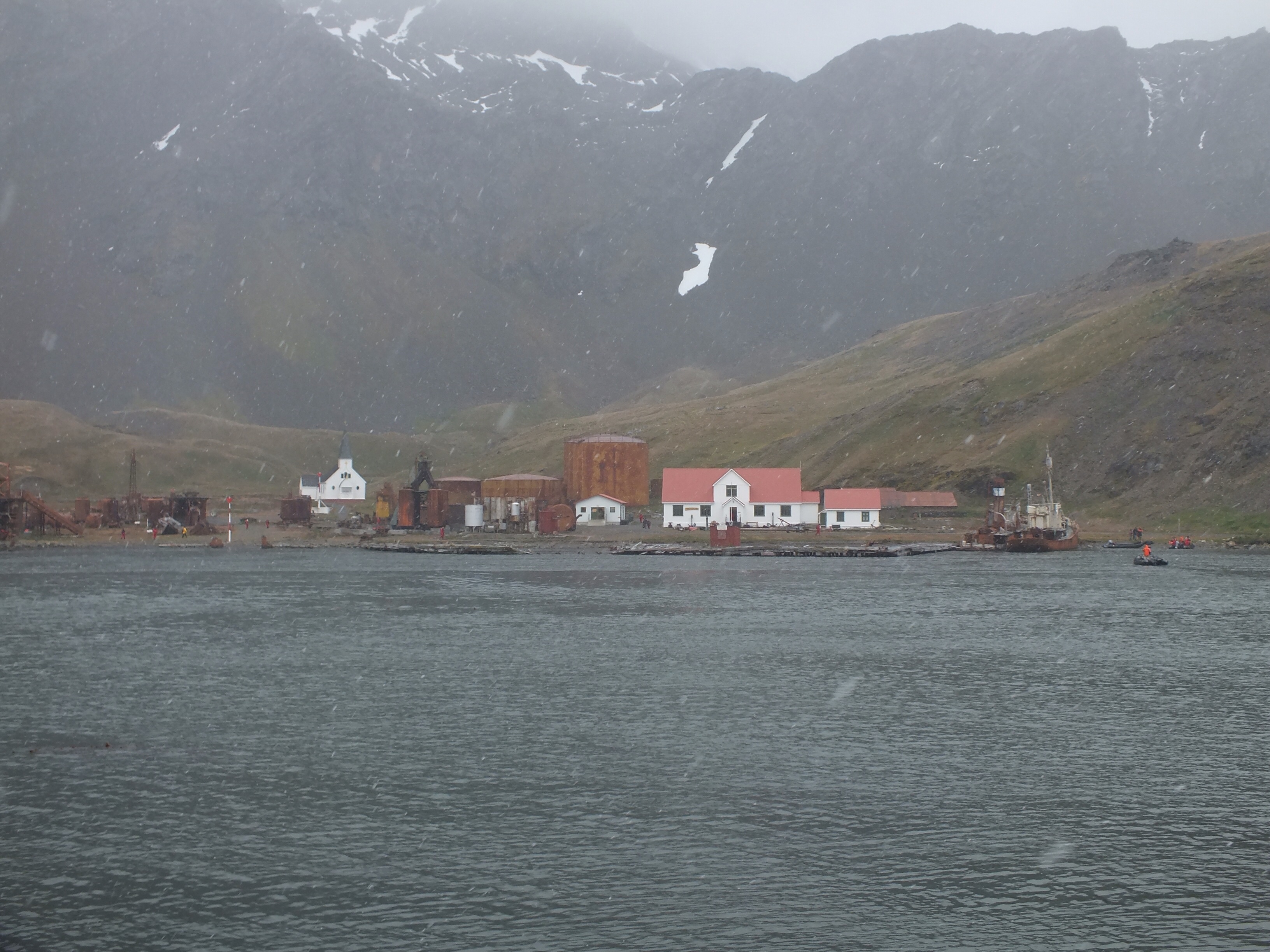
Whaling station, post office, museum and church. The full extent of Grytviken.
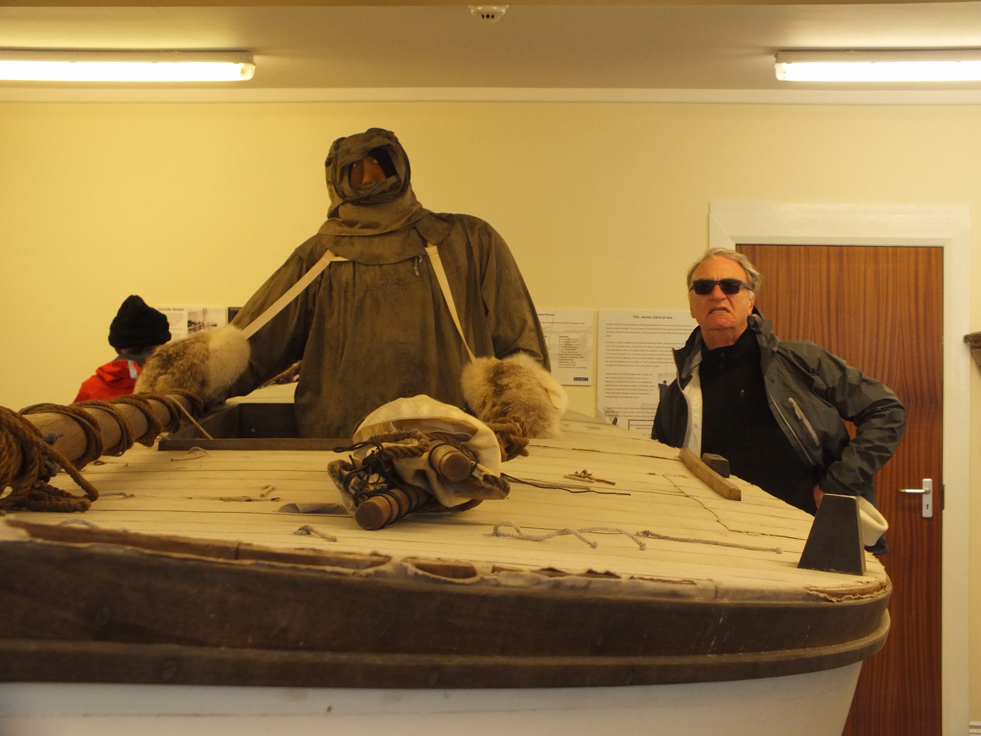
Replica of the James Caird
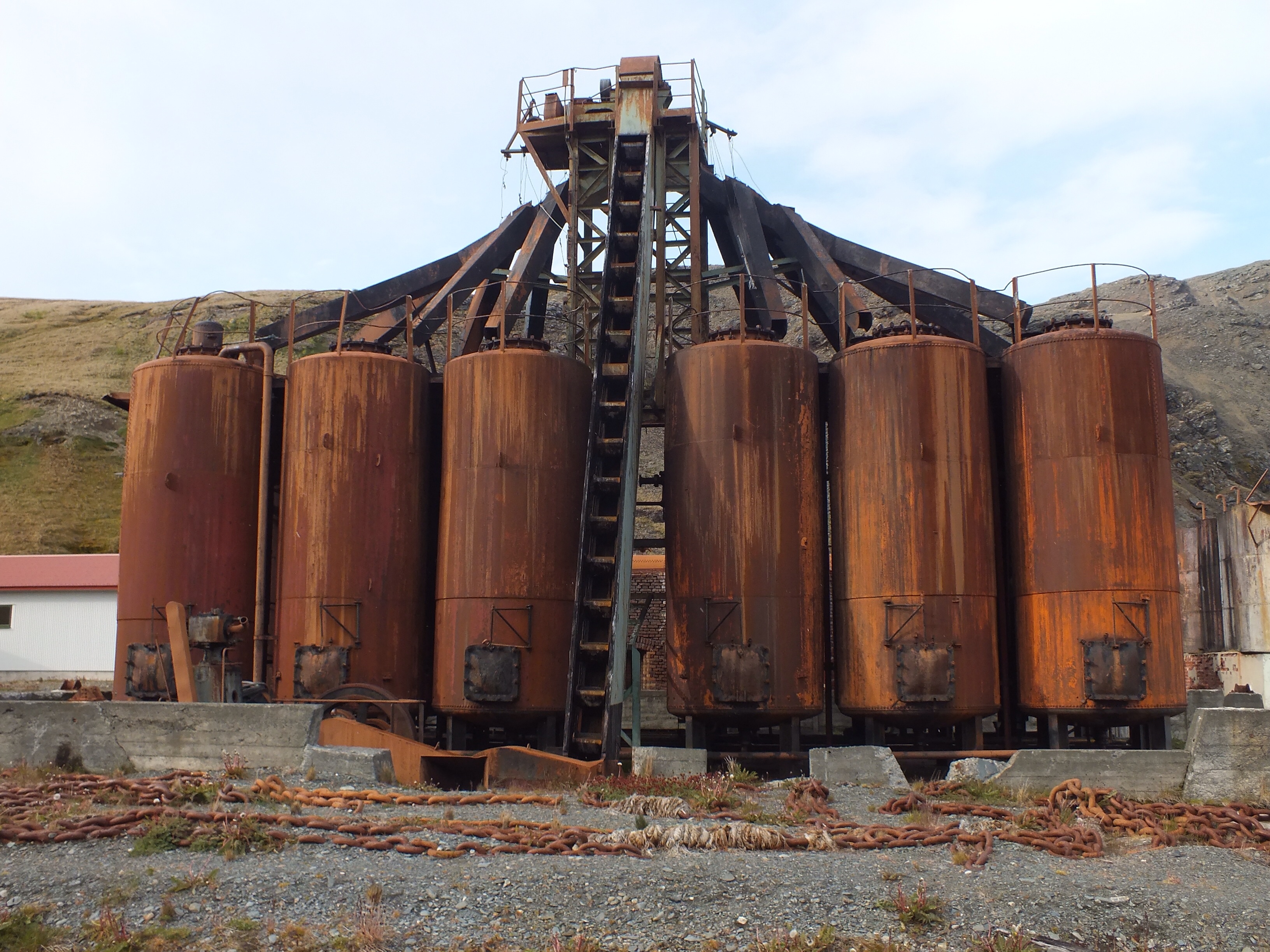
Contraption used to haul up and melt whale blubber
There is also a small church here but it is rarely used for religious purposes. It is used more as a meeting hall now. Grytviken is famous as the last resting place of Ernest Shackleton. After the dramatic rescue of his men from the failed Endurance expedition, Shackleton went back to Antarctica to make a second attempt at a transverse of the continent. However, on reaching S. Georgia he suffered a heart attack and died. Knowing how much he loved Antarctica, his wife instructed that he be buried there.
Church in Grytviken
One of the passengers we got to know, Harry, hails from the UK but is married and living in Ireland now. He had been given a special mission by his wife’s boss to deposit stones from Shackleton’s home county of Kildare, on the grave in Grytviken. This mission had been assigned to someone else previously but who had died before getting to S. Georgia. Thankfully, Harry succeeded. Being a little superstitious, I was never so glad to see stones scattered, and history not repeat itself. We poured some whiskey on the grave too, a tradition held by the tour operators we are with.
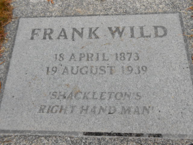
Buried alongside Shackleton are the ashes of his right hand man, Frank Wild. It was Wild that was put in charge of the men left on Elephant Island and by all accounts it was down to him that they all survived the long months waiting to be rescued. His remains were found in S. Africa after many years of searching, by a woman whose name I have forgotten. His ashes were brought to Grytviken in 2011 and after a ceremony in the little church I mentioned earlier, his ashes were re-interred. Wild and Shackleton’s descendants (grandchildren I think), attended the ceremony.
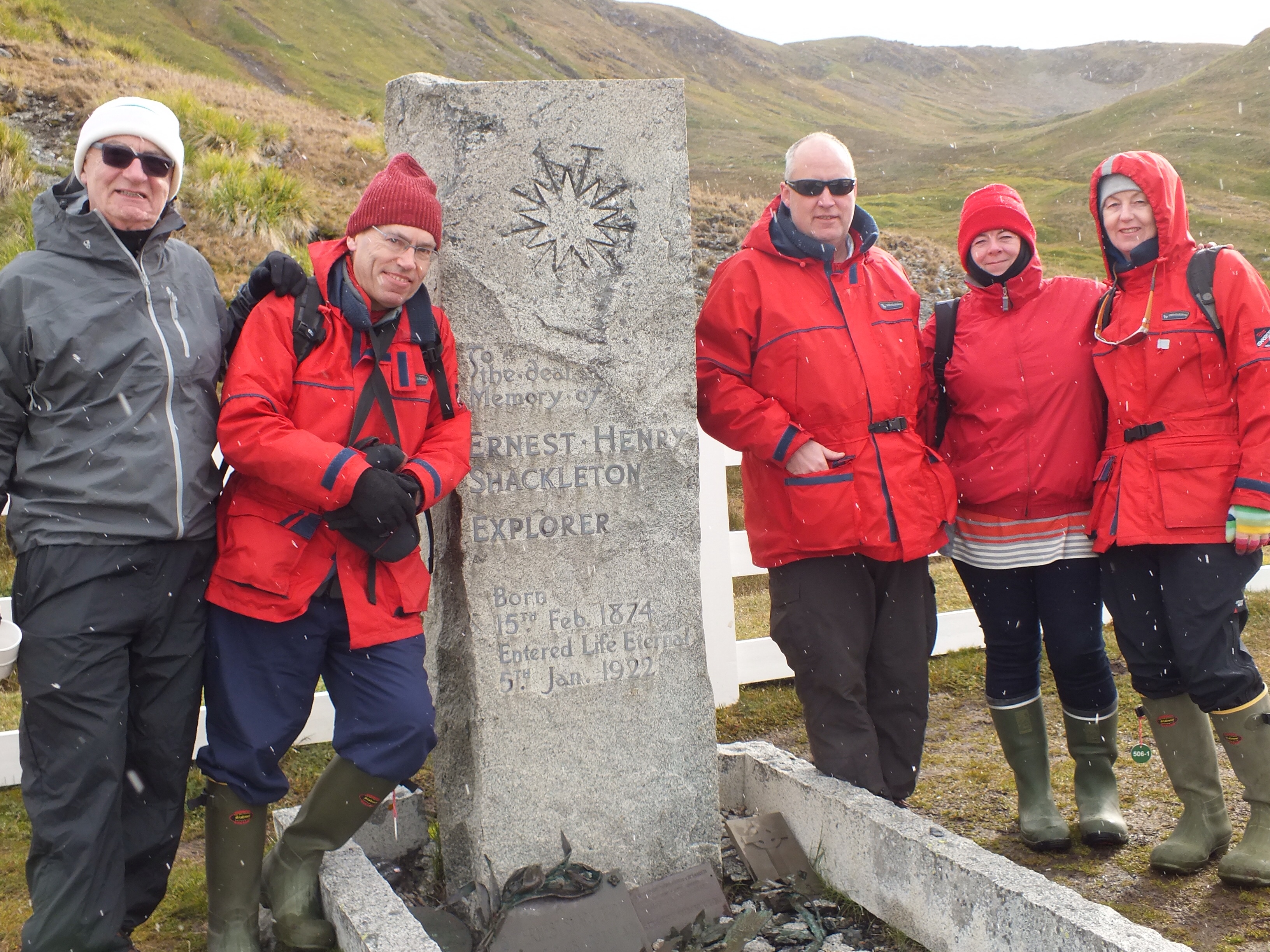
Shackleton’s grave
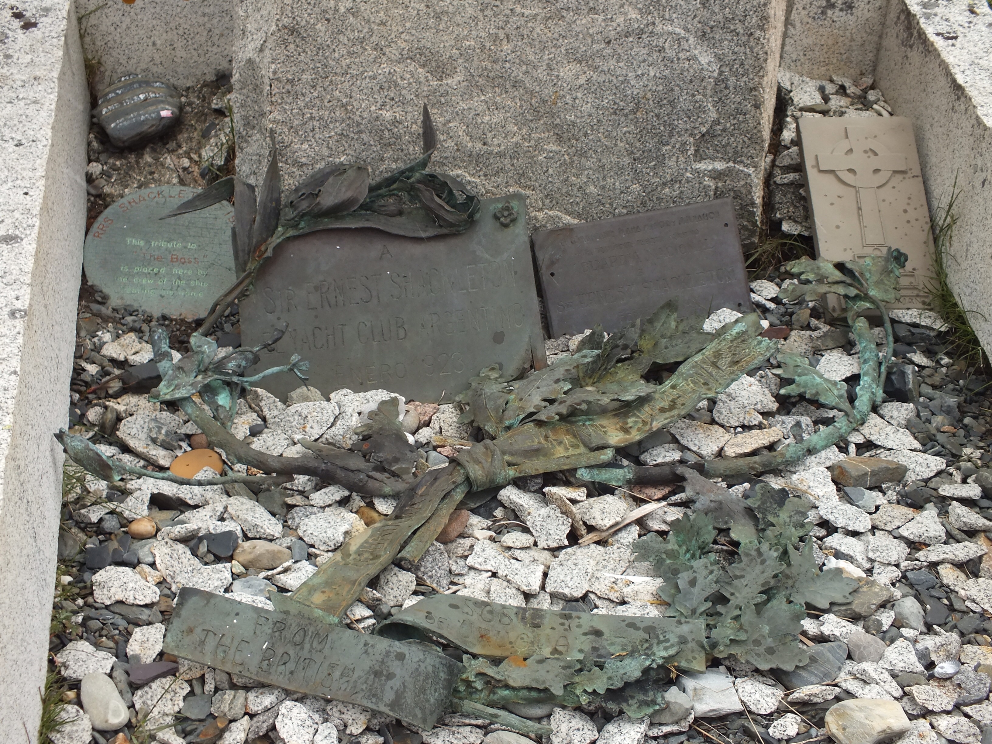
Stone carvings on the grave, you’ll need to zoom in
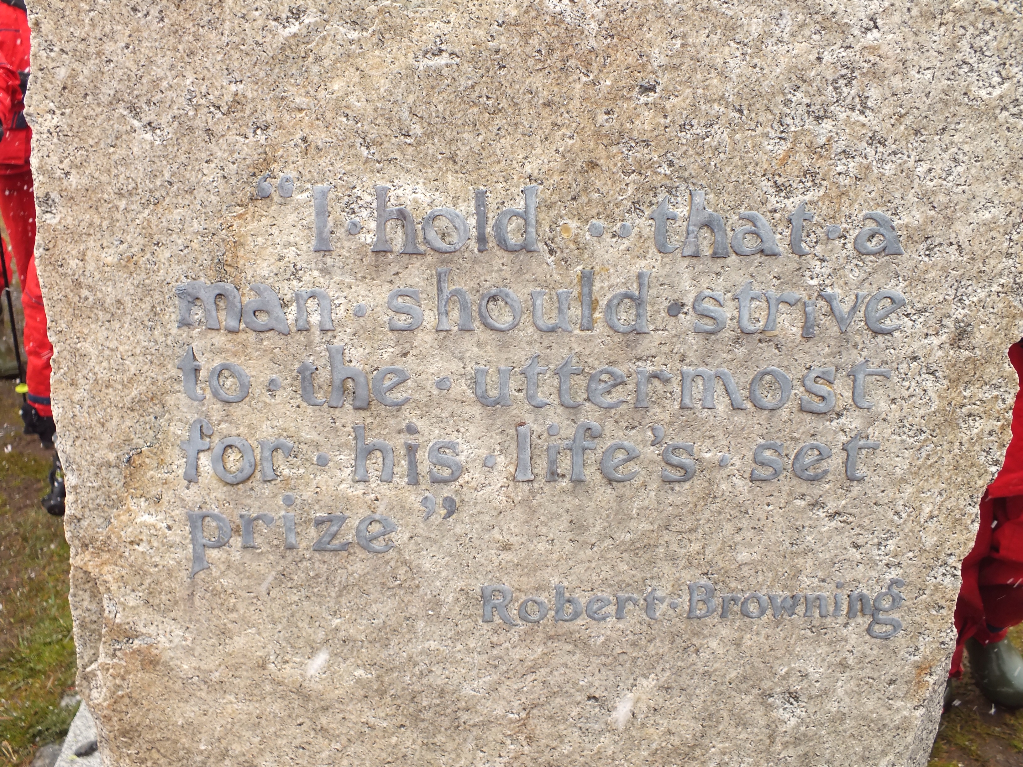
Back of the headstone
Apologies for the quality of the above photo. It had started snowing then and my camera had gotten cold. It needs to be heated up regularly. I have been using these amazing hand warmer pads to do the trick.
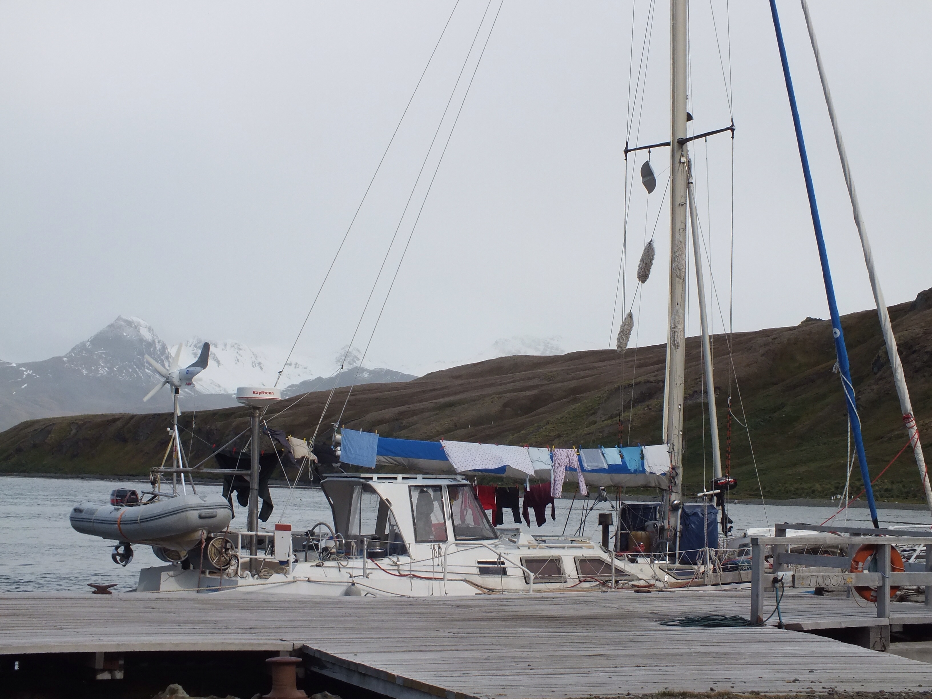
We were surprised to see a yacht pulled into the tiny harbour. There is no way I’d fancy sailing in these waters. However, there was a couple on board with their 2 children and they seemed happy enough to be chilling out here. Chilling being the operative word!!
Graveyard – taken during snowfall
In my previous blog I posted a map of S. Georgia. On this map there is a red line called Shackleton’s Route, stretching from King Haakon Bay to Stromness Bay. For those that might not be familiar with one of Shackleton and Tom Crean’s most famous feats, I’ll give an abridged version as background to this blog.
In December 1914, a ship called Endurance, with Shackleton, Crean and 26 others on board, set sail from S. Georgia for Antarctica in an effort to be the first to cross the Antarctic continent from west to east, on foot. Before they hit land, the Endurance got stuck in the ice and was trapped for 9 months before eventually being crushed and sunk. They rescued 3 lifeboats and whatever supplies they could and set off across the ice heading for open sea. They eventually got to open sea (long story) and sailed off in the 3 life boats. Their destination was Paulet Island, where there were supplies left by some previous expedition, but the current pushed them to Elephant Island. They knew no one would look for them there so the only thing for it was to use the prevailing winds and currents and sail to S. Georgia. (Malvinas/Falklands were nearer).
Using bits of all 3 life boats they, cobbled together one seaworthy boat, the James Caird. 6 of them headed off in this and 22 stayed behind, using the remaining bits of boats as shelter. After a gruelling 15 days at sea, and an amazing piece of navigation the 6 finally arrived at Haakon Bay on S. Georgia. Unfortunately, this was the wrong side of the island and the boat was no longer seaworthy. So Shackleton, Crean and Worsley, had to embark on an alpine trek across the island to get to the whaling station in Stromness. They did this by remembering how many bays there were along this coastline. Don’t forget they had left from here 17 months earlier. Anyway, they miscounted and descended from the mountains into Fortuna Bay. So, they had to go back up and across to Stromness. Tough men. They made it.
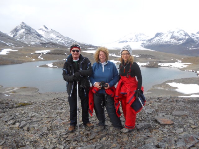
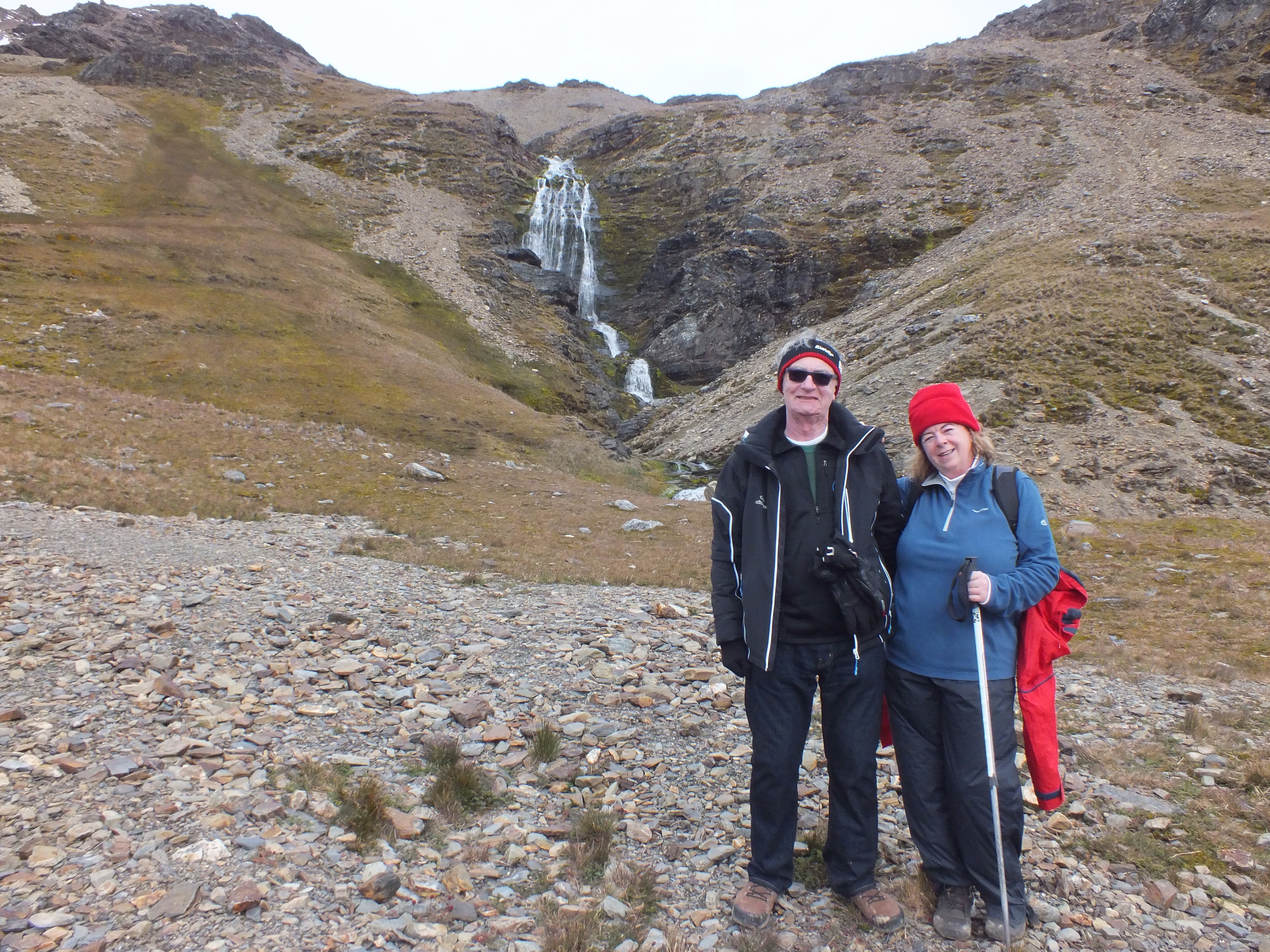
This is where our story begins. So, as part of our cruise we were given the option of retracing the trek from Fortuna to Stromness. We were warned that this was a challenging climb and that the ship would not be waiting in Fortuna but would be sailing on to Stromness. Therefore, once dropped off by Zodiac, there was no turning back. Margaret was well up for this, but I couldn’t believe it when John said he was going too. And since he is 11 years older than me, I felt I had to rise to the challenge. (We did make sure first that the ship’s doctor was also going on the trek). So that just left Patricia – and she wasn’t going to be odd-man-out. Surprisingly, given the average age of the passengers, 39 people put their names down to go.
Next morning we were up at 5am for coffee and croissants. A snow storm arrived, a complete white out, and I thanked my lucky stars. But, as with all sailors, the captain had a forecast and knew that this would pass and we would have a 3 hour window before the next storm was due. So, off we went, into the Zodiacs, 37 passengers and 6 guides.
Getting togged out for the climb
Dark – still very early morning

Patricia striding ahead – me (in the blue top) not quite at the back, for a change
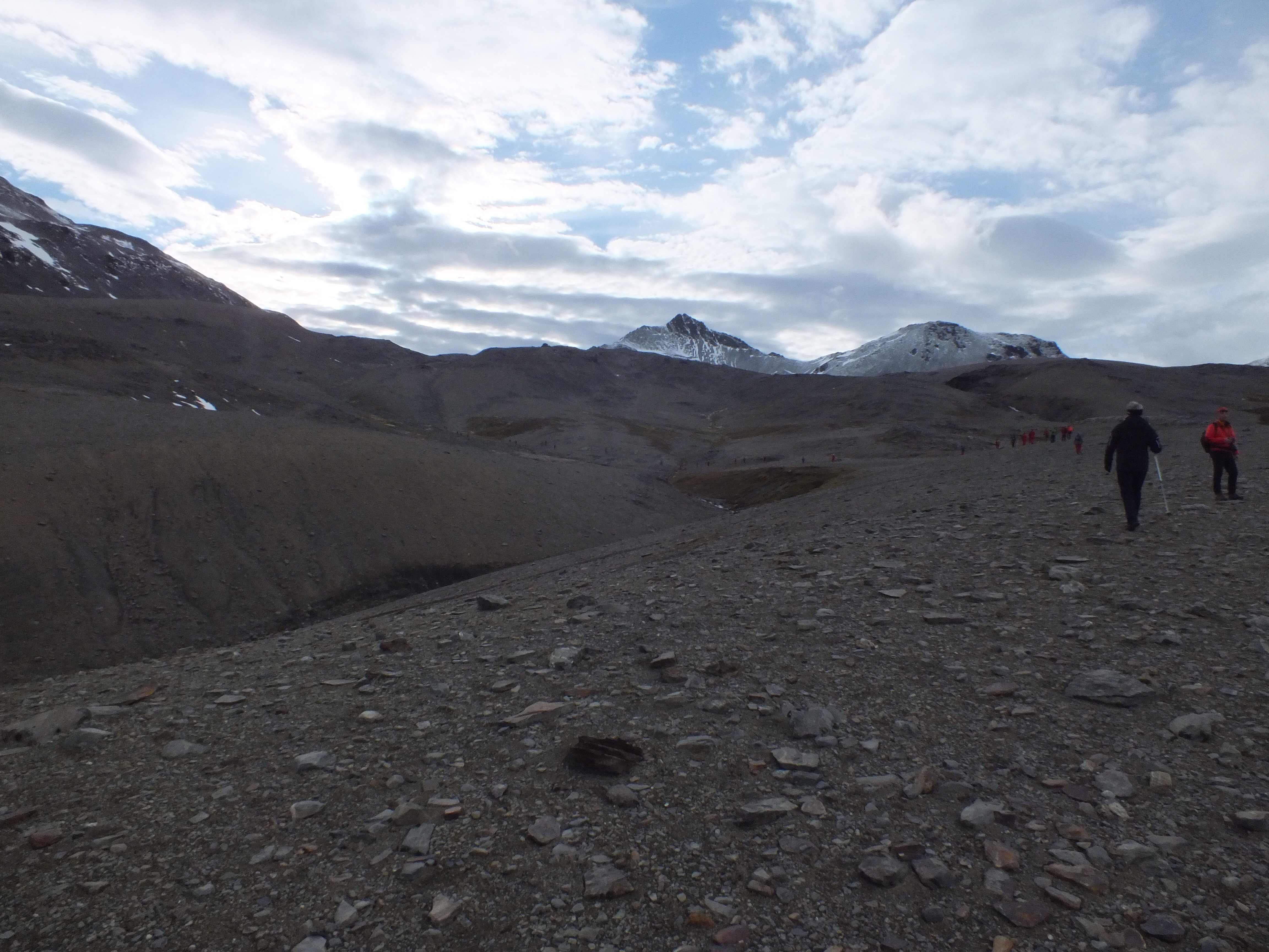
I have to confess to a momentary panic when the empty Zodiacs made their way back to the ship and the anchor was brought up. No going back now. My occasional hill walks in the Dublin mountains were no preparation for this. The first 30 minutes were really steep but I was determined not to be left at the back so started off much too fast. I had a blinding headache after about 10 minutes and thought I was going to die. (I was just recovering from a bad cold, which didn’t help). Margaret was miles ahead at this stage and I didn’t see her again until we got to a plateau at the top. I’m grand on the flat bits. Patricia was also up at the front and John was ahead of me for most of the time too. I just kept thinking of Shackleton and Crean and how they must have felt in their crappy wet clothing, eating seal, and doing this in much more inclement weather.
Corrie lake that Crean fell into
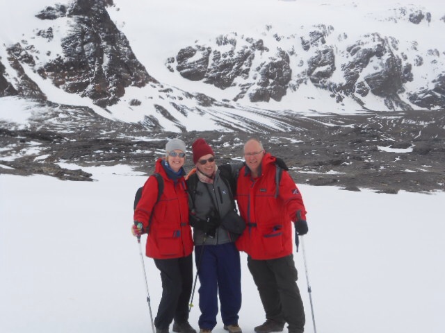
Margaret with Greg and Harry
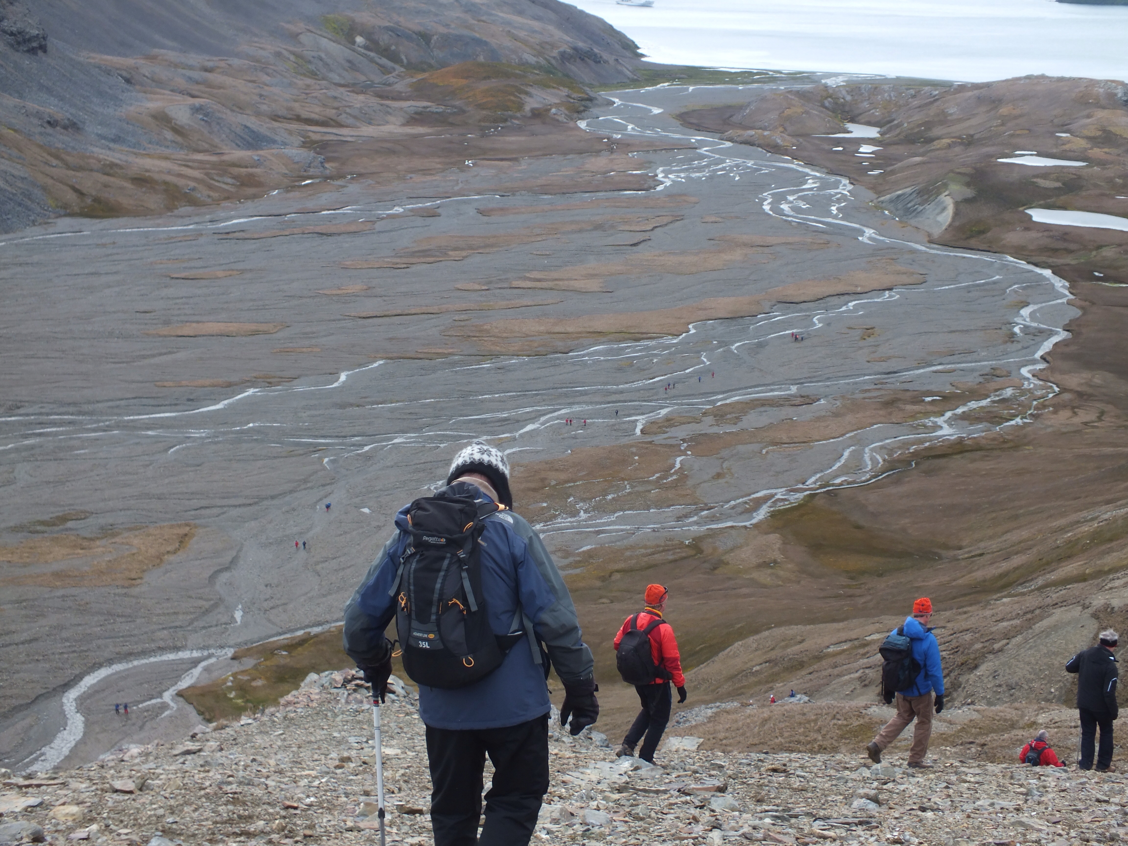
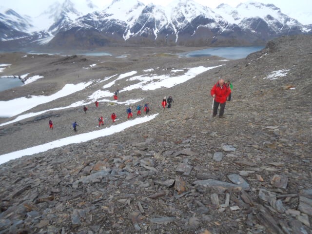
John heading down at last. This was the ridge that Shackleton stood on waiting to hear the whale station horn to guide him down. All the red dots in the delta are the rest of the passengers ahead of us
John on the left with the long awaited whaling station in the right hand corner
I have to say, the walk was really well organised by the guides, 2 each at the front, middle and back. The doctor had chocolate for us when we got past the worst incline. Because we had to complete the trek within 3 hours, the pace was fast but those of us at the back were cajoled along nicely.
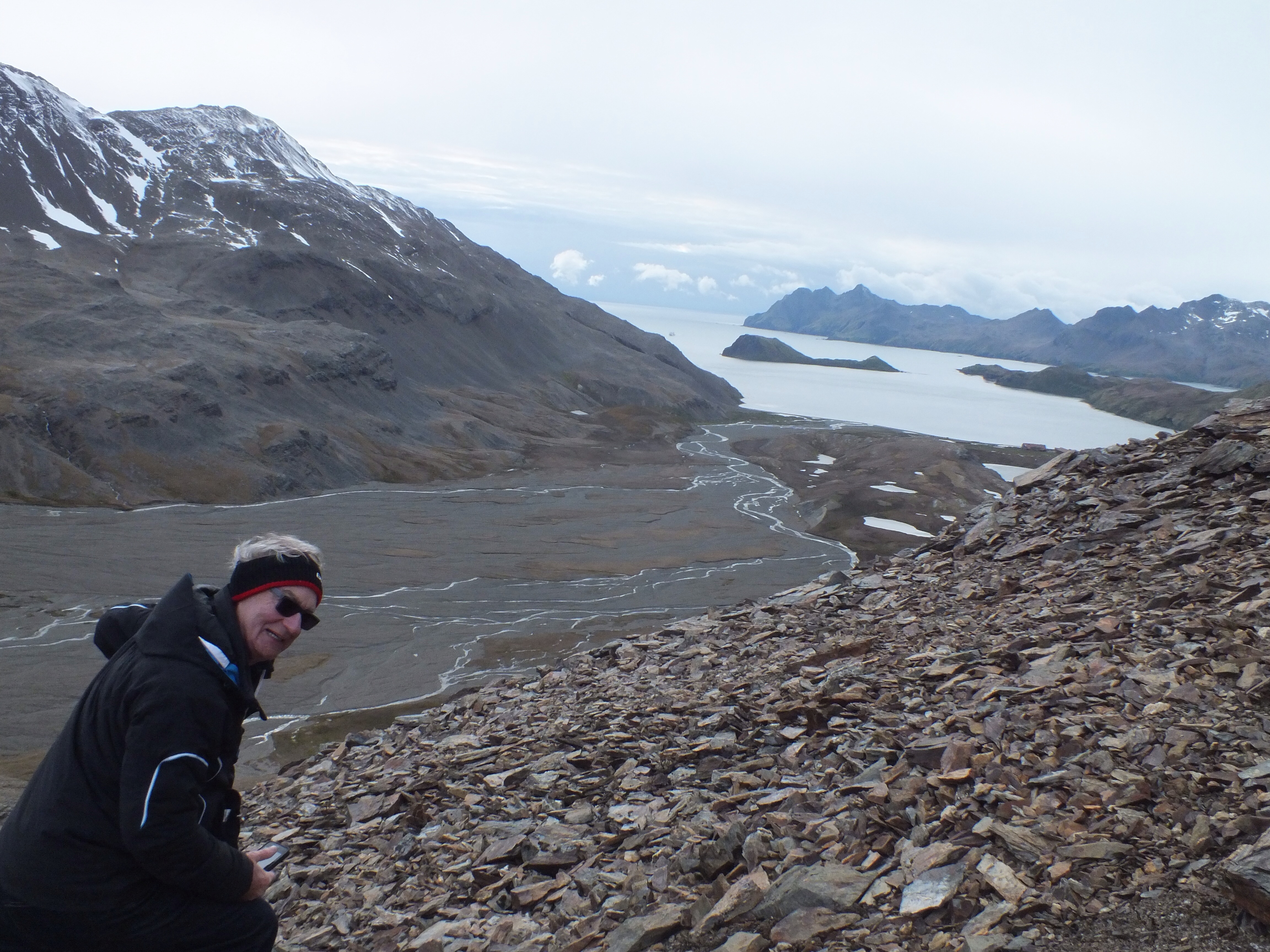
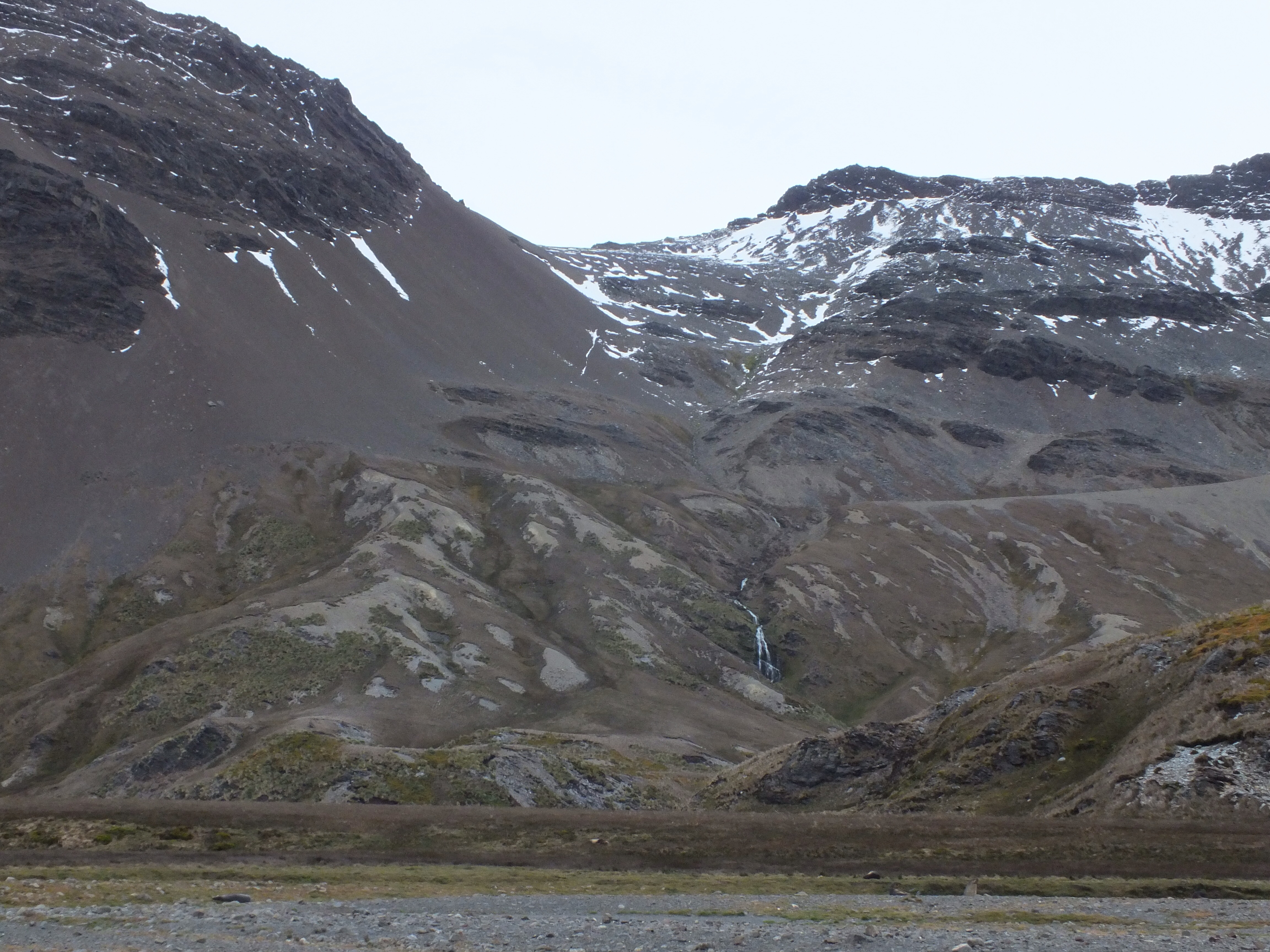
We passed the waterfall that Shackleton, Crean and Worsley descended by rope and we finally stood on the peak where they listened out for the horn of the whaling station. When they heard the horn at 7.00am, after 36 hours of trekking, they shook hands and started the decent!! The views were amazing. I hope I’ve managed to capture them.
Waterfall that Shackleton and his men descended by rope
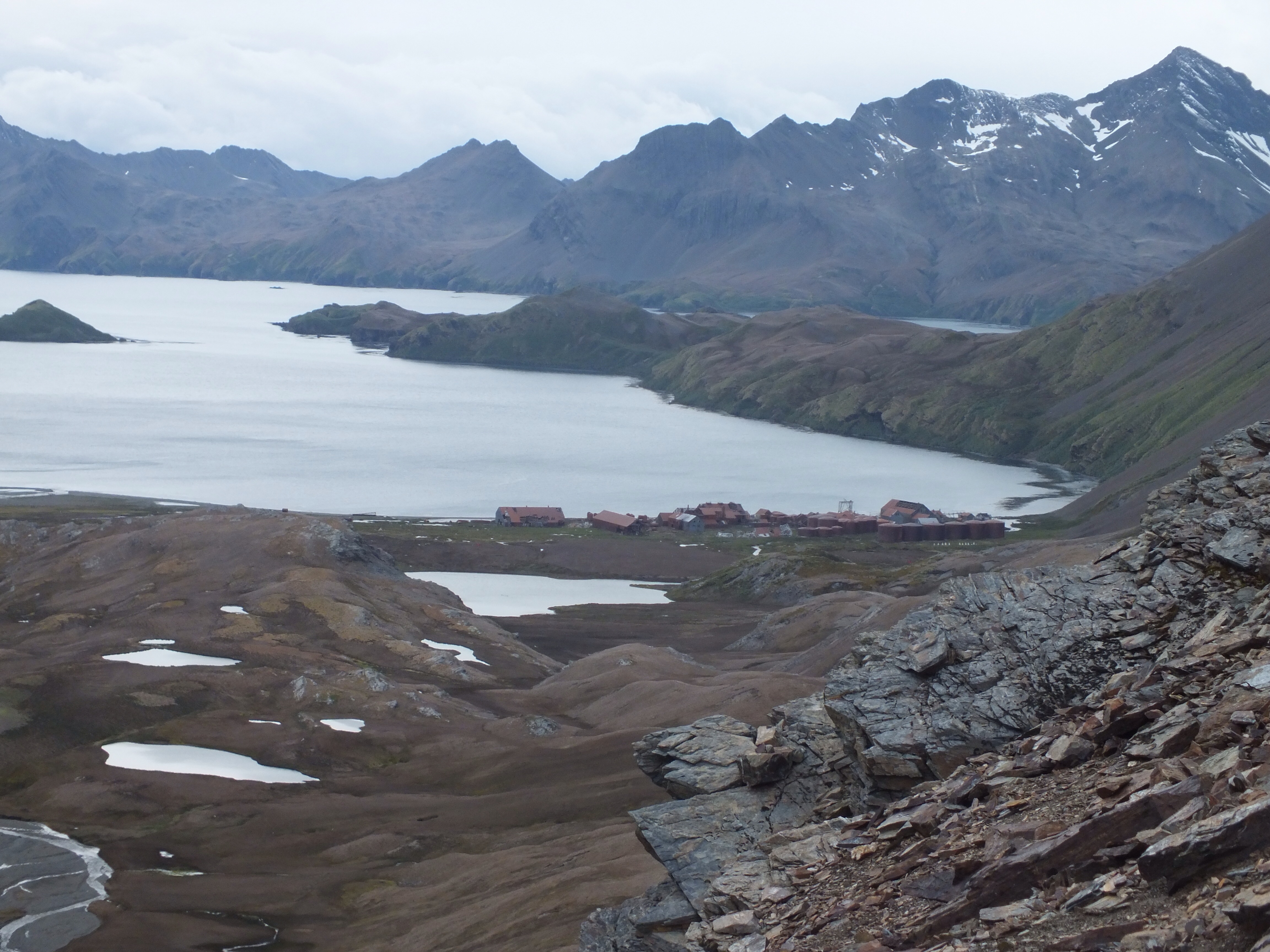
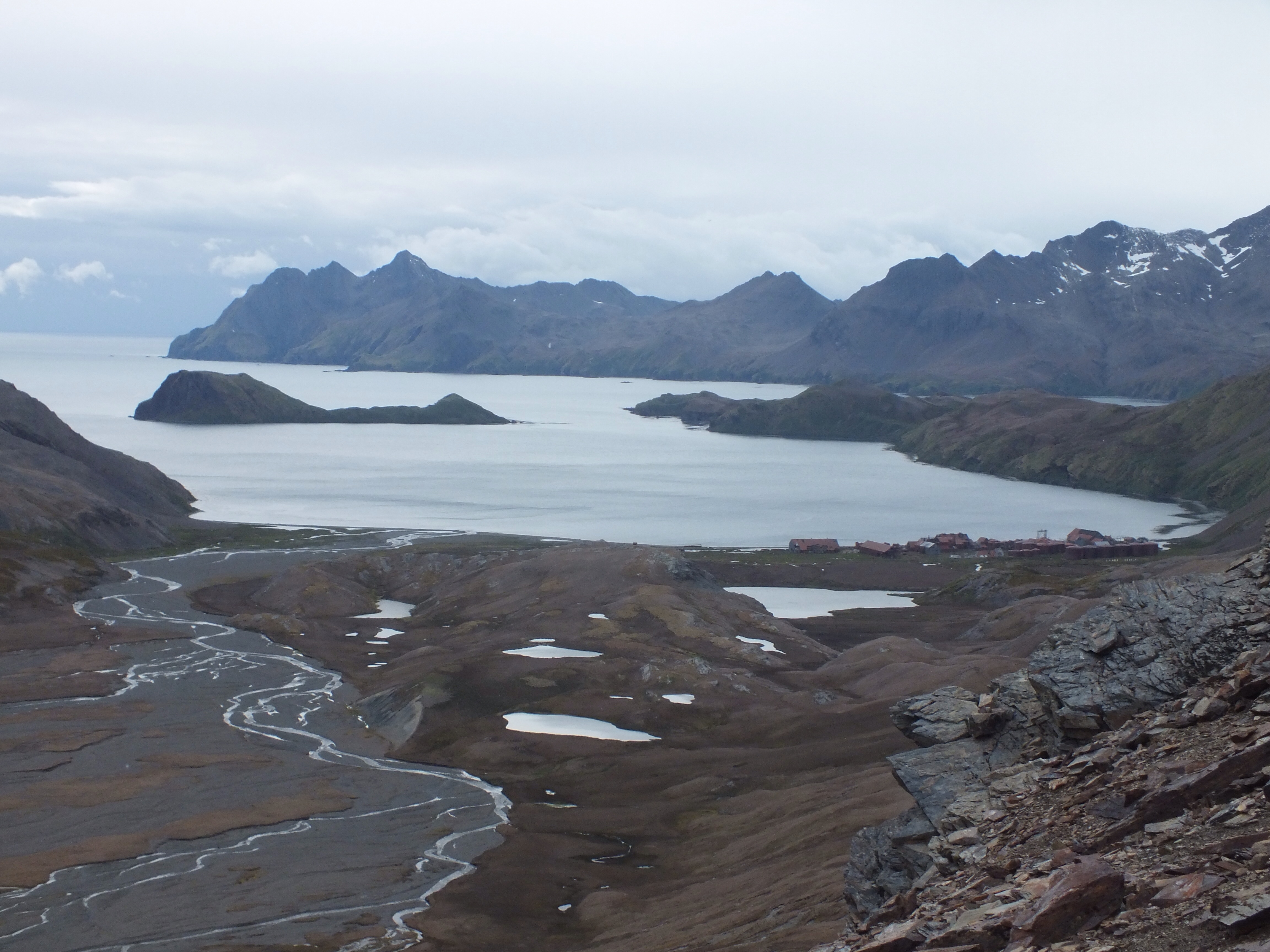
Whaling station getting closer
A look back at the ridge we’ve just crossed over
Where’s the ship? Are we to be left here?
We made it to the whaling station after just 2hrs and 45 mins. That was some achievement by all of us. The only one to fall was me – of course – but miraculously no damage done.

Margaret safely down and getting ready wot back on board Vavilov
We eventually rejoined the ship where they had a huge breakfast waiting for us.

First sight of South Georgia
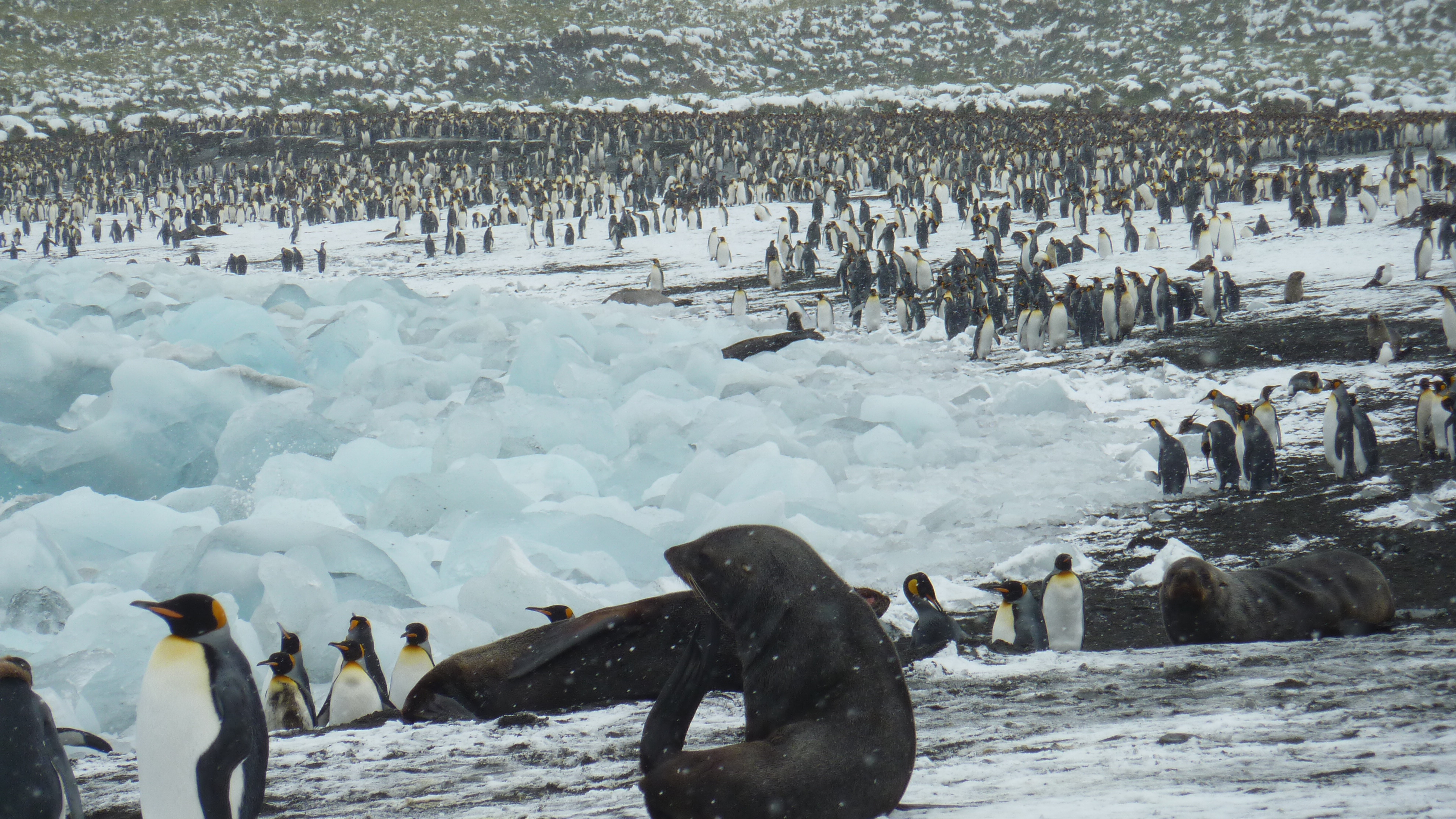
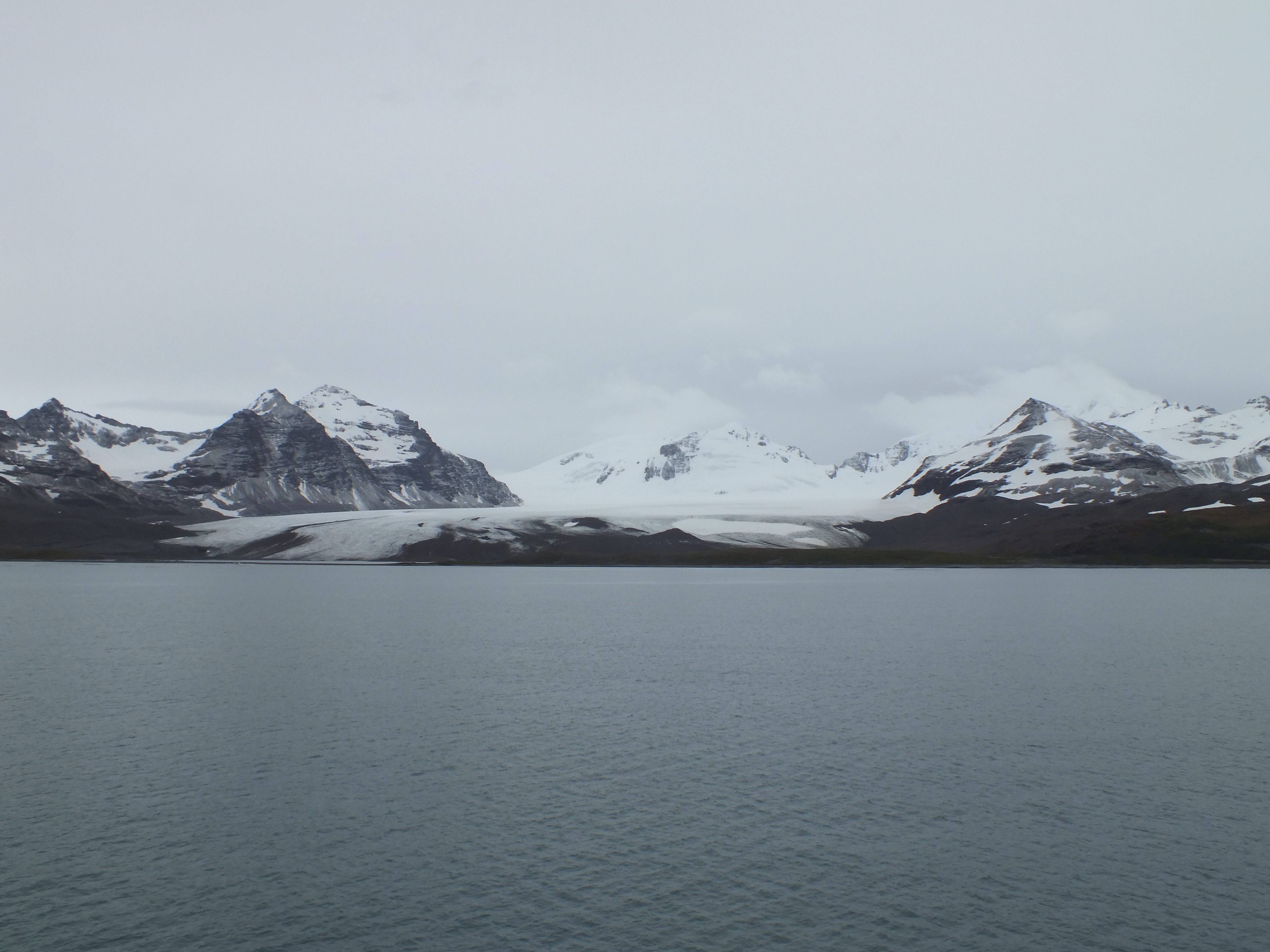
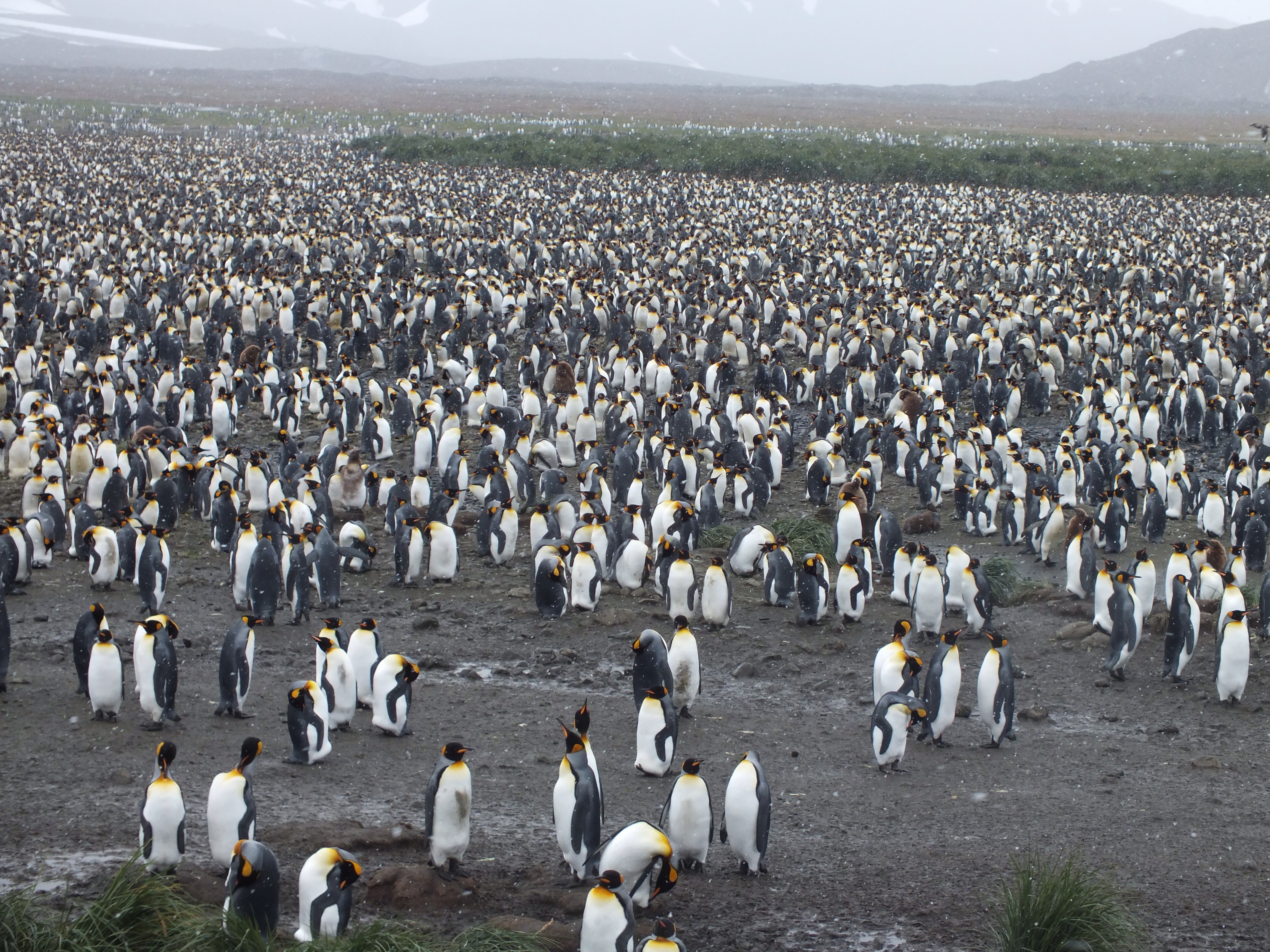
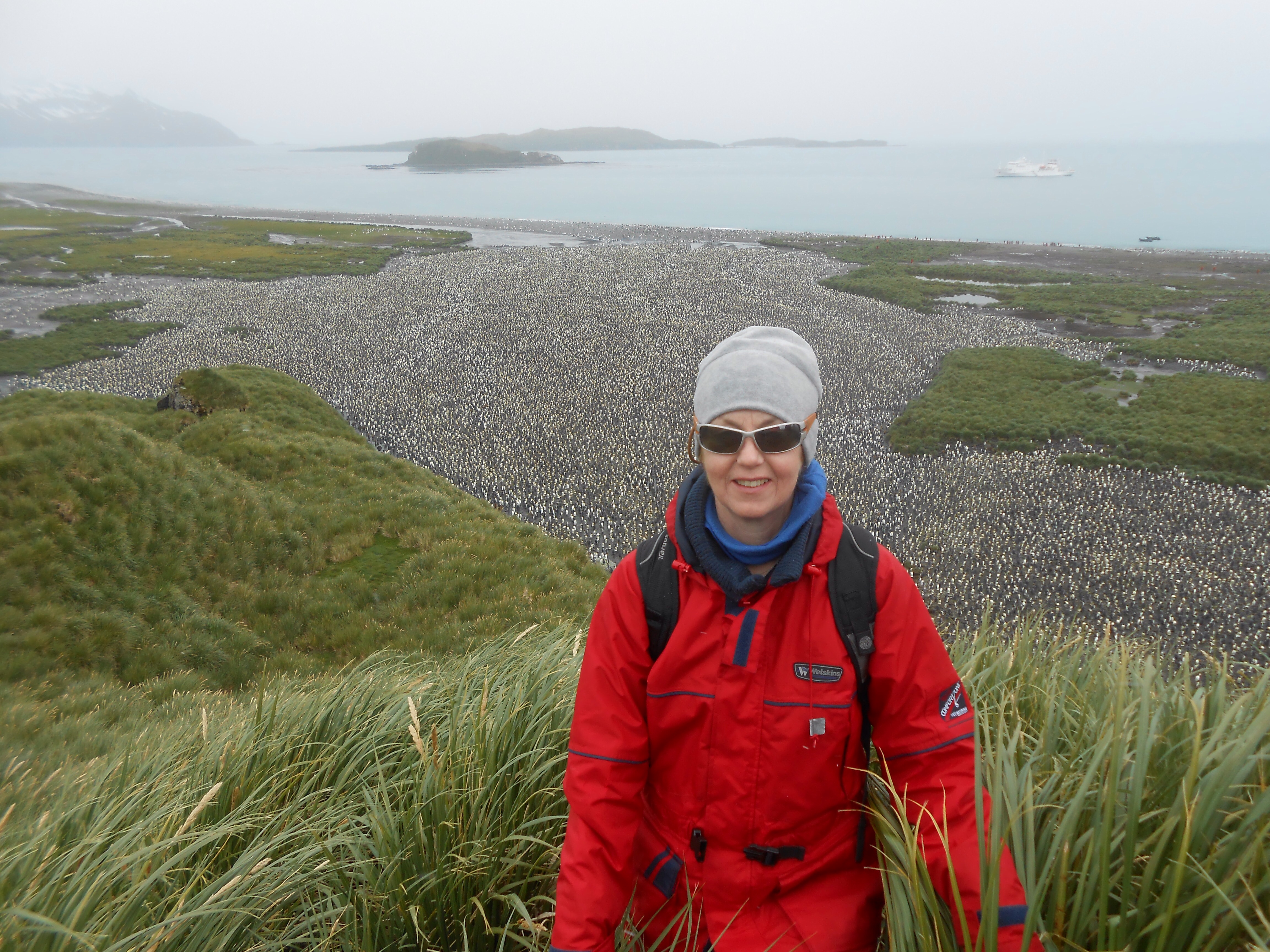
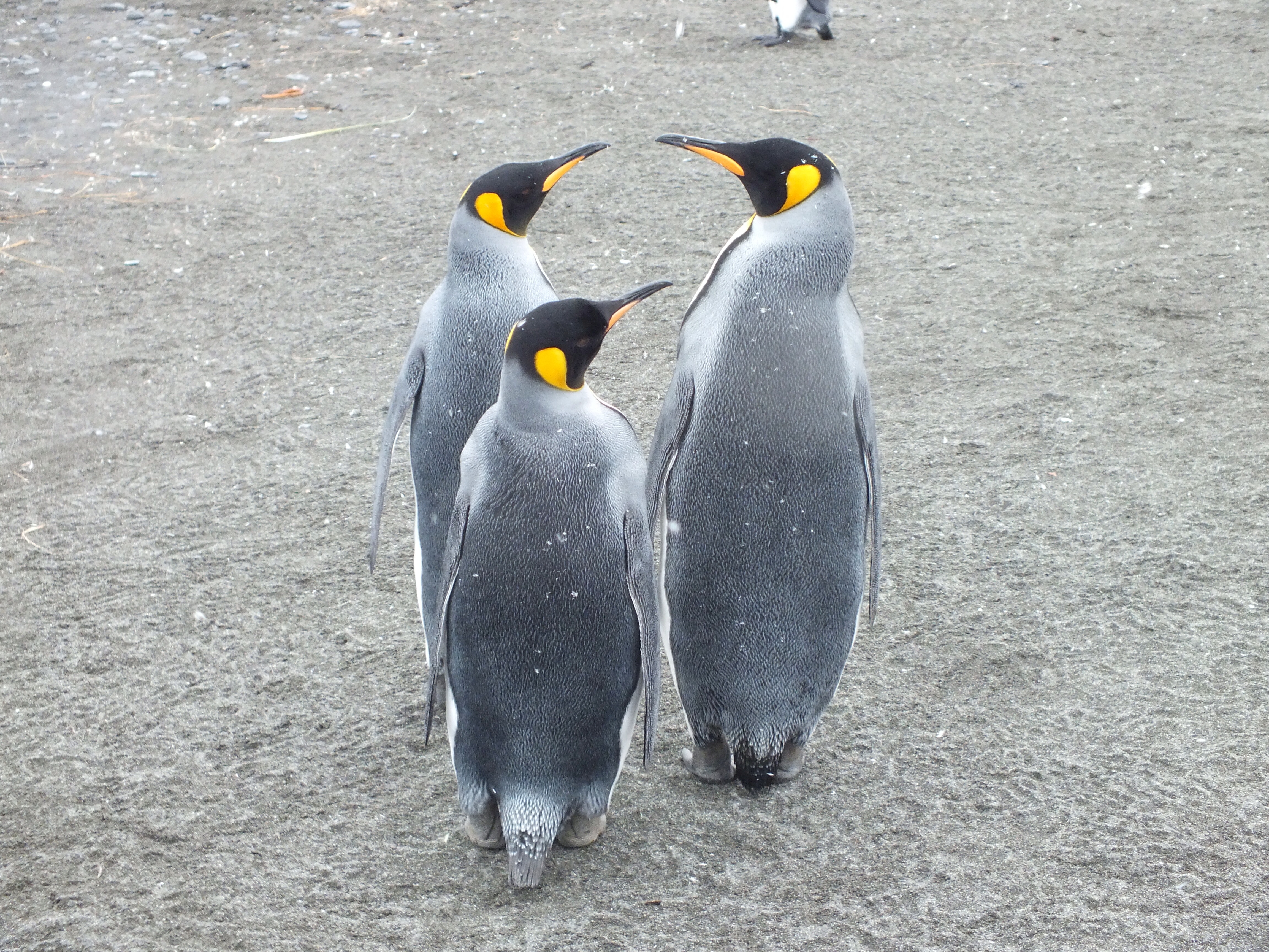
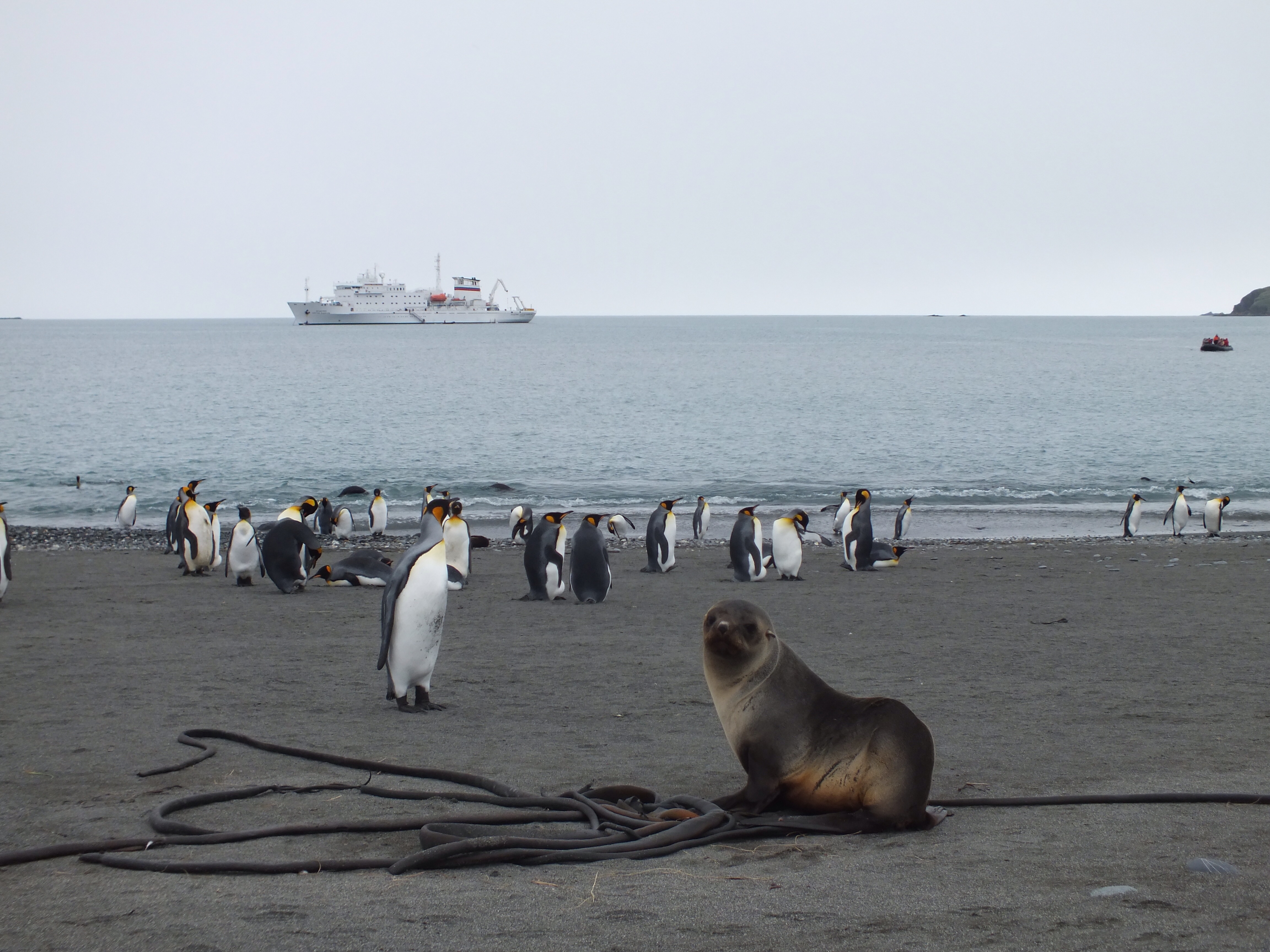
After 2 nights at sea we were woken up at 6.30am to catch our first glimpse of South Georgia. We had travelled 900 miles south east from Stanley. By the time breakfast was over we were anchored in the Bay of Isles. (Top left of photo above). It is amazing how much colder it is here than in the Malvinas. By now we had had enough R & R and were ready for another landing. So we wrapped up warmly, got into our foul weather gear and hopped on board a Zodiac. First stop was Salisbury Plain – home to a colony of 60,000 pairs of King Penguins.
The first recorded landing on South Georgia was made by Captain Cook, on his second trip around the world. He was looking for the long sought-after Southern Continent. When he reached S. Georgia he thought he had found it. He named the bay he landed in, Possession Bay, and named the island after King George III. He then got back on board and sailed southeastwards only to discover that he was back out at sea and that this was only an island and not a continent. As he looked back at the Island he named the last visible cape, Cape Disappointment.
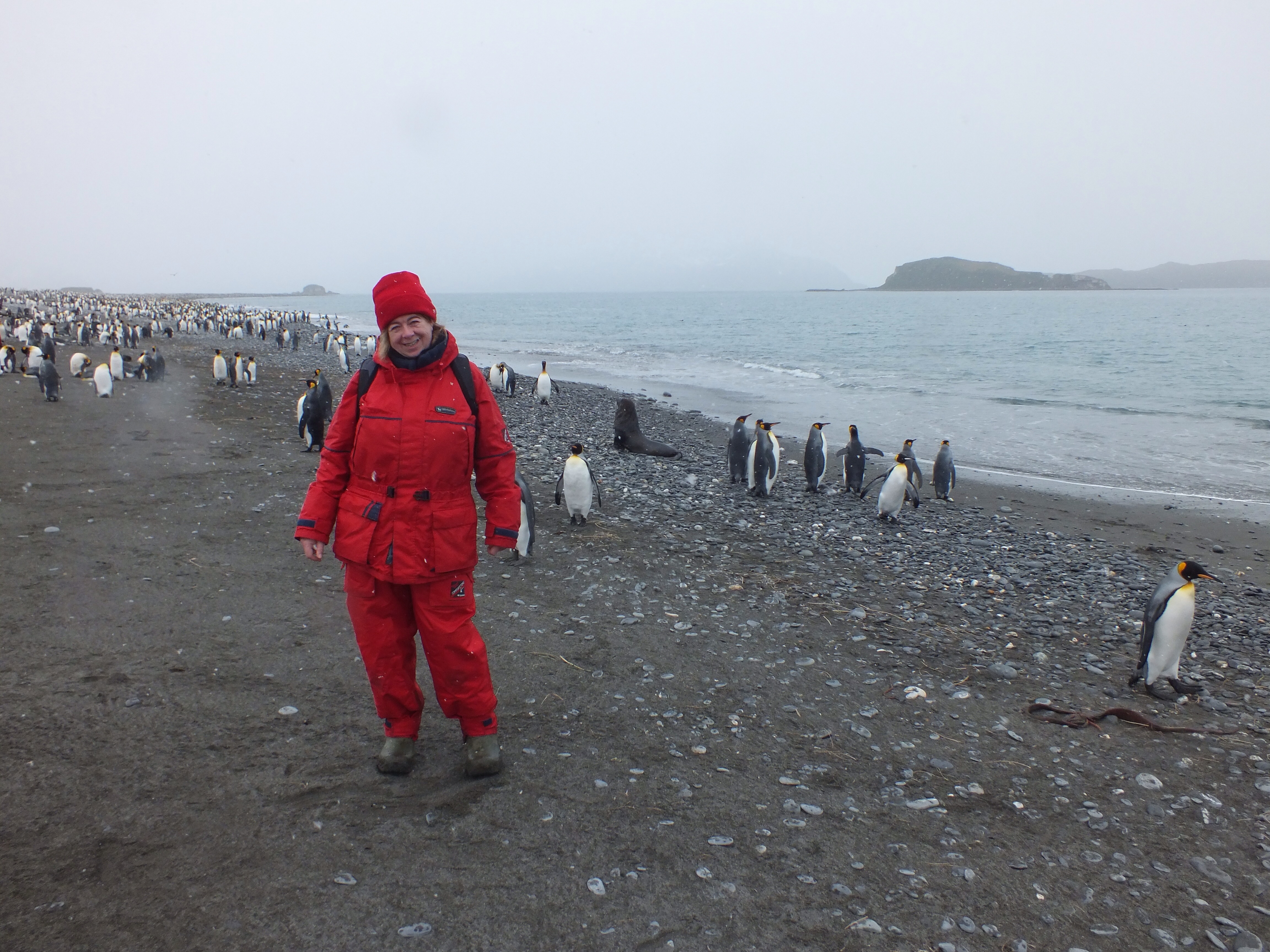
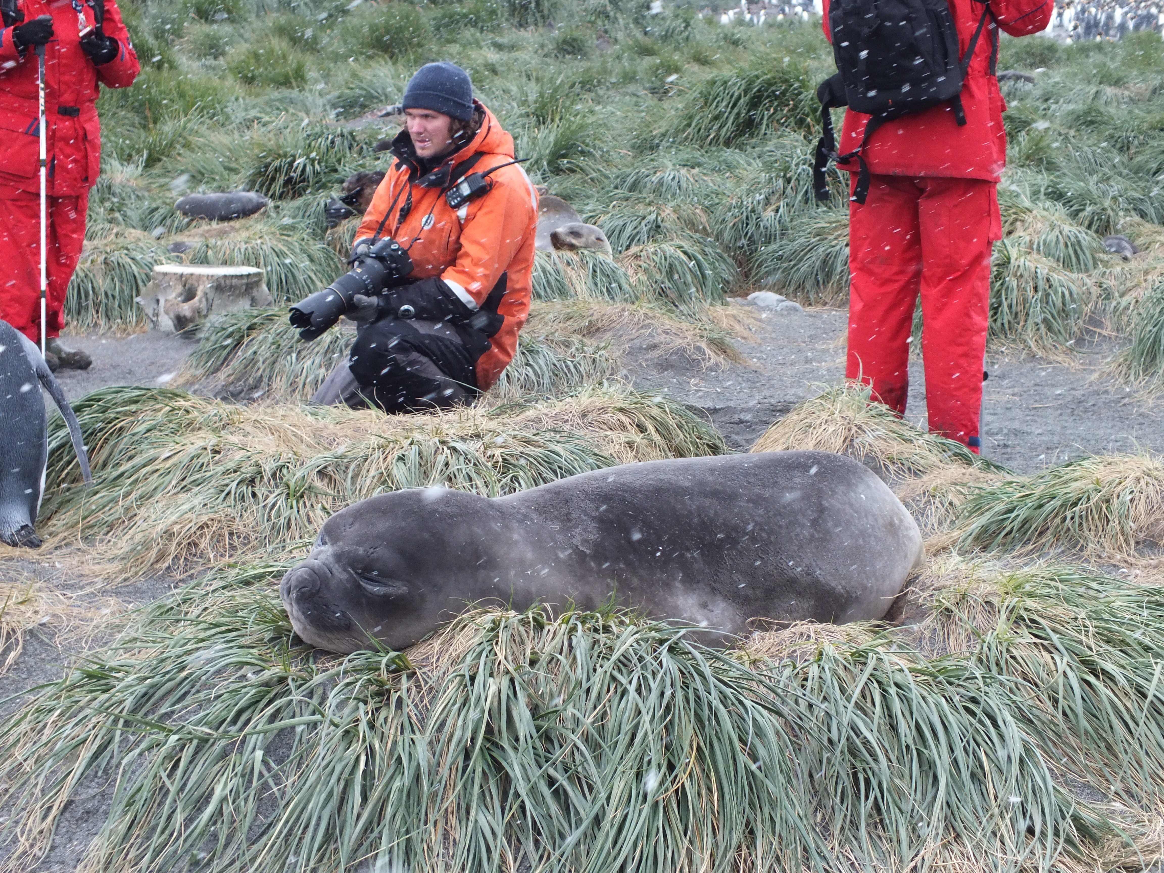
No such disappointment for us. This was our first taste of Antarctica and we were blown away by it. Towering mountains, wide glaciers, penguins and fur seals in huge numbers. The animals were very curious about us and with the exception of one fur seal Mother, pretty much ignored us as we landed on the beach. We have been instructed about keeping our distance and not making sudden movements. The best way to see the penguins is to just sit on the sand and let them come to us.
Margaret and a few of the more adventurous passengers, climbed up a steep hill and got a brilliant view of the colony. In the photo below, all those dots behind Margaret are King Penguins, as far as the eye can see. I stayed on flat land because my gums boots were uncomfortable for walking in – I’ve got a better pair now.
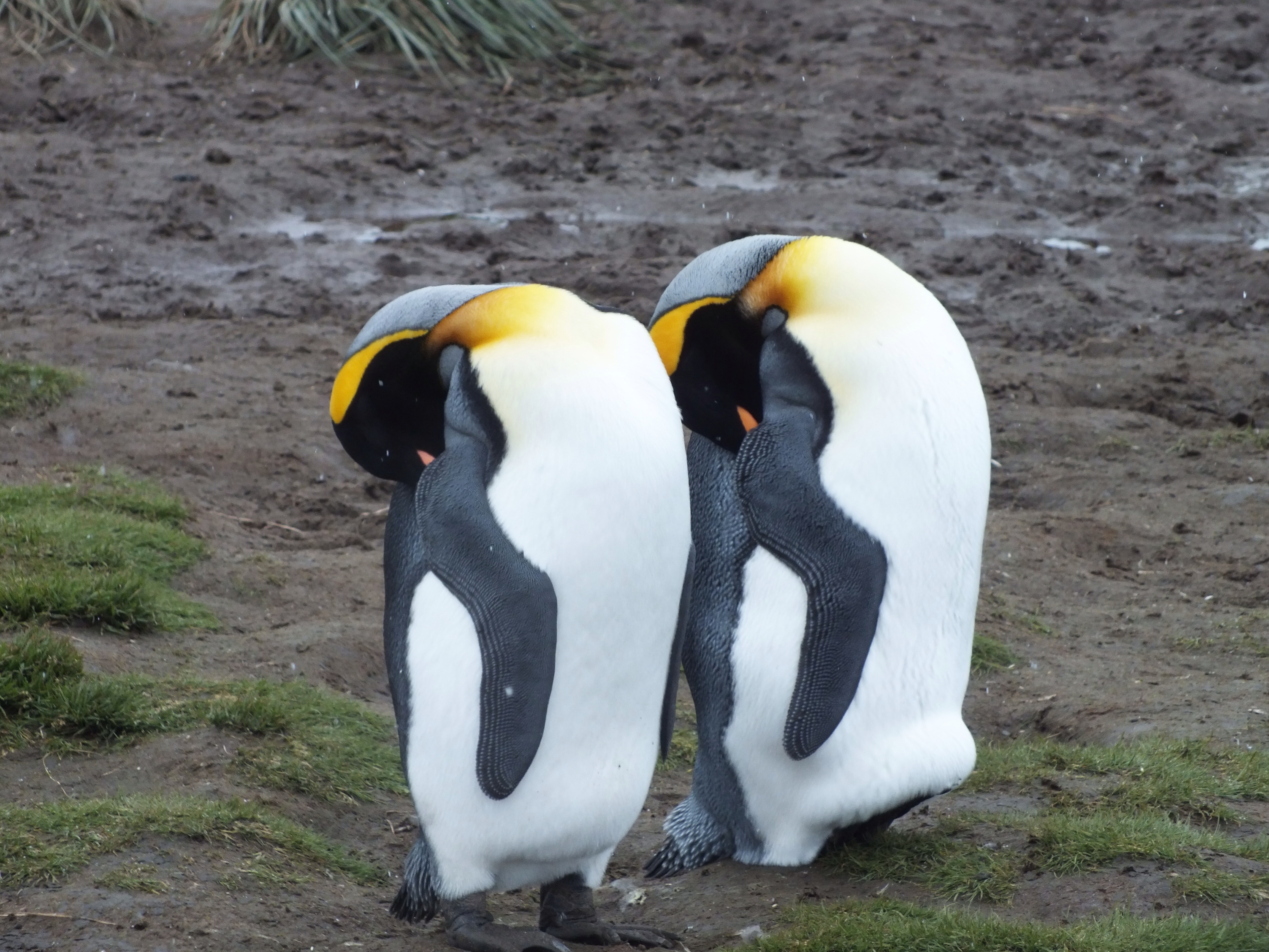
I learned something new today. Some of the penguins were moulting. They tend to congregate in small groups, away from the waters edge. The moulting process takes 3 week. During this time the penguins don’t eat and can’t go in the water. I have to say, they looked pretty miserable. We were warned to stay well away as this is a stressful period in their life cycle.
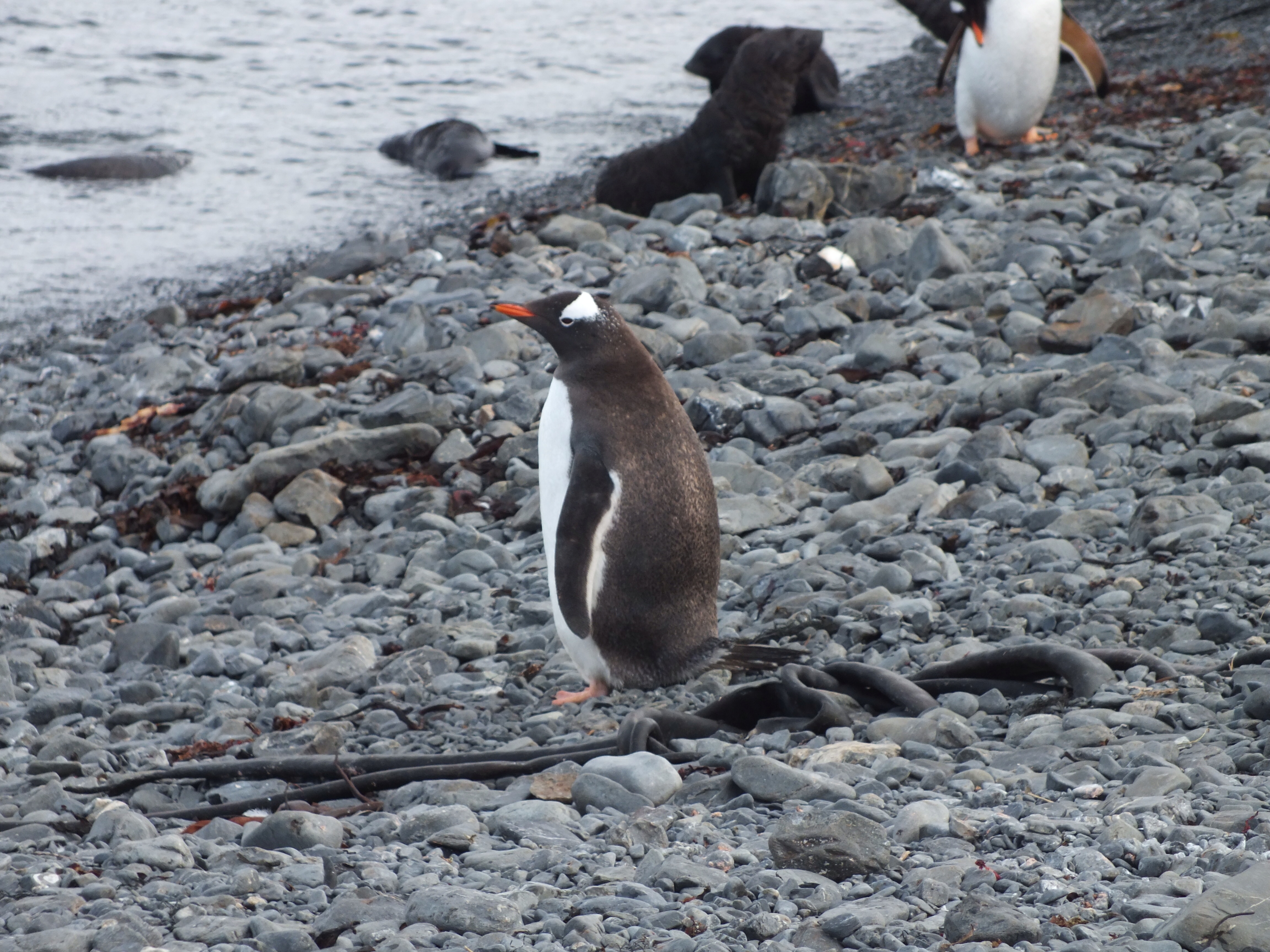
Gentoo penguin – lost amongst all the King Penguins
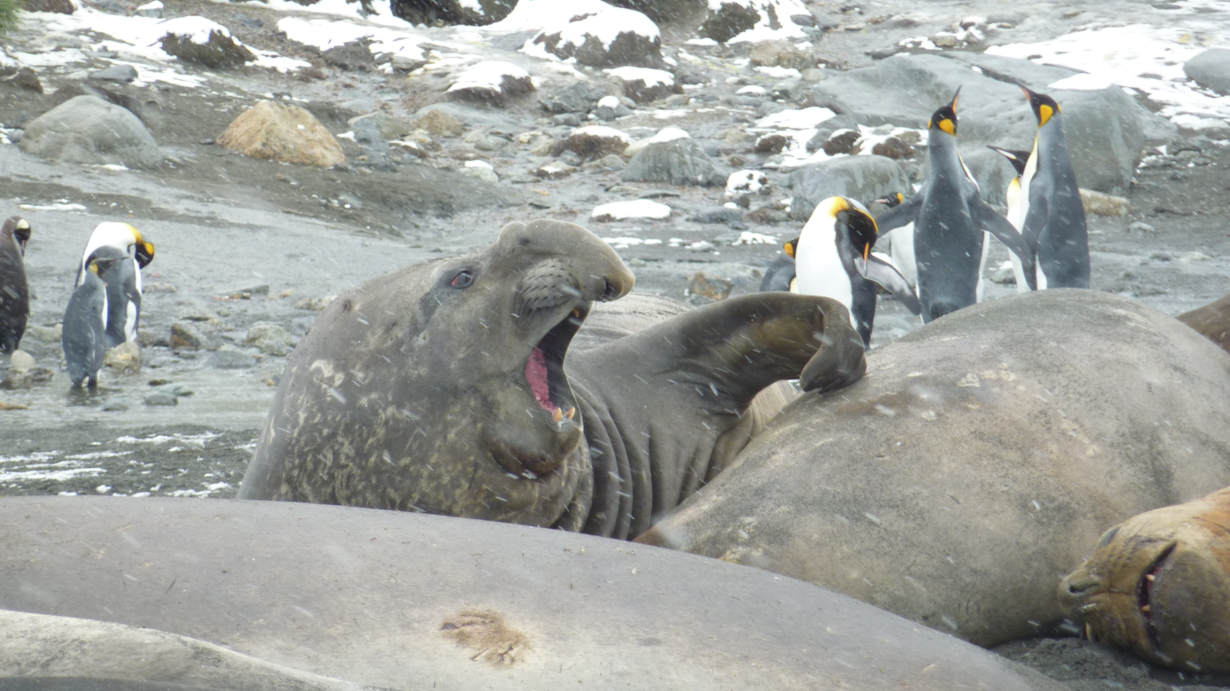
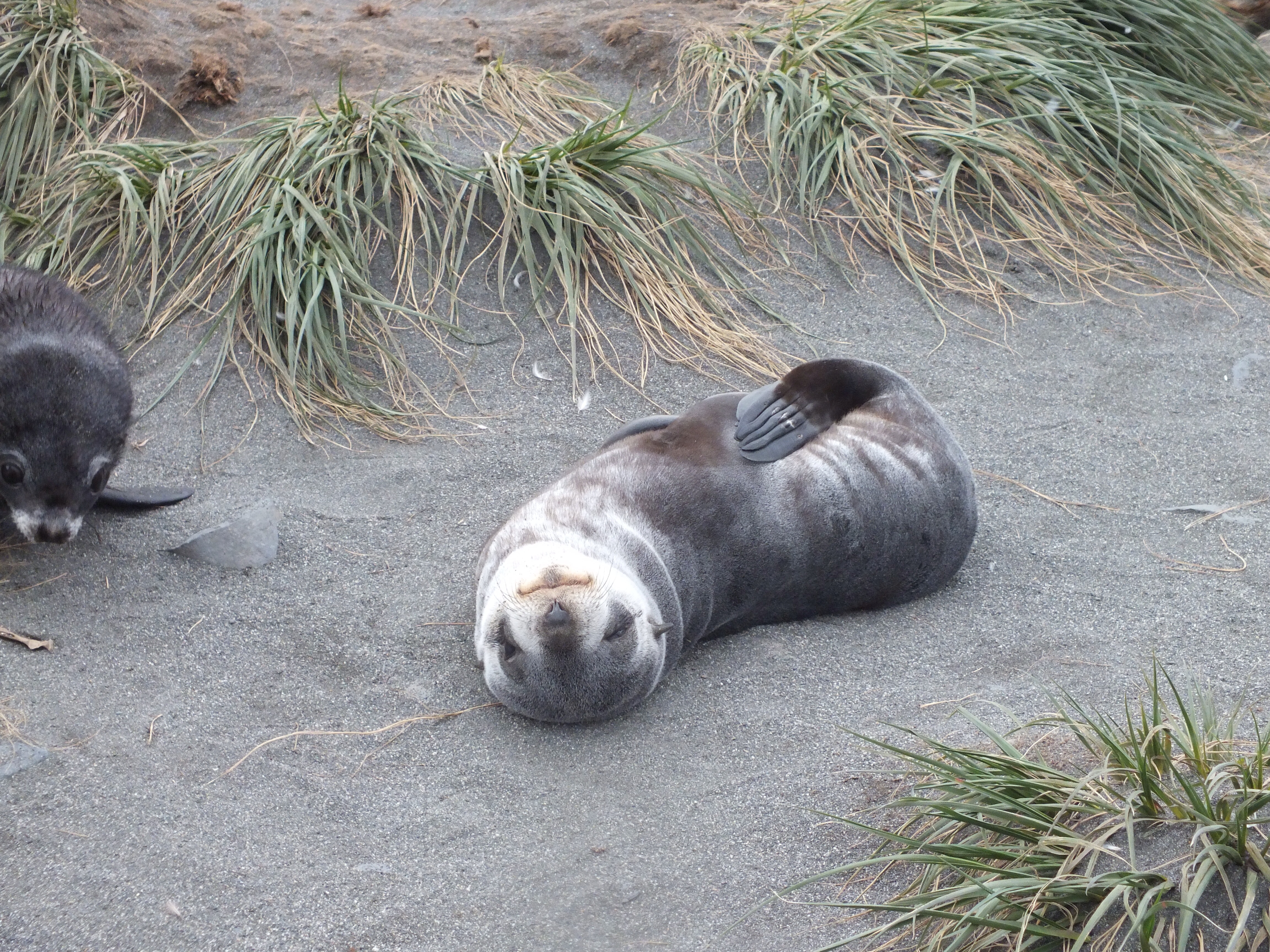
Sharing Salisbury Plain with the penguins, were Fur Seals. This species was almost wiped out in the early part of the last century. They are now making an amazing recovery. Sadly, this is largely due to the fact that their main predator, the whale, in on the decrease. They are by far the most beautiful seals I’ve ever seen. Their fur is thick and creamy in colour. The babies were only about 4-8 weeks old and many sat patiently on the beach or on grass tussocks, waiting for their parents to return with food.
After a couple of hours the cold was getting to us so we made our way back to Zodiacs and on board for lunch. While eating lunch the ship upped anchor and sailed around to Prion Island, in the same bay.
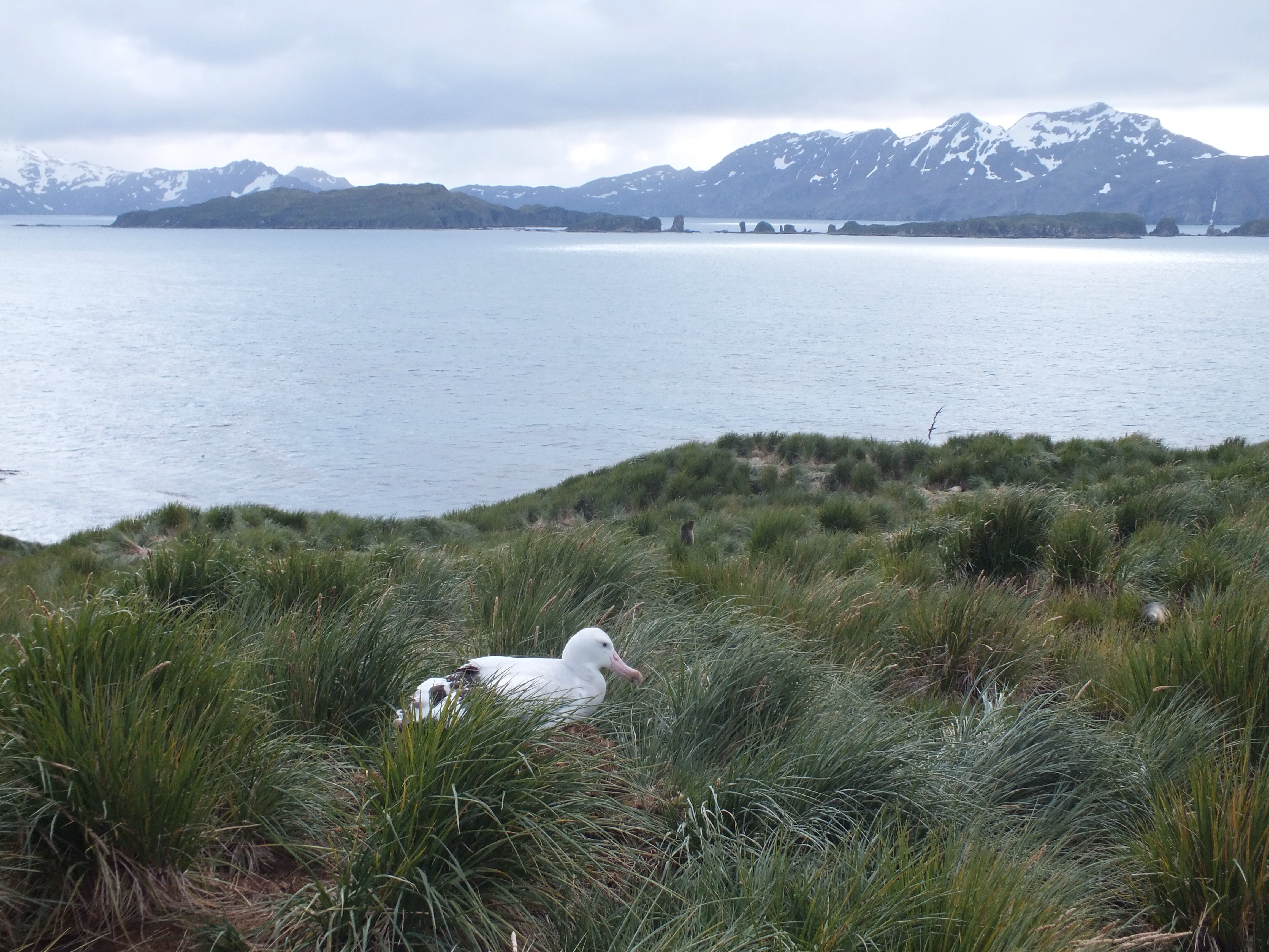
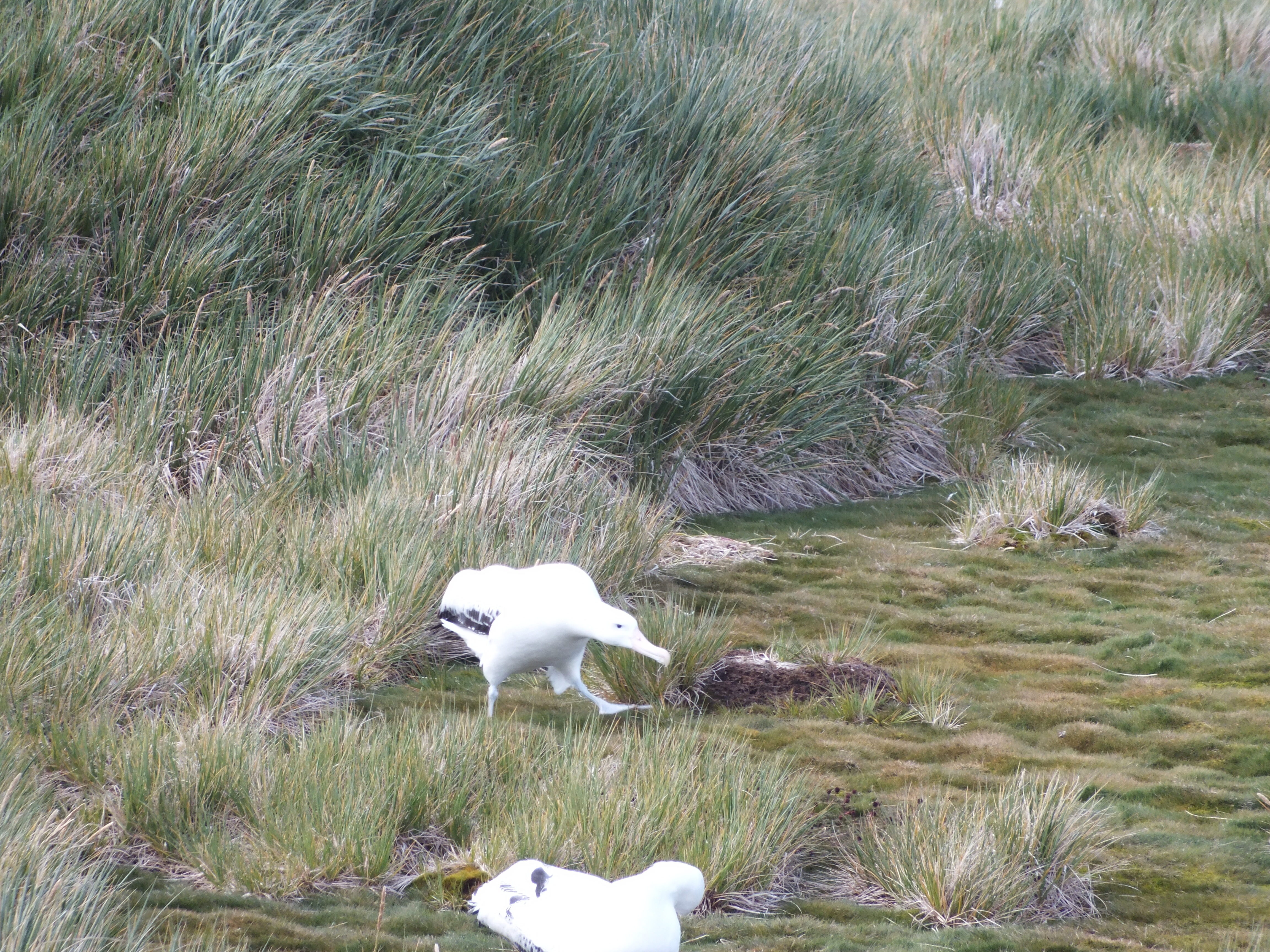
After lunch, Margaret headed off with the kayakers to paddle around the island. The rest of us took a trip around in the Zodiacs and eventually landed on Prion island. Luck is with us so far on this trip. Apart from the really smooth sail so far, we are also the first cruise this season to be able to make a landing at Prion Island. There are a number of Wandering Albatross nesting here. Due to a restriction on the number of people who can land at a time, we went ashore in 3 separate groups.
I was completely gob smacked when I saw the first albatross sitting in her nest. We had seen them flying around the ship on the way here, but this did not prepare me for the sheer hugeness of their bodies. They have a wing span of 3.5 meters, but they weigh up to 9 kgs!! And if they don’t get caught by long line fishing, they can live up to 40 years. Unlike Salisbury Plain, Prion Island had a purpose built walkway that we were required to stick to. While this felt a bit contrived it did protect the flora and I’m sure was less stressful for the animals.
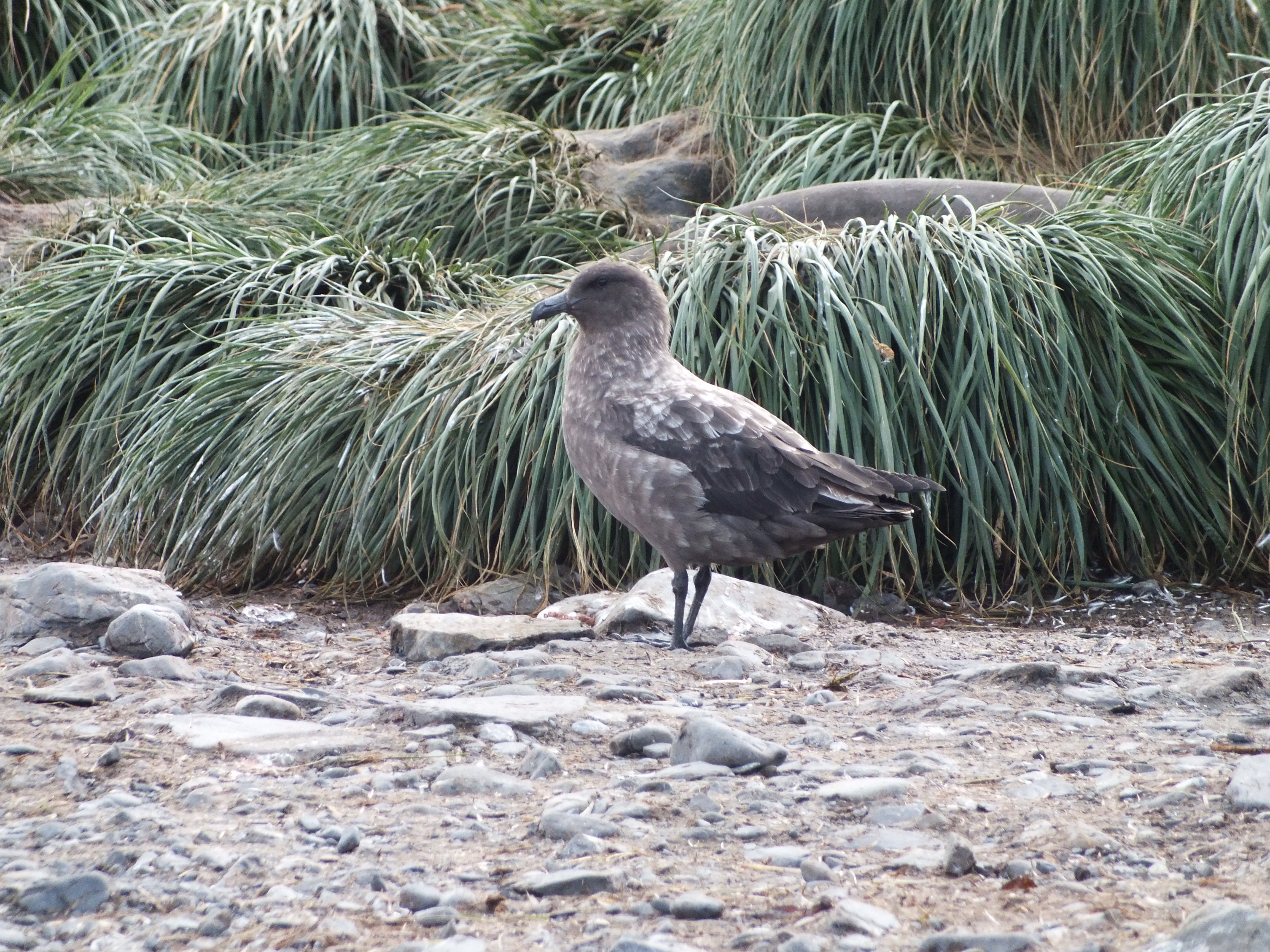
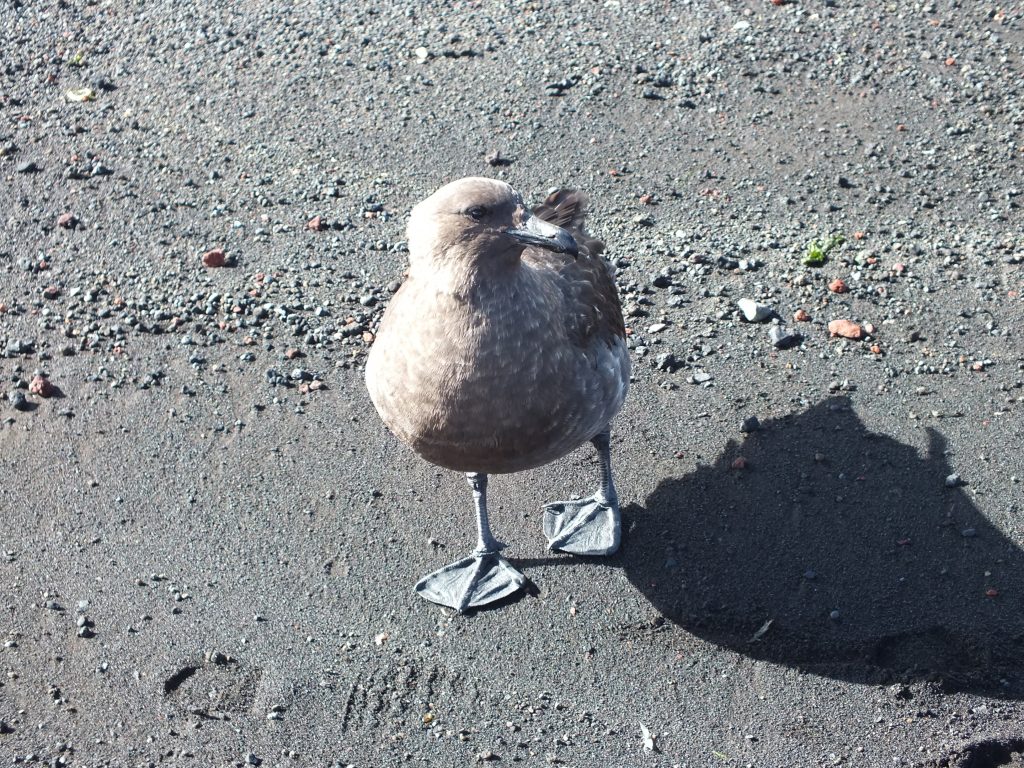
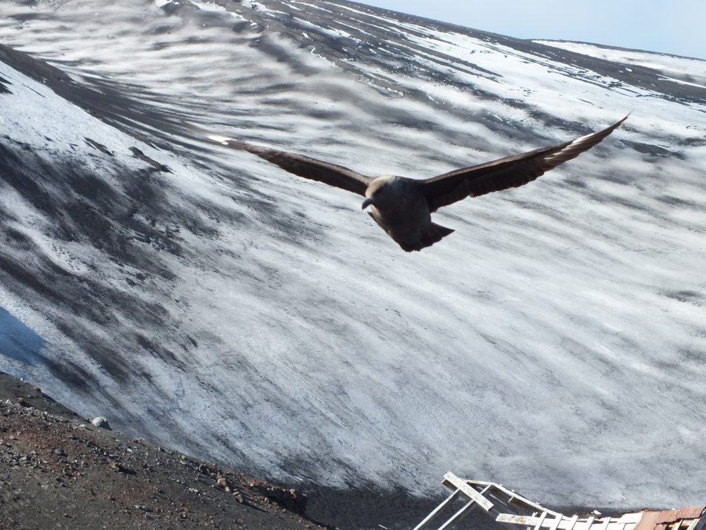
Skua
Wandering Albatross sitting on her nest
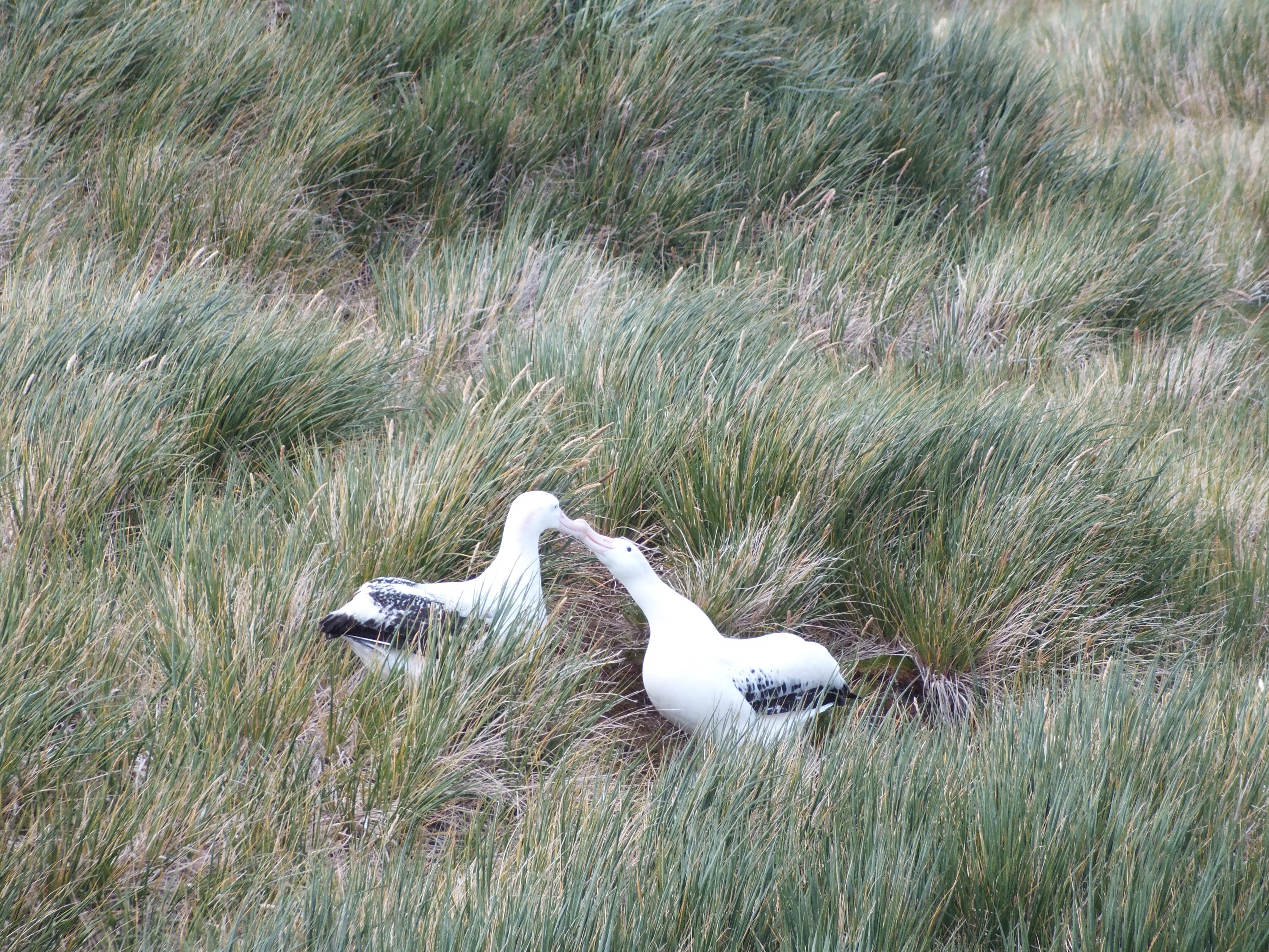
Courting albatross
Not sure what this about. Could be courtship, or rivalry

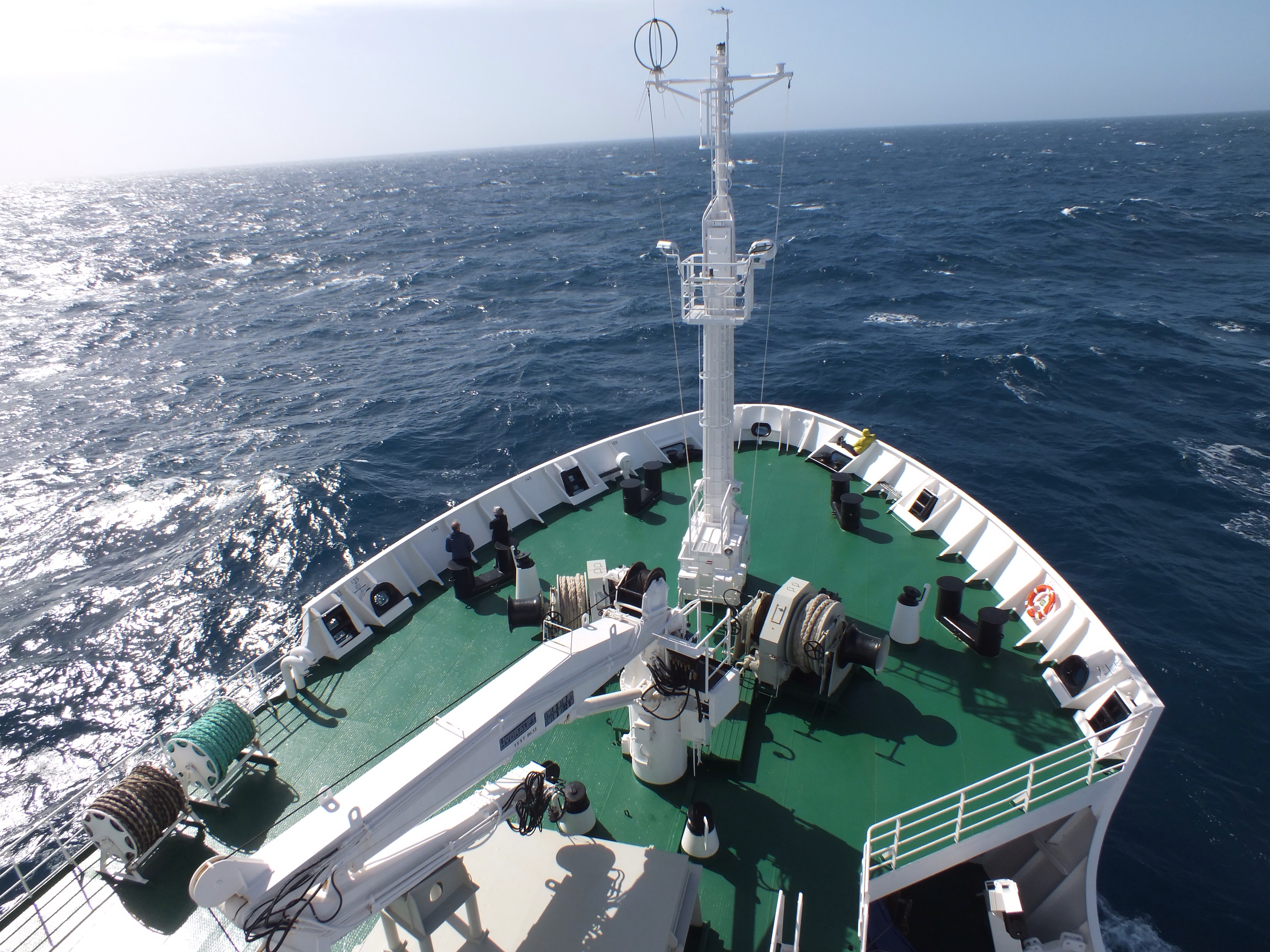
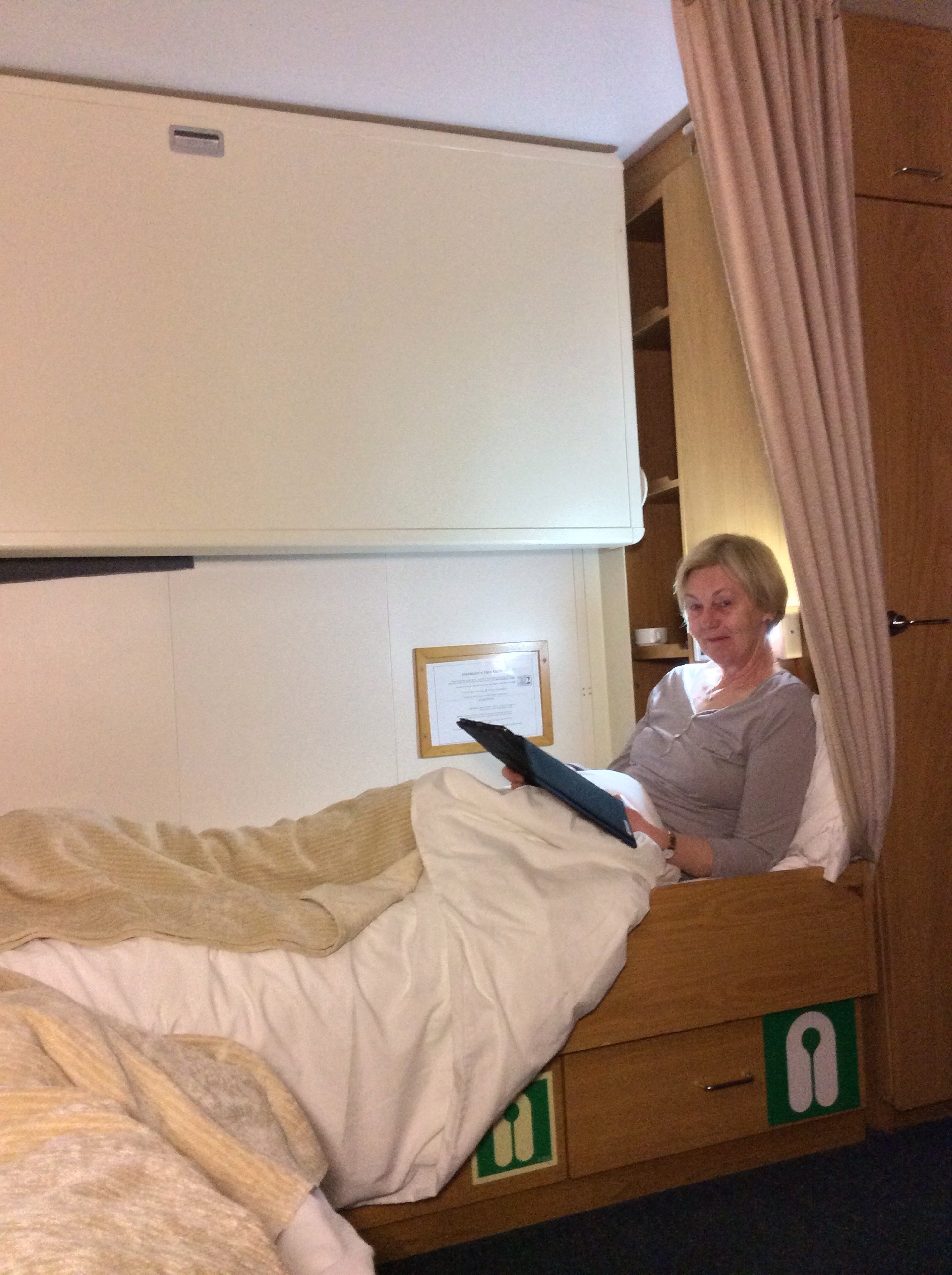
In terms of life onboard, I wasn’t sure what to expect when we booked this trip. The only reason we picked the Vavilov was that the departure date suited our holiday dates. As it turns out we couldn’t have picked a better ship if we’d tried. This ship was built by the Russians for scientific exploration of the Arctic and Antarctic. As such it has a reinforced hull and superb stabilisers. Nice to know since I’m looking out the window at some massive icebergs. We had 40-45 knots of wind last night and while it was rolling a bit, not enough to make the majority of people sick. The fact that the ship is small, in cruise ship terms, means that we can get into coves and bays that the larger ships have to sail past. (Not that we’ve actually seen any other vessels – apart from some crazy people in a yacht near South Georgia).
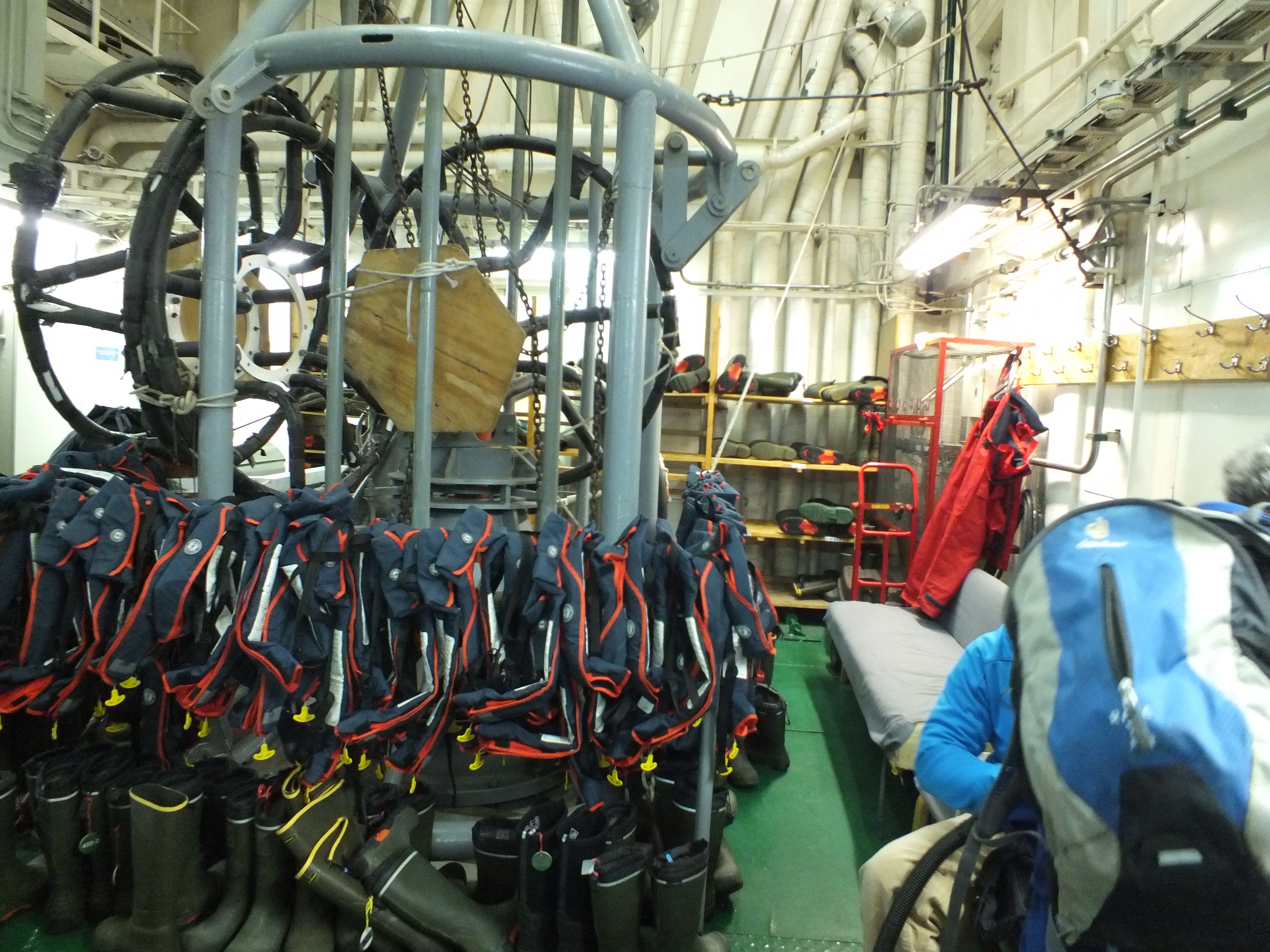
The Mud Room -where we get to put on sexy green wellies, wet gear and life jackets.
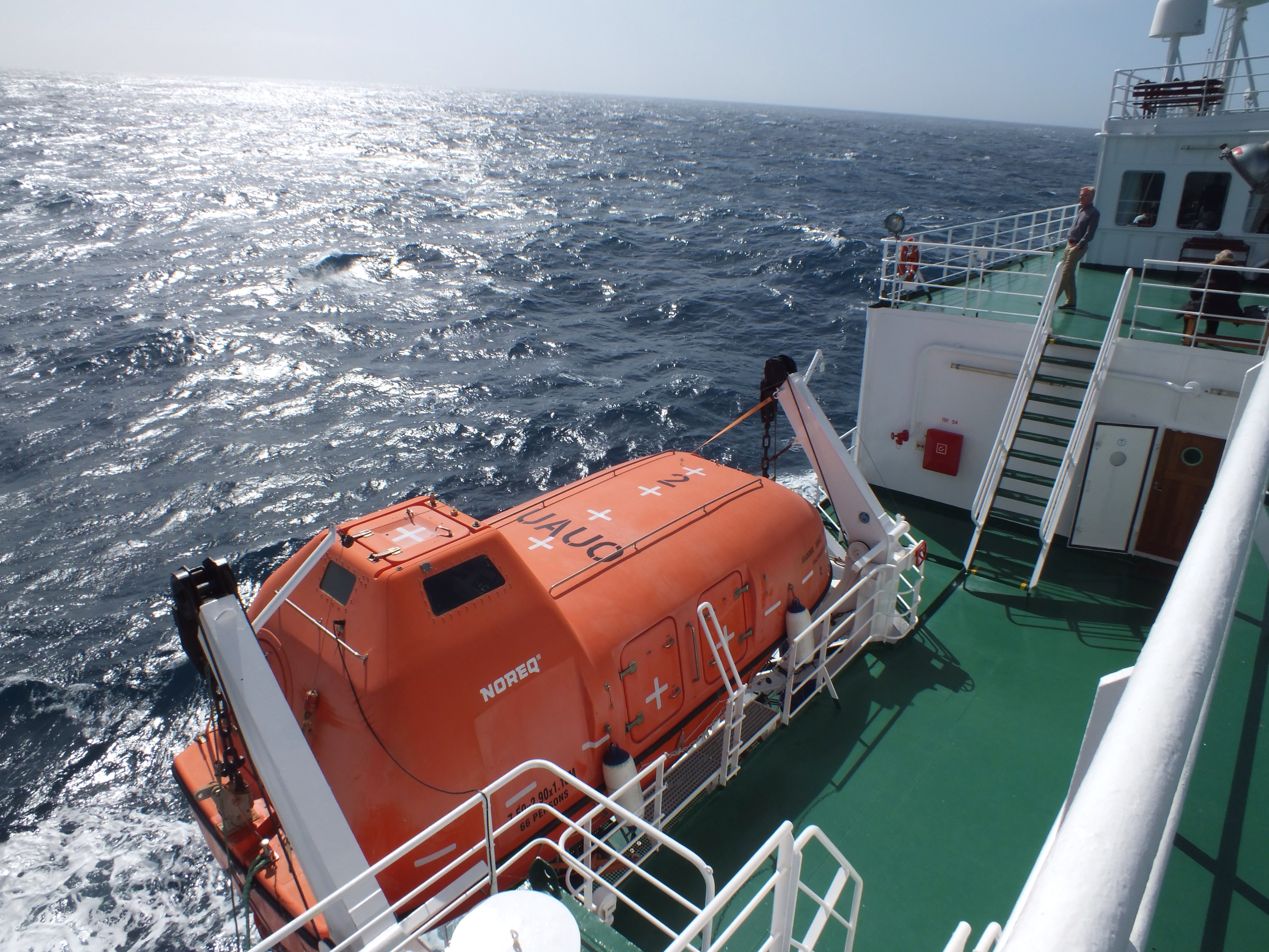
Life boat – smaller inside than it looks
There are 86 passengers, 16 expedition staff, about 30 Russian crew looking after food, cleaning, maintenance and sailing the ship. There are also about 10 scientists on board. They work in the lab and on the bridge. The passenger fees cover the cost of the scientific work on board. What this work is, is anybody’s guess. From the bridge they seem to be documenting numbers of whales, albatross etc. The lab guys are looking at water temperature and other stuff they don’t discuss.
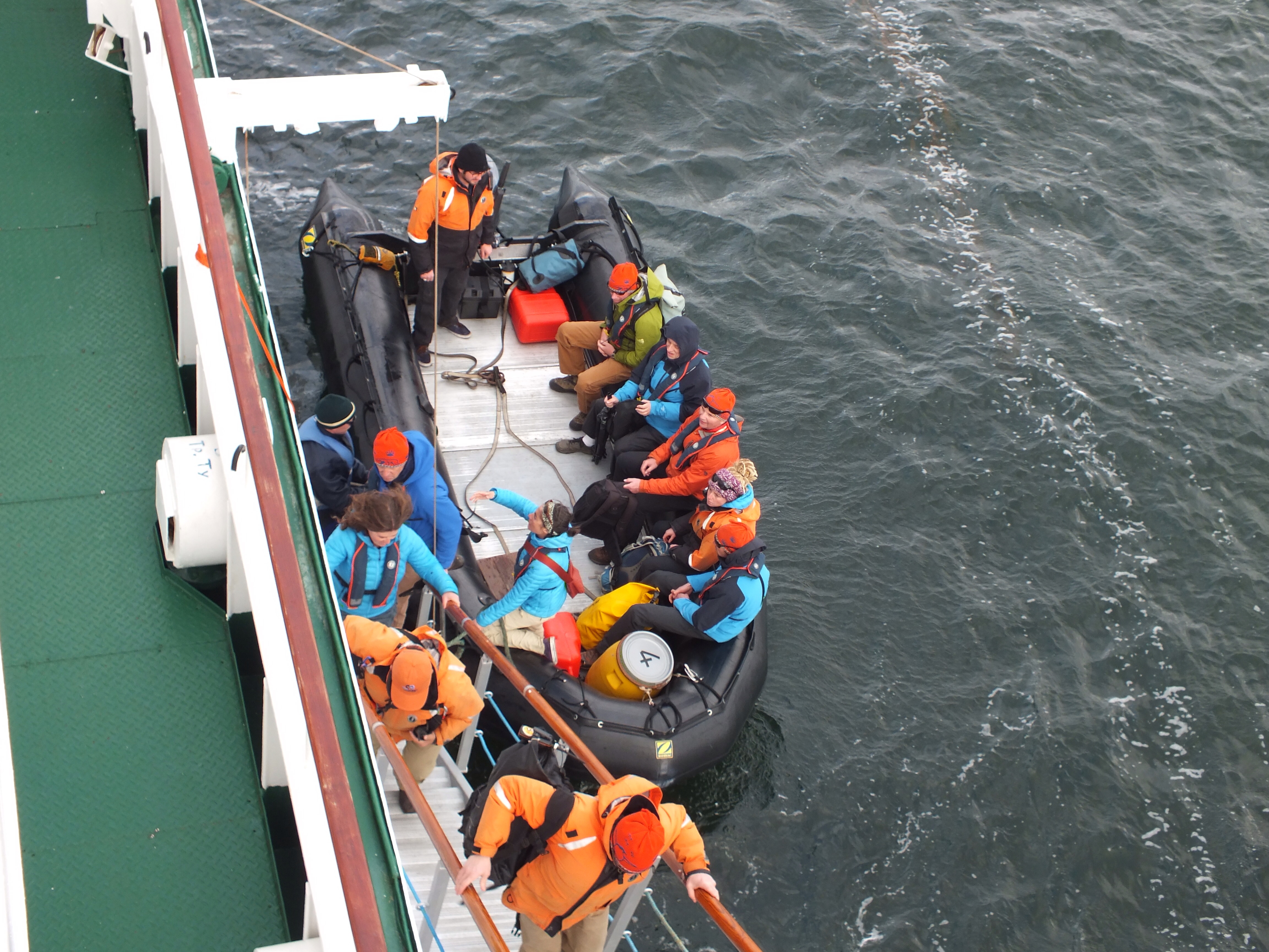
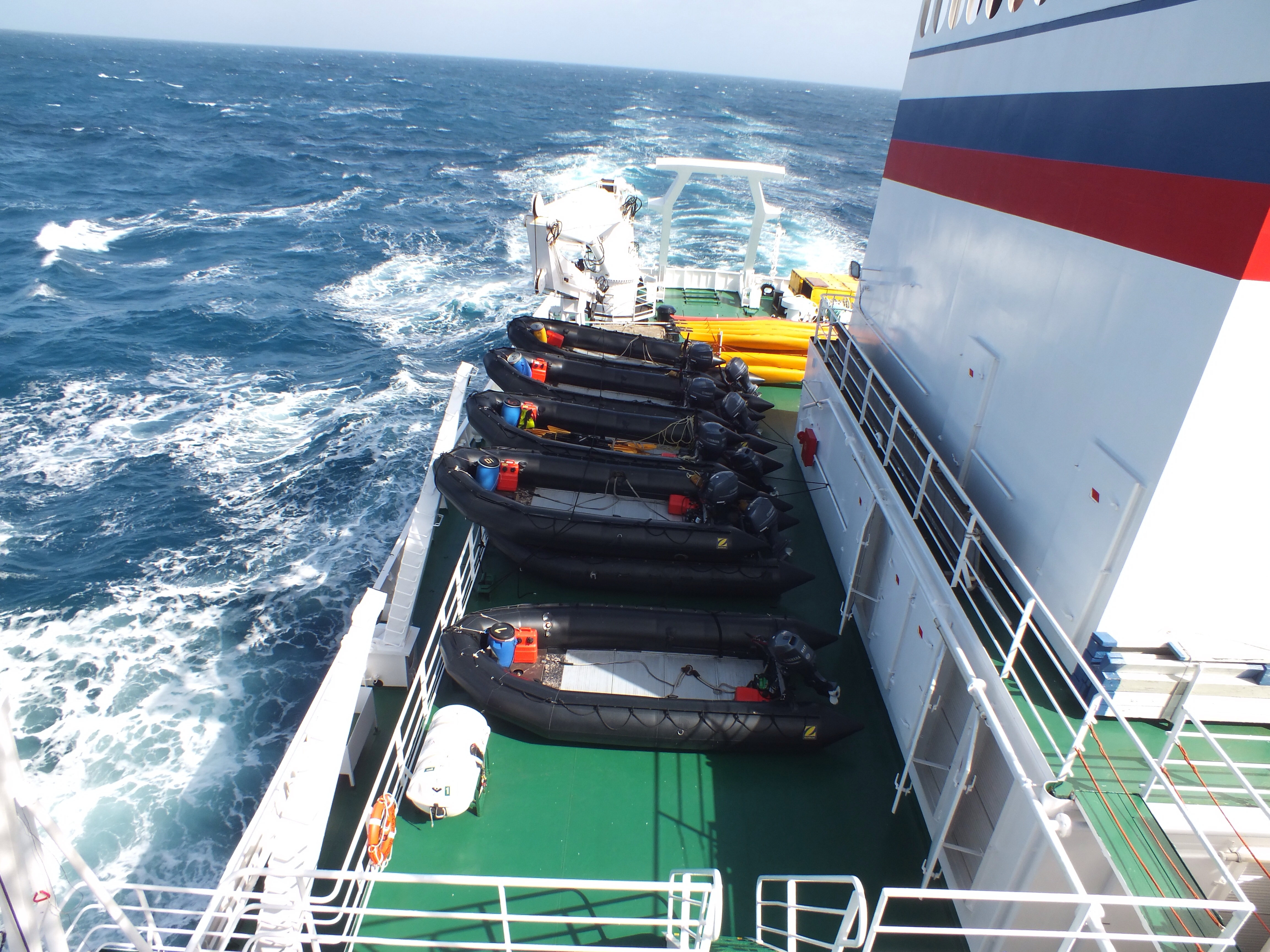
There are at least 5 Zodiacs on board. These are large inflatables we use to get from ship to shore. We also use them for coastal trips when it is not possible to dock. The drivers are really well skilled and are flexible about stopping for us to take photos.
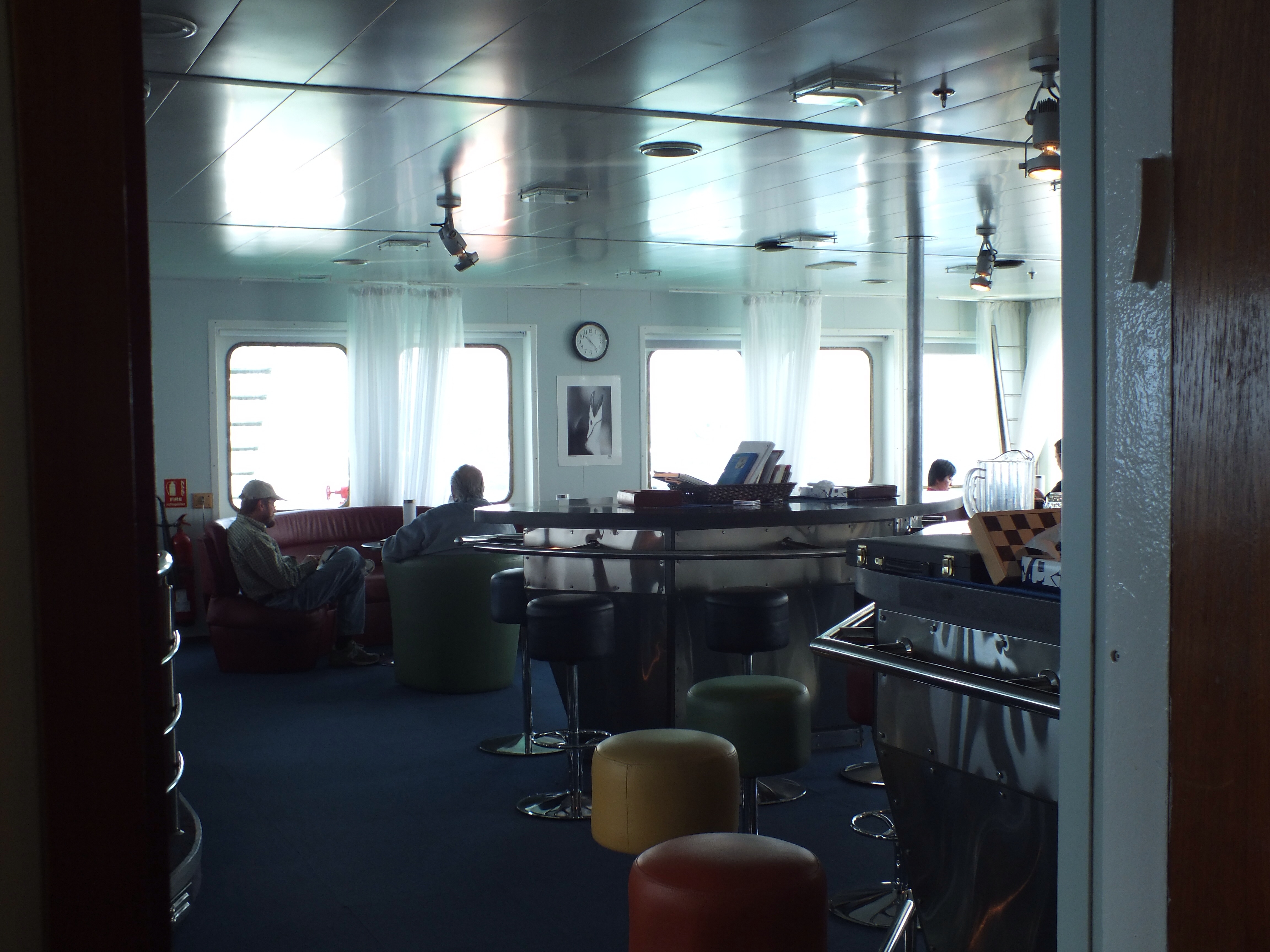
The bar – usually empty except during happy hour
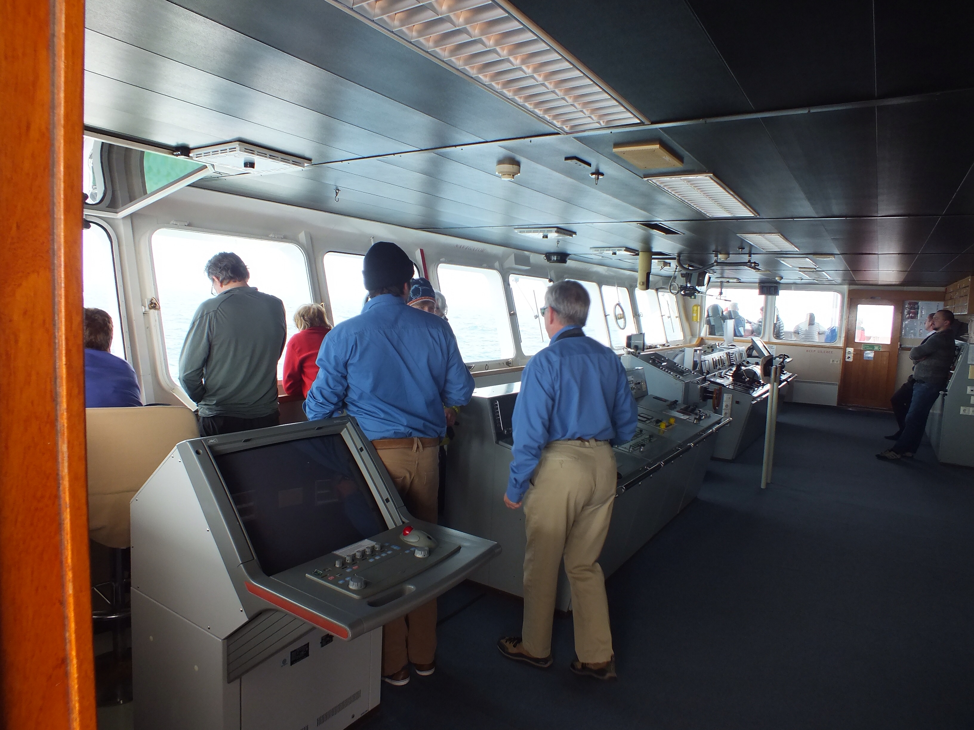
The Bridge – great spot for whale watching
We have a couple of days and nights at sea between each destination and I can’t believe how quickly this time passes. Apart from 3 excellent meals a day, there is happy hour in the bar before dinner, and there is always a card game in the bar after dinner. Mostly played by the Aussies as they seem to have better lasting power than the rest of us, including the small number of Irish on board.
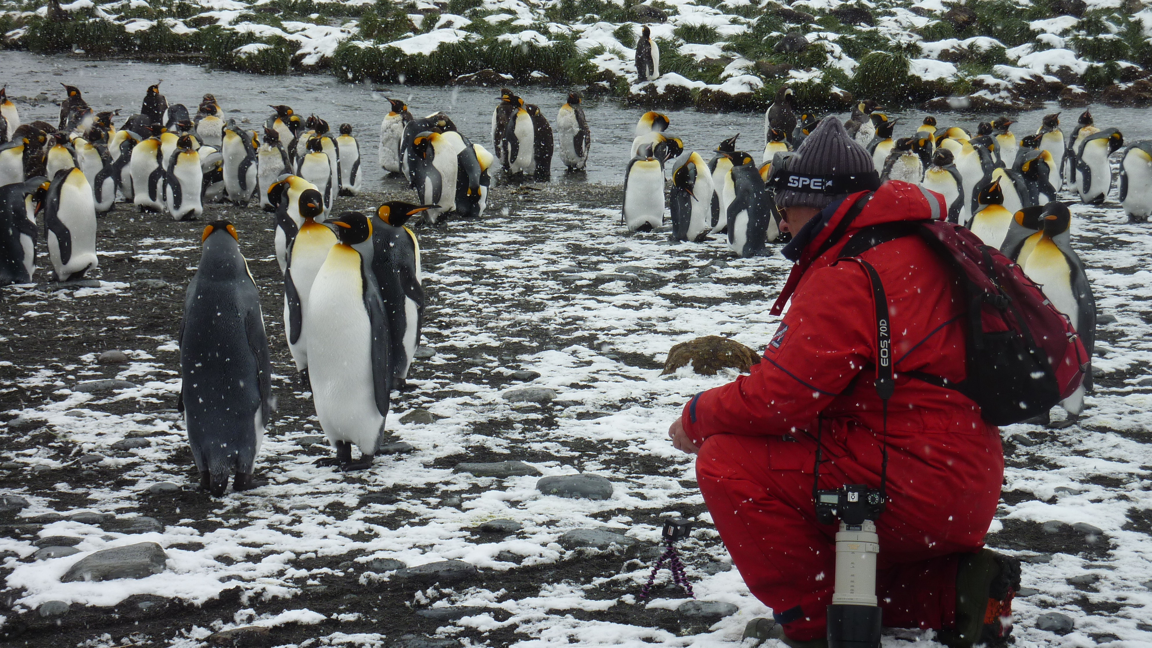
During the day there are usually at least 2 lectures in the Presentation room. These are given by the Expedition staff and cover the fauna and flora of our next destination. Before we got to South Georgia, there were a number of talks given and documentaries shown about Shackleton and his adventures. I been giving all of the above a miss. I’ve read just about everything there is on Shackleton, seen all the documentaries, and David Attenborough has kept me well informed on the flora and fauna. However, I have been attending all the lectures on photography. Having said that you might be expecting some amazing photos on the blog. Unfortunately, theory and practice are still miles apart for me.
There is the oddest mix of people on board. For instance, some people are only here for bird watching and know nothing about the great days of Polar exploration. One such bird watcher asked me if I followed Shackleton all around the world. I explained as best I could that sadly, he is dead, and anyway, only ever explored the Antarctic!! Other folk only seem to be here because it is “a destination” and they have pots of money for travelling. And then of course there are those, like Margaret and I, who have long dreamed of (and saved for) this trip. Mostly people are decent and friendly and while they don’t have the adventurous spirit of the people I met on the Arc, are none the less ok to be with.
How else do we fill our days? I’m not sure, but time is disappearing fast just the same. There is a gym on board – but I’ve not used it. We have made great use of the sauna though. It’s piping hot and great for easing up tired legs after a day on-shore. There is a really well stocked library – all you ever wanted to know, and more, about all things Polar. You can also go up on the bridge for a fantastic view of wildlife, ice bergs etc.
Just to finish up. While it is not strictly to do with life onboard, I have to mention the kayakers. Margaret opted for kayaking, without really knowing what would be involved. A brave move and one that has really paid off. They get to kayak whenever the ship is at anchor and can get into areas the rest of us can’t. But the reason I am mentioning them in this blog is that I think they are some kind of a secret society. They have meetings that none of the rest us are invited to, are always first off the ship (without having to queue) and they even have meetings on days when we are at sea and there will not be any kayaking!! I wonder what that’s all about?
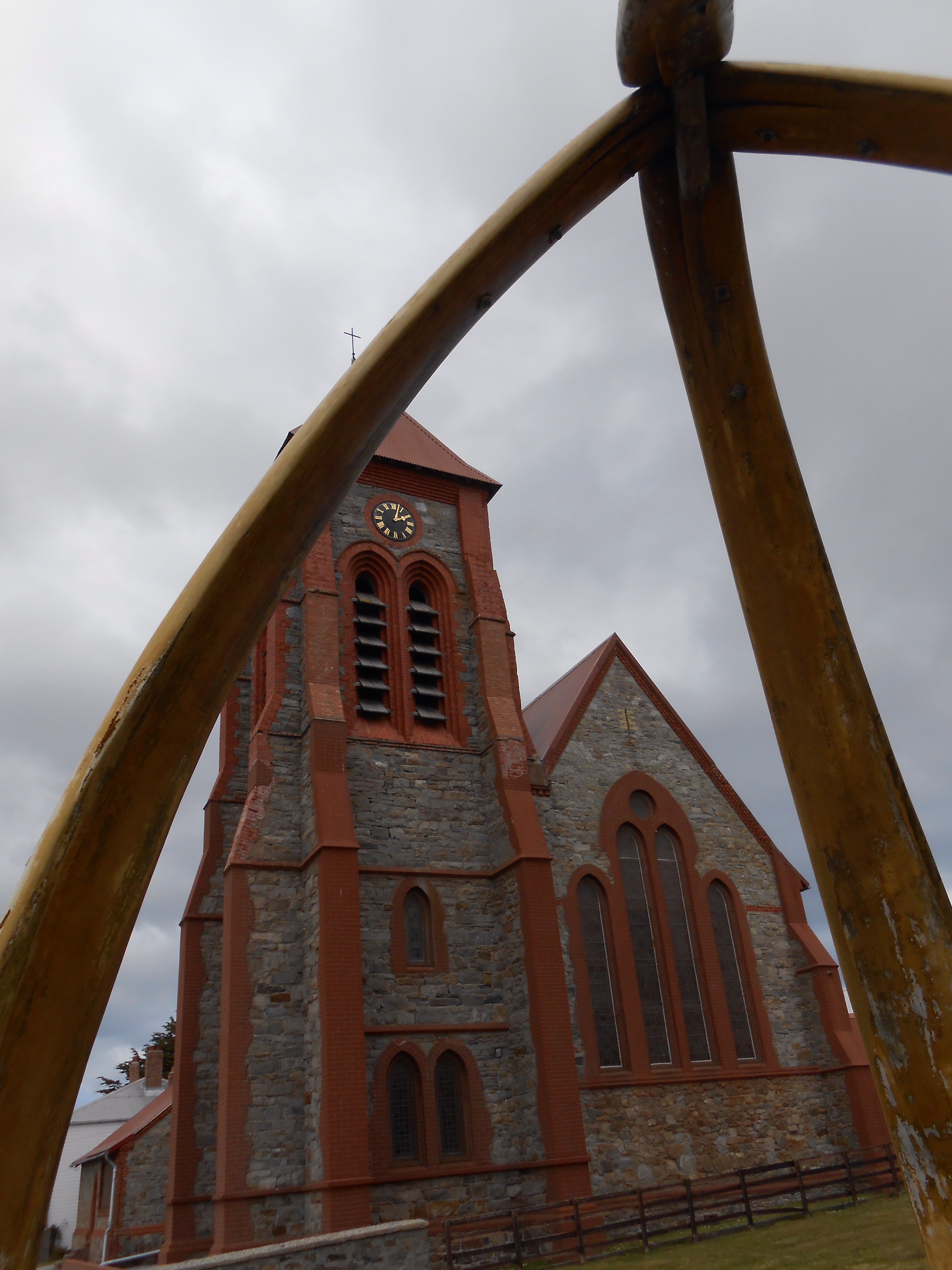
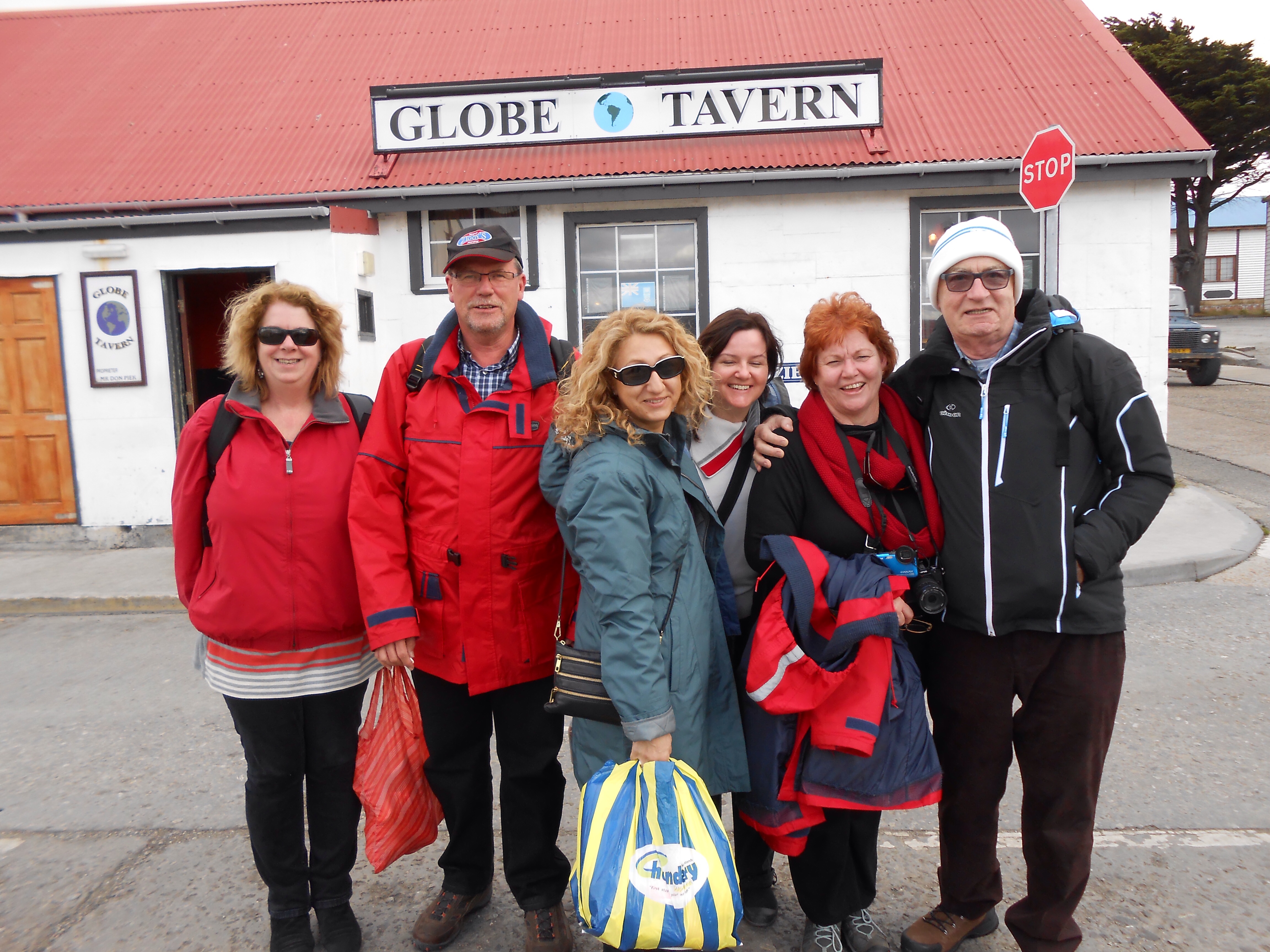
When sailing, upon arrival at land, we normally drop the fenders, tie up and jump off the boat, delighted to be on terra firma. Not so on a cruise. There is a whole palaver with regard to getting off, which has to be done when dealing with such large numbers. None-the-less, as soon as possible, John , Patricia and I escaped the ship and headed off walking from the port into town. I spent a good few hours getting the previous 2 blogs uploaded and took myself off to the pub afterwards to recover!! So, since I didn’t see much of Stanley, Margaret is going to do this blog. Over to you Margaret……
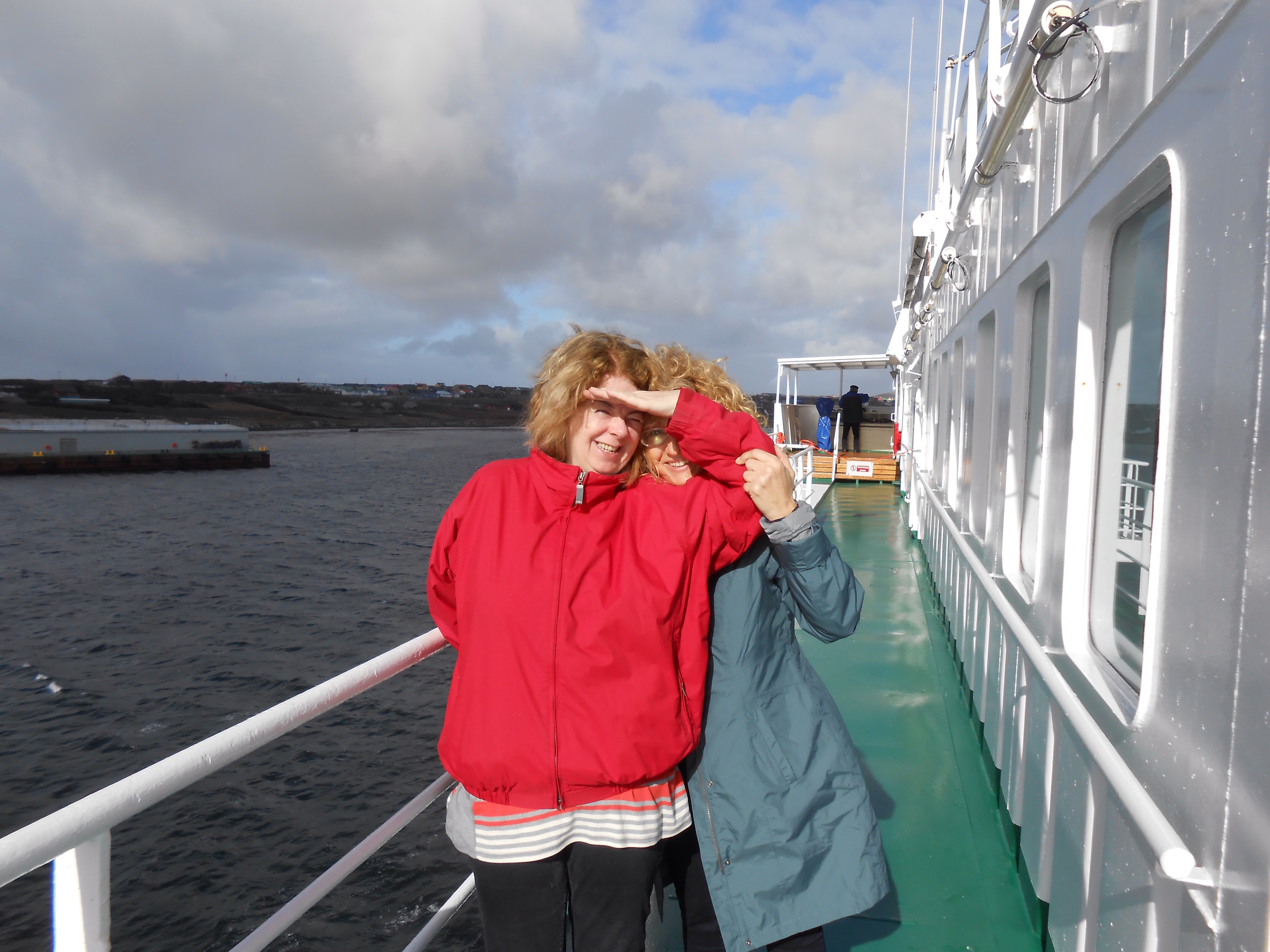
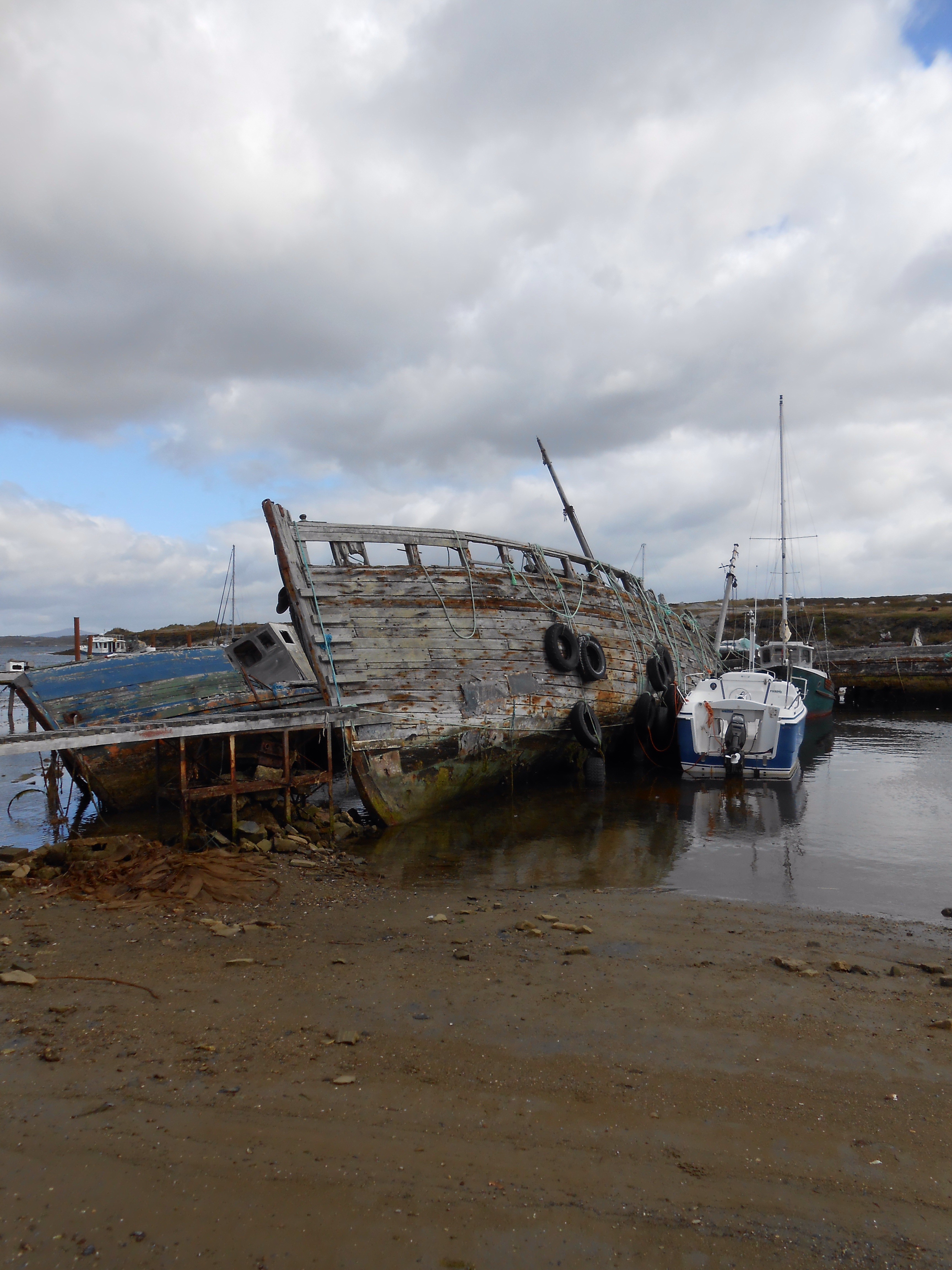
We arrived in Stanley on West Falkland about 9.30 am and after watching a very careful docking were glad to get off the ship and spend a day on land, exploring. A large group opted to go directly by bus to Gypsy Cove. These eager beavers were lined up on the gangplank well beforehand, cameras, lenses, tripods all in evidence. I opted for a walk, about 4 miles out the coast. Hugh, the on board doctor was leading the walk . We walked through the port area and noticed a few old fishing boats abandoned, reminder of times past. The Lady Elizabeth sits out in the harbour and she originally limped into Stanley in 1913, damaged and in need of repair. She ended up being used as a floating warehouse for some years until a storm finished her off and set her to rest on her side a distance from the dock. 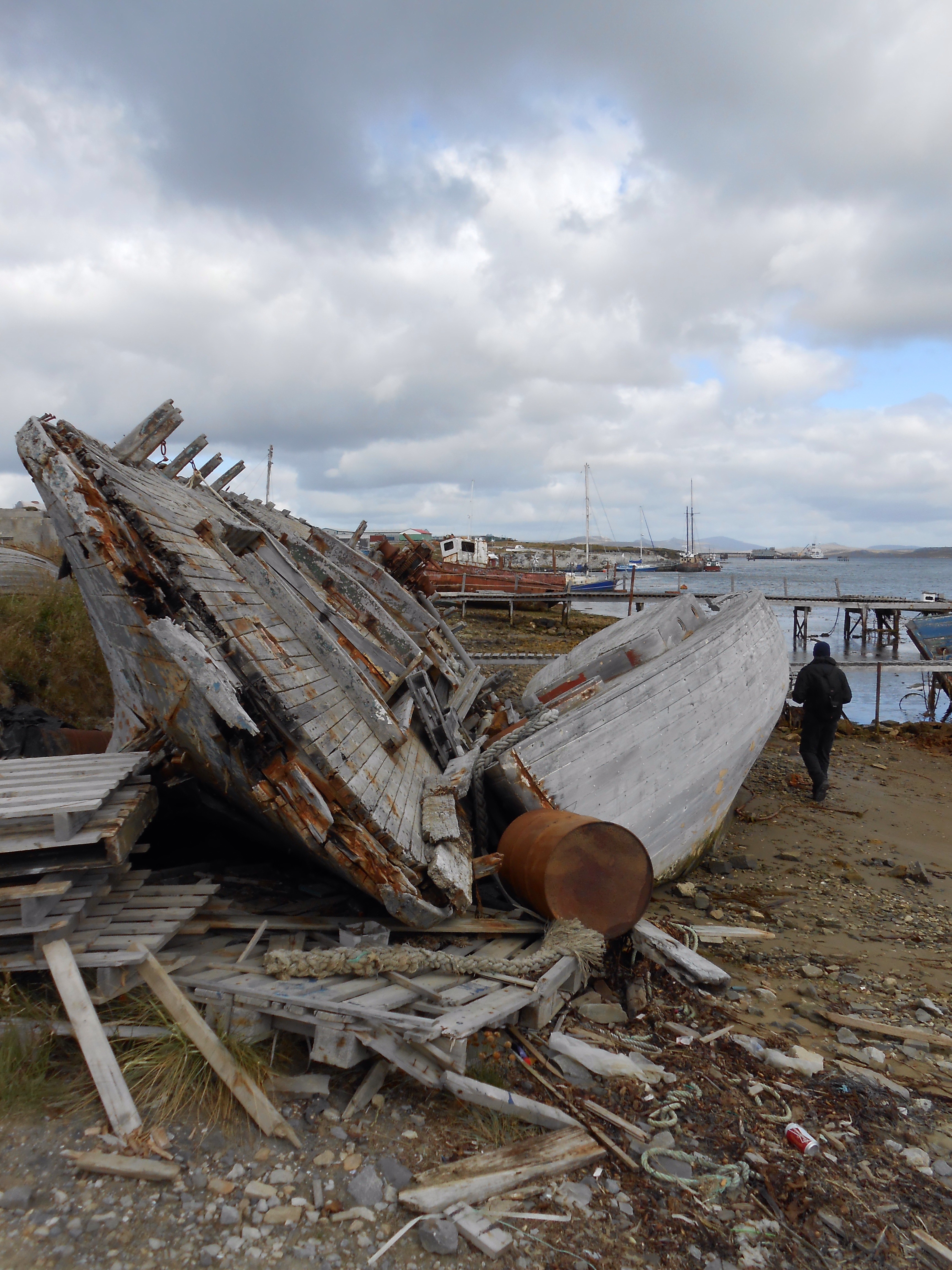
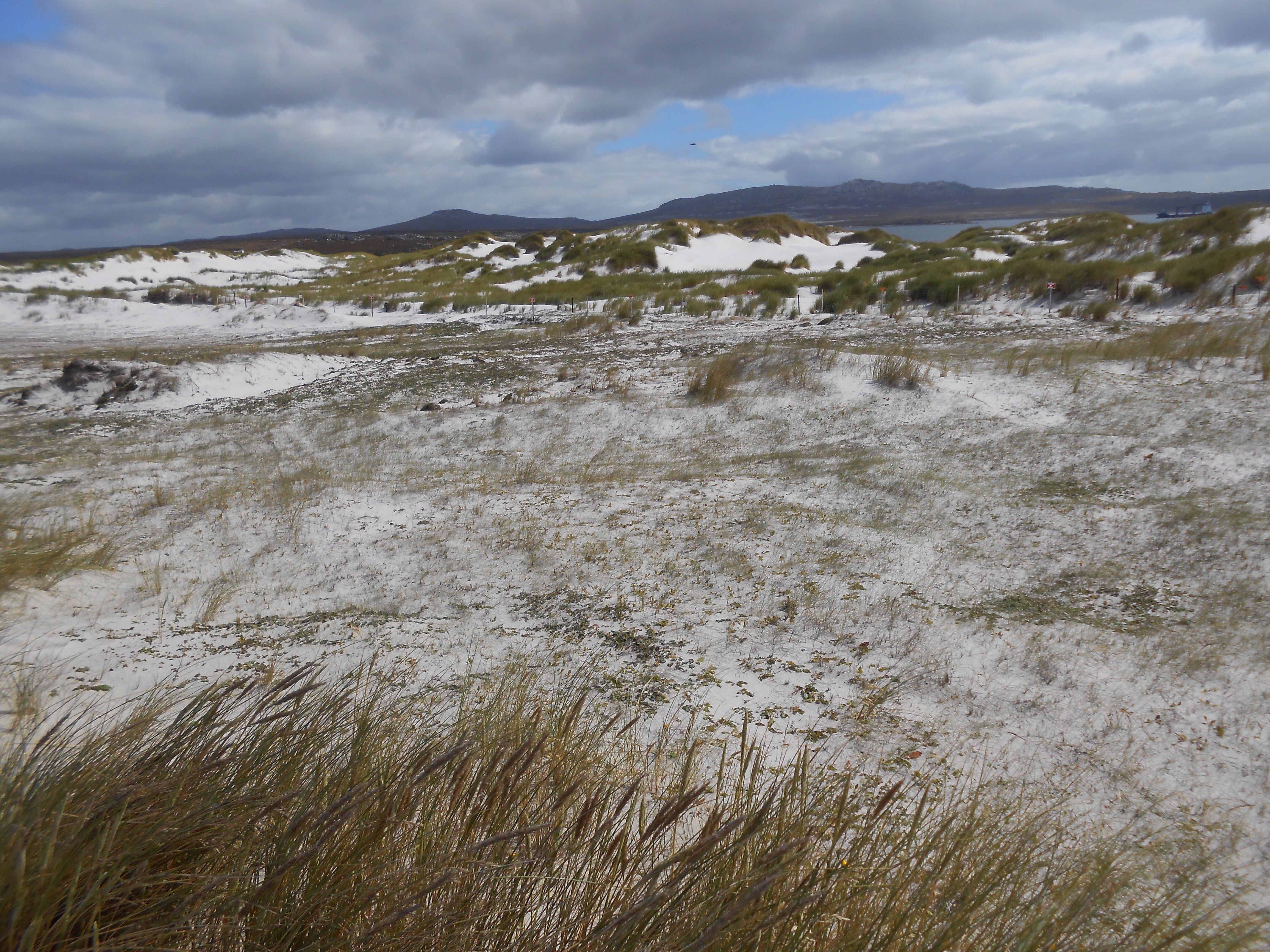
 Walking on to Whalebone Cove, called this because at low tide large number of whale bones can be seen. Whaling and sealing were important for early economic growth on the island. As we walked on to Gypsy cove we saw several warning signs for landlines and the area nearest the coast was fenced off. The white sandy beaches were out of bounds , but the wildlife flora and fauna were enjoying the space. A group of Magellanic penguins stood at the top end of the beach, they are quite small, nest in burrows under the tussac grass and make lots of noise. By now nature was calling and I was glad to take the bus back to Stanley . We made straight for the Victory pub where we sat and enjoyed a real English lunch of fish and chips and beer. What more could one ask for!
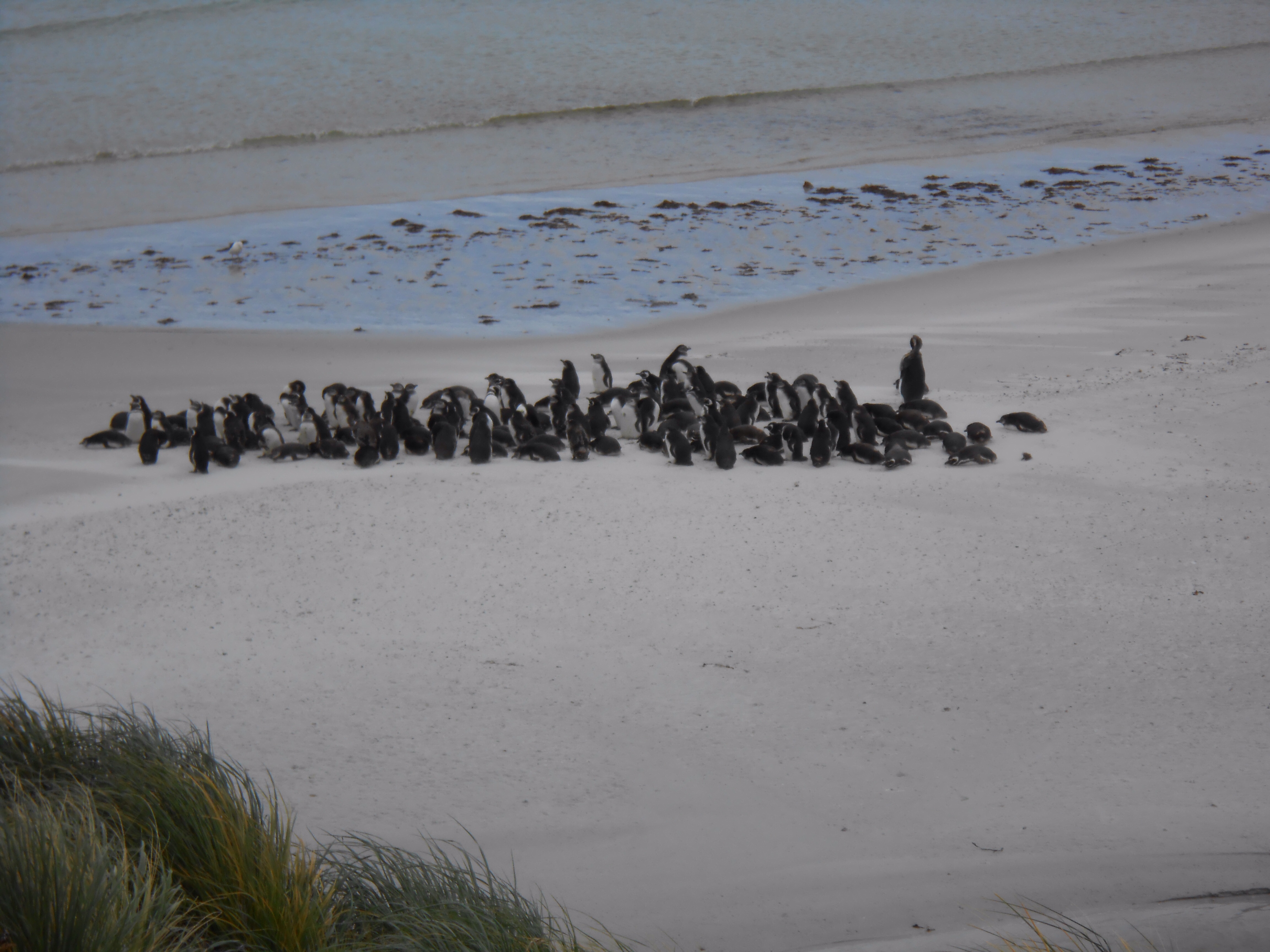
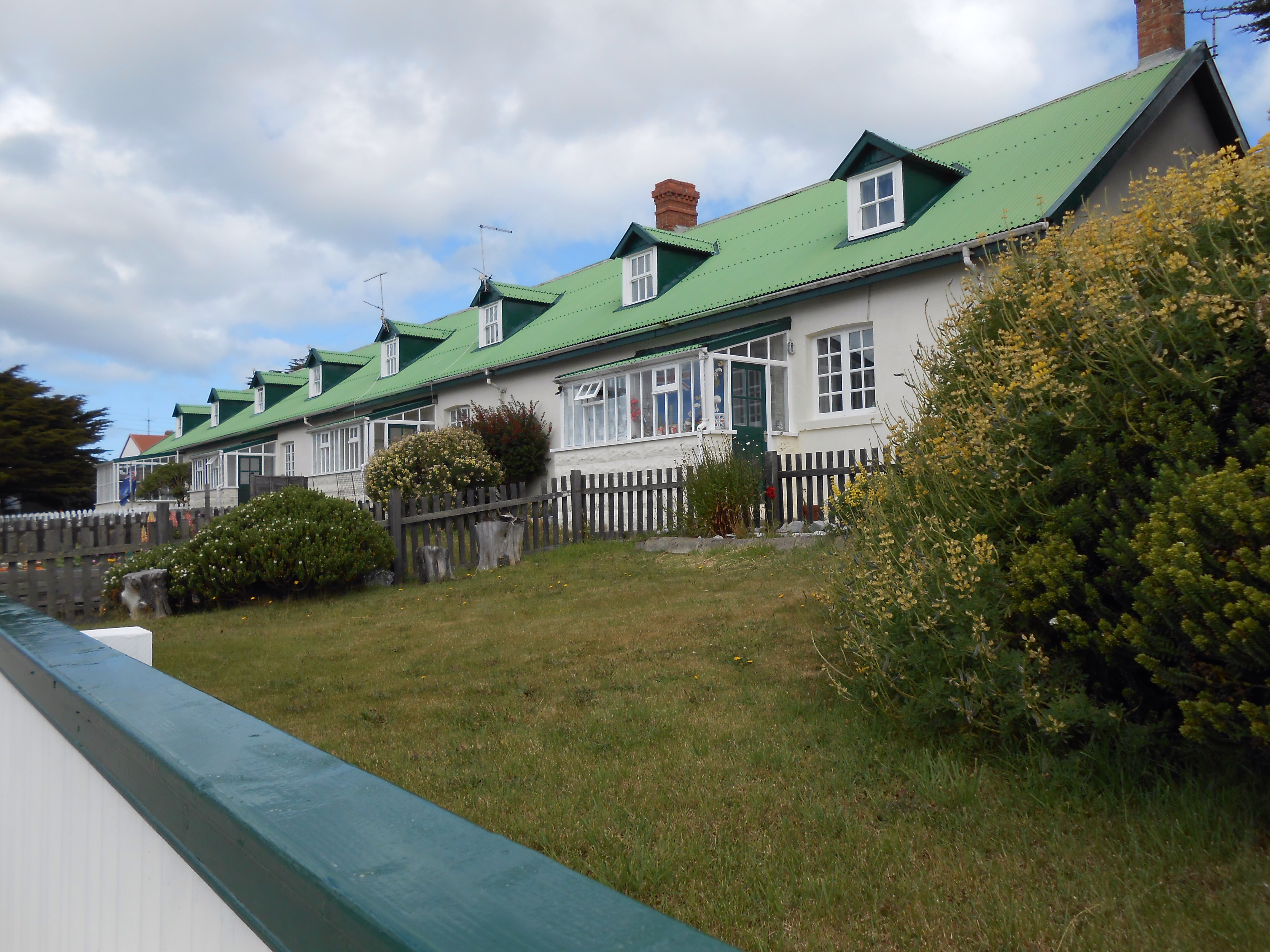
I took a walk around looking at the houses and shops mainly clapboard houses with coloured tin roofs …no slate roofs . I felt it was more like a film set, neat and tidy some lovely fruit and vegetable patches, a small hospital, supermarket and a small hotel. I didn’t make it to the museum as I was drawn back to the Globe Tavern for a few refreshments before boarding the zodiacs at 5pm.
Well if we think the Arran Islands are remote or Inis Boffin for that matter, come here to experience remote. Check out the English telephone boxes and post box painted that bright red and the locals who unanimously want to be wed to Britain .
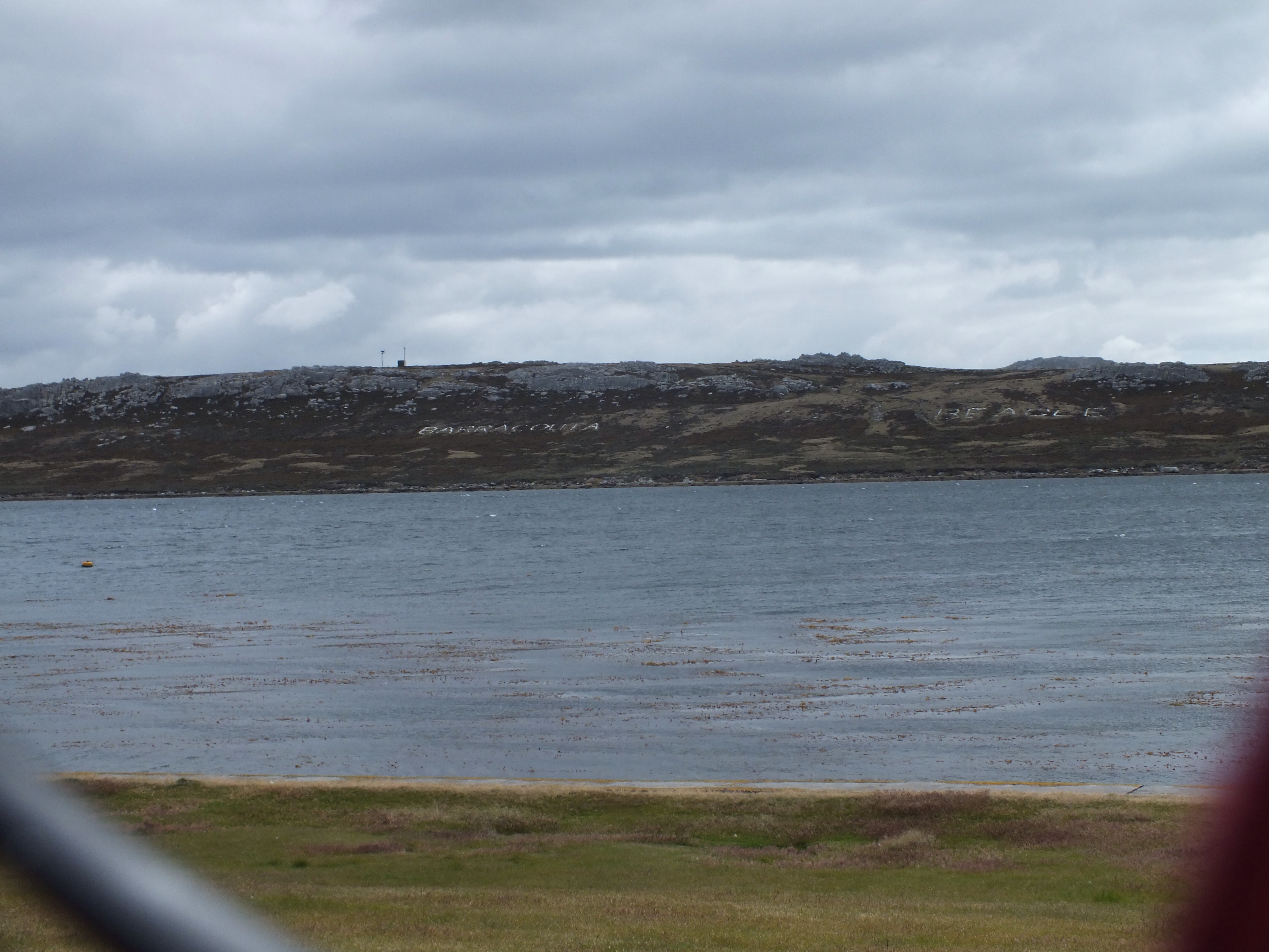
Names of British ships involved in the war written in rocks on the hill
More evidence of the war